| Location: Cache La
Poudre WIlderness, North-central Colorado.
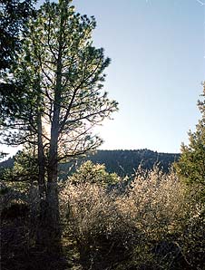
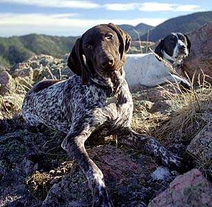
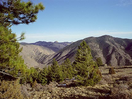
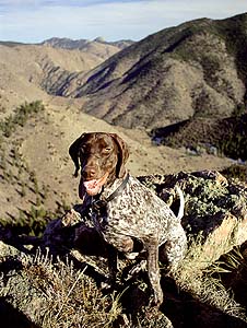
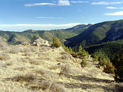
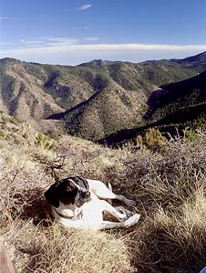
Maps: USGS 7.5' Quad: Big Narrows; Trails Illustrated 1:40K: Cache La Poudre/Big Thompson #101 Access: From Ted's Place, drive about 15 miles to the Steven's Gulch picnic area. Wilderness is on south side of the highway. Parking: NAD83 zone 13 465505e 4503578n Elevation: 6120' Fees: None Trail: None Webcam: CSU Foothills campus, 15mi SE Weather: NOAA Stove Prairie Station Local Forecast  January 2003 Buck Ridge is located just south of Hwy 14 in the Poudre Canyon, within the confines of the Cache la Poudre Wilderness. I explored a tiny fraction of the area on an unseasonably warm Saturday. I took both Frank and Makenzie, as Andra had other matters to attend to that day and couldn't come along. This was one of those trips that I never planned to take, but just ended up in the area by luck. I drove the car up the canyon, and stopped at the Upper Landing Picnic Ground, just east of Steven's Gulch. The beginning of my makeshift route wound through thick vegetation up the north face of the incline to the south of the highway. Within seconds I was hidden from view of oncoming traffic. It was a jungle of Mountain Mahogany and Ponderosa Pine, and the hiking was slow going. The lack of snow, even in northern-facing hollows, was conspicuous. Angling up a drainage, I topped out on a north-south ridge that quickly sloped up into another deeper draw. This draw led southeast to a saddle between two prominent peaks, and while hiking here, I was completely out of touch with the highway on the other side of the ridge. It was hard work getting to the saddle, since it was so steep, so I stopped and watered the dogs and myself once I arrived. The saddle was open and grassy, and the sun was uncommonly warm for January. To the east I could make out the cleft where Stove Prairie Rd was, but could not actually see the road. I heard gunshots in that direction, and figured the open slope wasn't the best place to be. Faced with the choice of which mountain to climb, the shorter one to the east or the taller to the west, I chose the taller. The fact that the gunshots and the highway both lay to the east helped make that decision. The southern slopes were much steeper and more open than the northern slopes, so we took the northeastern face up. Thick ponderosa and juniper made the going slow, but helped ease my mind about the steepness of the slope. Had there been no trees and shrubs to hang onto, I never would have tried climbing up. Frank and Makenzie scooted up with ease, owing to that nice, low cener of gravity they have. The steepest point was a rocky draw that would make a great waterfall in the event of heavy rain. Again, were it not for the thick pine tree population, I never would have made it up, as I used them as handholds to pull myself higher. At last, the draw opened up onto a flat savannah sloping east, with grass and cactus and a view to the south. It's always a nice feeling to rise up in elevation so quickly. At this point it was a cinch to walk up to the top of the peak, and we did so from the east. The highest elevation reached was 7748 feet. From the summit I could pick out Grey Rock and the unnamed peak west of Young's Gulch that I hiked in the winter of 2002, and the spring of 2003, to the east. Bear Mountain, one of the few named peaks in the area, lay to the south. To the north the slope dropped very quickly to the highway, and I could clearly pick out the slender crack of Steven's Gulch, and the barren southern face of Sheep Mt just to the west. We hung out on top for awhile and I studied my map. It looked easy to drop down to the saddle and then continue on southwest along Buck Ridge, but in living color from my perch on top, the drop down to the saddle looked pretty steep and long, and I decided not to try it. It was approaching 3 o'clock, and spending a night on a 7000' peak in January is not my idea of fun. We slipped our way down through loose tallus and heavy pine needle duff to the saddle where we stopped in the deepening cool of evening shadows to drink. This was my first test of the day-glo yellow water bottle Matt had gotten me for Christmas and the thing seemed to be shining like a lantern. It was pretty incredible the way it glowed. I also ate an apple and threw bits of it to the dogs, salivating greedily before me. Near the road, I stopped to take a few shots of the evening sun on Red Mt across the highway. Then we descended the steep slope, sliding alot of the way, to the car and drove home. The area is very rugged, and very beautiful. As far as I know, there is only one designated trail in the wilderness, and that is the one that tops Mt McConnel. However, trips like these prove you don't need a trail to get to cool places. My next goal is to find other easy entry points to go exploring, and perhaps make more time to follow Buck Ridge further to the west.
|
|