GREYROCK MT
GREYROCK MT
| Location:
Roosevelt
National Forest, northwest of Ft Collins, Colorado
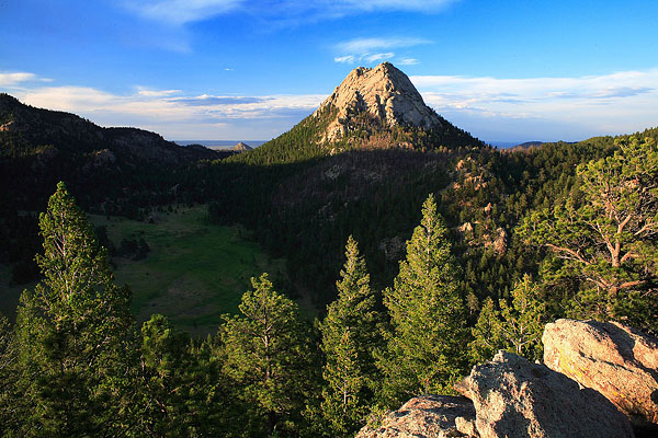
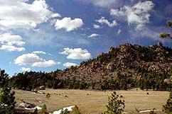
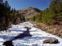
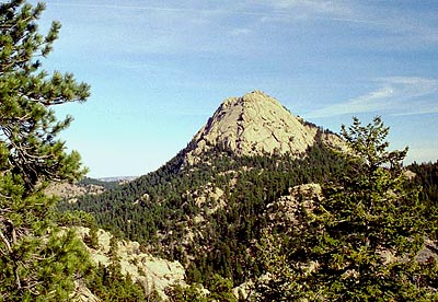
Access: From Ted's Place at Hwy 287 x Hwy 14, drive 9 miles west to a well-marked parking lot on the south side of the road. Trail: Moderate 7 mile round trip on a loop which leads through ponderosa pine and montane grassland to the summit of a mostly bald mountain from which 360 degree views of the plains, Fort Collins, and the Rocky Mountains. The trail starts at Hwy 14, crosses the Poudre River to the north and climbs up a gentle slope to a split. The north route is called the Meadow trail, and is slightly longer than the steeper southern route. Views of Hewlett Gulch, the next designated hiking trail up the canyon, are visible from along the Meadow trail. I have found that most people take the short route, so if you want a better chance at solitude, take the Meadow Trail. It's a very nice hike, and is accessible most of the year, though winter ice can make it dicey. The trail is well marked, but the route up the actual mountain is a bit tricky to follow, as it circles around the SE side and over bare stretches of rock. Watch for cairns and trail marker posts marking the way. I've hiked it in all four seasons, and I'd have to decline to say which season offers the best experience since they all have something to offer. Typically, weekends find this trail sustaining very heavy use. Trailhead: NAD83 zone 13 475970e 4504912n Elevation: 5565' Maps: USGS 1:24K Quad: Poudre Park; Trails Illustrated 1:40K: Cache La Poudre/Big Thompson #101; Trail map Fees: None Dogs: 6' handheld leash Weather: Stove Prairie NOAA weather station National Weather Service Point Forecast  |
 TRIP
#1 TRIP
#1
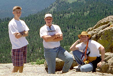
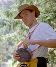
My very frist trip up to Greyrock occurred on a bright and sunny June day in 1996, during my first summer in Colorado after my freshmen year at CSU. The only other time I had been up in the mountains was for a campout at Lake Agnes the previous September. Thus, it was with complete ignorance that I stepped out of the car with Chuck (my housemate), Rob and Jen early on that Saturday morning into the cool mountain air. Growing up in the flatland, the steep slopes of dense pine and spruce simply amazed me. Im writing about this hike almost 7 years after the fact, so I dont recall all the little details. However, I am amazed at what I do recall. The photos I took really help jog my memory. I find that hikes I dont have photos for are as unknown as someone elses life. Anyway, I know that we took the Meadow Trail on the way up, and stopped at a well-known clump of pines on the south slope overlooking Hewlett Gulch to rest. Near the meadow, in the shadow of Grey Rock, we came upon two shaggy dogs that seemed to like us a lot and hiked with us all the way to the top. Nobody every claimed them or called for them. I assumed they belonged to someone who lived nearby. At any rate, they didnt look worried to be out alone, in fact, they looked like they were loving it. Jen did not go with us all the way to the top, so my pictures taken on the pseudo-summit (we only climbed to the top of the eastern edge which is lower  than
the western side) show only Rob, Chuck and I. Two more things I remember
vividly from that trip: The hawk that soared so close to where we stood
on the summit I could see its eyes clearly, and the gob of pine sap that
stuck in my hair while I was trying to hang my camera from a branch to
set the timer and take a photo of everyone. After dallying up top and enjoying
the scenery, we hiked down. Jen had started back to the car via the short
route when we started out up the mountain, so we anticipated catching up
to her somewhere along the trail. At some point in a crazy burst of youthful
exhuberance, we began to run pell mell down the steep, rocky trail. Its
lucky none of use broke a leg. We stopped to rest and pant at the park
bench near the trail fork, then hiked down to the river where Jen was waiting.
I soaked my feet briefly in the water, but although it was a hot afternoon,
the water was only marginally above freezing. All hiking trips should be
as perfect as that one was. than
the western side) show only Rob, Chuck and I. Two more things I remember
vividly from that trip: The hawk that soared so close to where we stood
on the summit I could see its eyes clearly, and the gob of pine sap that
stuck in my hair while I was trying to hang my camera from a branch to
set the timer and take a photo of everyone. After dallying up top and enjoying
the scenery, we hiked down. Jen had started back to the car via the short
route when we started out up the mountain, so we anticipated catching up
to her somewhere along the trail. At some point in a crazy burst of youthful
exhuberance, we began to run pell mell down the steep, rocky trail. Its
lucky none of use broke a leg. We stopped to rest and pant at the park
bench near the trail fork, then hiked down to the river where Jen was waiting.
I soaked my feet briefly in the water, but although it was a hot afternoon,
the water was only marginally above freezing. All hiking trips should be
as perfect as that one was.
 |
| TRIP #2
The second time I got to the top of Grey Rock was two months after my first trip. In mid-August, Rob and I decided to backpack to the top and camp up there. At that point in time, I had absolutely no backpacking equipment. The only piece of camping equipment I owned was a heavy flannel-lined 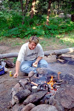 Coleman
sleeping bag that I bought for $20 at Savers thrift store. Nevertheless,
I loaded up my school bookbag with a can of soup, some granola bars, a
couple of water bottles and some clothes and attached to that my sleeping
bag and the tent poles from Chucks tent using my belt looped through the
shoulder straps. Primitive, and painful on the shoulders. We hiked up around
mid day, and I recall us sitting on the bench near the trail fork discussing
what type of pine tree was populating the slopes. I have since come to
learn that these are Ponderosa pines, but at that point I was ignorant
of all Colorado trees. We took the steeper, shorter trail up to the mountain,
scrambling off the trail at one point while some nut came running down
the trail with a live rattlesnake in his hand. We reached the base of the
mountain, then wove our way up following as best we could the trail of
cairns until we reached the grass and tree oasis at the top. Another party
was camped in the trees so we pitched our tent as far away as possible
to be neighborly. A fire pit was already in place, and we quickly had a
fire going to cook our dinner of hot dogs and soup. This was fun, primitive
camping with no dishes, and nothing but sticks for roasting skewers. Soon
after we set up camp, a fellow came over to chat and we found out from
him that there was a large meteor shower tonight. Good, serendipitous timing
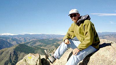
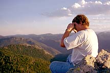
on our part. As evening progressed, we hiked up the small slope to the
very tip-top of the mountain on the western edge, where I had never been
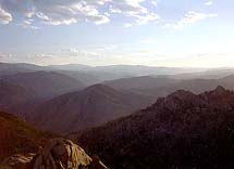
before. We watched shadow creep over the city to the east, and the beautiful
afternoon light turn orange and then red over the ocean of jagged peaks
stretching out to the west like an impossible maze. The sun finally dipped
below the horizon, and the sky to the east turned blue, then black as we
sat on the mountaintop and chatted. Rob was a good friend that summer,
and we hiked and fished a lot. Seems like friends come and go, and thats
too bad in a way. I hardly ever even see Rob these days. Coleman
sleeping bag that I bought for $20 at Savers thrift store. Nevertheless,
I loaded up my school bookbag with a can of soup, some granola bars, a
couple of water bottles and some clothes and attached to that my sleeping
bag and the tent poles from Chucks tent using my belt looped through the
shoulder straps. Primitive, and painful on the shoulders. We hiked up around
mid day, and I recall us sitting on the bench near the trail fork discussing
what type of pine tree was populating the slopes. I have since come to
learn that these are Ponderosa pines, but at that point I was ignorant
of all Colorado trees. We took the steeper, shorter trail up to the mountain,
scrambling off the trail at one point while some nut came running down
the trail with a live rattlesnake in his hand. We reached the base of the
mountain, then wove our way up following as best we could the trail of
cairns until we reached the grass and tree oasis at the top. Another party
was camped in the trees so we pitched our tent as far away as possible
to be neighborly. A fire pit was already in place, and we quickly had a
fire going to cook our dinner of hot dogs and soup. This was fun, primitive
camping with no dishes, and nothing but sticks for roasting skewers. Soon
after we set up camp, a fellow came over to chat and we found out from
him that there was a large meteor shower tonight. Good, serendipitous timing
on our part. As evening progressed, we hiked up the small slope to the
very tip-top of the mountain on the western edge, where I had never been
before. We watched shadow creep over the city to the east, and the beautiful
afternoon light turn orange and then red over the ocean of jagged peaks
stretching out to the west like an impossible maze. The sun finally dipped
below the horizon, and the sky to the east turned blue, then black as we
sat on the mountaintop and chatted. Rob was a good friend that summer,
and we hiked and fished a lot. Seems like friends come and go, and thats
too bad in a way. I hardly ever even see Rob these days.
|
TRIP #3
 I
was really enamored with Grey Rock after the summer, and decided that my
good friend Dave Burns just had to see it too. I dont think at that point
he had hiked it, despite living in Fort Collins the same amount ot time
as I had. This time it was early October 1996 when we made the hike. I
remember the aspen were changing at the time and the cool fall air made
everything extra crisp and clear. I dont remember much from this trip,
and I dont know the route we took, though I think we took the shorter
route. There was a group of boy scouts climbing the south face of the mountain
when we passed. Seemed to be having a good time. We didnt dally up top
too long since it was pretty cold as best I can recall. It was a pretty
nice day to be hiking. Nothing is better than hiking in the mountains on
a clear, brisk fall day. I
was really enamored with Grey Rock after the summer, and decided that my
good friend Dave Burns just had to see it too. I dont think at that point
he had hiked it, despite living in Fort Collins the same amount ot time
as I had. This time it was early October 1996 when we made the hike. I
remember the aspen were changing at the time and the cool fall air made
everything extra crisp and clear. I dont remember much from this trip,
and I dont know the route we took, though I think we took the shorter
route. There was a group of boy scouts climbing the south face of the mountain
when we passed. Seemed to be having a good time. We didnt dally up top
too long since it was pretty cold as best I can recall. It was a pretty
nice day to be hiking. Nothing is better than hiking in the mountains on
a clear, brisk fall day.
|
TRIP #4
 I
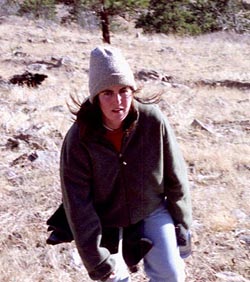
met Andra in July of 1996, but it wasnt until the spring of 1997 that
we started hanging out together (a practice that has continued up to the
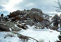
present day). We got together on March 2 for a hike up Grey Rock, and I
guess you could call this our first date, although she remained maddeningly
aloof. We hiked up and down the shorter route through some fairly deep
snow. I dont ever recall seeing so much snow at Grey Rock since then.
The day started out clear and sunny, but gradually turned overcast and
by afternoon the sky was dull white with unbroken high cloud cover. The
top of the mountain had significant snow pack, and the ponds were frozen.
The hike took most of the day as we talked and walked pretty slow. I
met Andra in July of 1996, but it wasnt until the spring of 1997 that
we started hanging out together (a practice that has continued up to the
present day). We got together on March 2 for a hike up Grey Rock, and I
guess you could call this our first date, although she remained maddeningly
aloof. We hiked up and down the shorter route through some fairly deep
snow. I dont ever recall seeing so much snow at Grey Rock since then.
The day started out clear and sunny, but gradually turned overcast and
by afternoon the sky was dull white with unbroken high cloud cover. The
top of the mountain had significant snow pack, and the ponds were frozen.
The hike took most of the day as we talked and walked pretty slow.
|
TRIP #5
 A
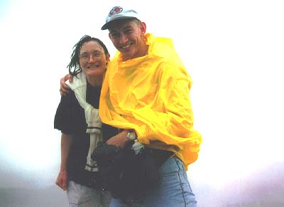
couple of months later, in late May 1997, my Mom flew out from New Hampshire
to visit. The entire week she was here it rained, and I was very frustrated
at the streak of bad weather. Towards the end of her trip, we decided to
just go hike in the rain since it was obvious the rain intended to stick
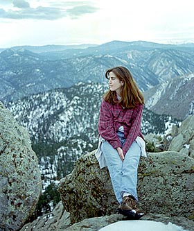
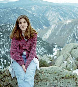
around. Andra came with us on this hike up Grey Rock through a cold, spring
rain. We all got drenched, despite ponchos and hats. The rain just seemed
to come from all directions. Mom was very intimidated by the first sight
of the mountain after we had hiked 4 miles to get there, and it took some
convincing to make her believe that we truly intended to reach the top.
With visibility so low, one couldnt see the surrounding ridges and mountains,
so Grey Rock looked like a soaring spire that would require ropes to climb
to the top. We made it up alright, although the wind was strong up top
and it chilled us all. We were, admittedly, not well prepared for the cold.
We hiked quickly down the short route in the rain that was intensifying
as the day wore on. A
couple of months later, in late May 1997, my Mom flew out from New Hampshire
to visit. The entire week she was here it rained, and I was very frustrated
at the streak of bad weather. Towards the end of her trip, we decided to
just go hike in the rain since it was obvious the rain intended to stick
around. Andra came with us on this hike up Grey Rock through a cold, spring
rain. We all got drenched, despite ponchos and hats. The rain just seemed
to come from all directions. Mom was very intimidated by the first sight
of the mountain after we had hiked 4 miles to get there, and it took some
convincing to make her believe that we truly intended to reach the top.
With visibility so low, one couldnt see the surrounding ridges and mountains,
so Grey Rock looked like a soaring spire that would require ropes to climb
to the top. We made it up alright, although the wind was strong up top
and it chilled us all. We were, admittedly, not well prepared for the cold.
We hiked quickly down the short route in the rain that was intensifying
as the day wore on. |
TRIP #6
|
| TRIP #7
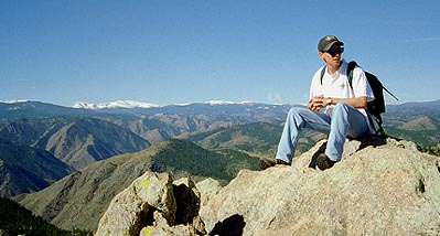
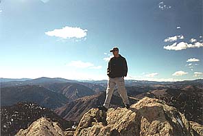
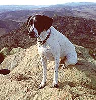
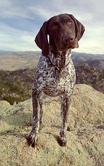
The next Grey Rock hike I recall for certain occurred in December 2002 when I took Frank, and Andras young pointer pup, Makenzie, all the way to the top on a brilliant winter day. I took the meadow route, which was by far the least-traveled route for me. I enjoyed the day very much, encountered very few people, and had a good time with the dogs. They enjoyed it too, as they do every hiking trip.
|
|


;)