Greyrock Peaks
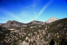
A compilation of reports from several trips to the 5 peaks that circle Greyrock Mt (in progress).

Location: Roosevelt National Forest, northwest of Ft Collins, Colorado 

Access: From Ted's Place at Hwy 287 x Hwy 14, drive 9 miles west to a well-marked parking lot on the south side of the road. 
Trails: All peaks except Greyrock Mt are off-trail, but the Greyrock trail is useful for getting close to these peaks.
Trailhead: NAD83 zone 13 475970e 4504912n  Elevation: 5565' 
Maps: USGS 1:24K Quad: Poudre Park; Trails Illustrated 1:40K: Cache La Poudre/Big Thompson #101
Fees: None 
Dogs: 6' handheld leash 
Weather: Stove Prairie NOAA weather station
              National Weather Service Forecast


Peak 7180
June 22, 2007
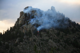
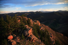
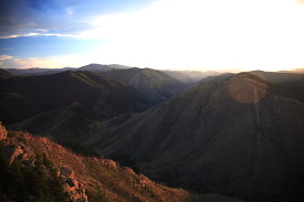
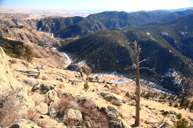
I wanted a quick overnight trip, so I packed my hammock, some dry food and a few liters of water, and headed up towards Greyrock Mt via the Meadow Trail, hoping to climb Peak 7456, which is a rocky peak just west of Greyrock Mt. I left after work, so it wasn’t until fairly late in the day that I approached Peak 7180, which lies fairly close to the trail. I got there by deciding I had begun descending the trail towards Greyrock Meadow, and then jumping off to scramble uphill to the west. The summit of 7180 was very nice, especially in the evening light. Rocky and open in all directions but east, I took photographs of Greyrock Mt, and to the southwest of Hewlett Gulch. Directly north, Peak 7456 rose up from a jumble of boulders, and I had planned on scouting the best route up from Peak 7180. Unfortunately, Peak 7456 was on fire, and smoke streamed up from near the summit. I could see some flames, and the sound of occasional rocks rolling down the slope rippled across the meadow to me. OK, so hiking 7456 was off the plan. I ate a dinner of cheese and crackers with an apple, then moved on, seeking an alternative.

I wanted to distance myself from the fire. It didn’t seem very severe, but one doesn’t want to sleep too close to something like that. I hiked along the trail to the Greyrock junction, then headed east along the Wintersteen Trail a bit and tracked uphill into the woods to find a couple of trees to string my hammock on. It was past dark by the time I found a suitable spot, and I could see the red glare of the fire on 7456 very clearly. I hopped in the hammock and fell asleep, though it was fitful because of that fire. I felt safe with the green meadow between me and the fire, but knowing how fast a fire can move in dry timber, I woke up often in the night to peer out through the mosquito netting at the immobile red glare on the mountain. By morning, after a less-than-restful night’s sleep, I was anxious to move on. At dawn, a pall of smoke hung in the meadow, and all around Greyrock, obscuring it somewhat from view. I rolled up my hammock, shouldered my pack, and returned to the car by about 7:30. I stopped at Ted’s Place around 8:00 to make sure somebody knew about the fire. They did. The cashier said there was a group of firefighters up there right then, but that seemed hard to believe since I didn’t hear a single voice at all, and there was no wind to hide voices all night. Still, satisfied that someone at least knew it was burning, I rolled on home, saving Peak 7456 for another day.


Greyrock Mt peaks, CO
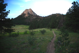
Greyrock meadow

Greyrock Mt peaks, CO
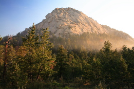
Smoky sunrise at Greyrock Mt

Greyrock Mt peaks, CO
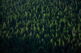
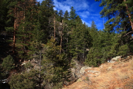
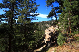
Conifers on the north slope of Peak 7309

Greyrock Mt peaks, CO
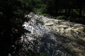
Poudre River

Greyrock Mt peaks, CO
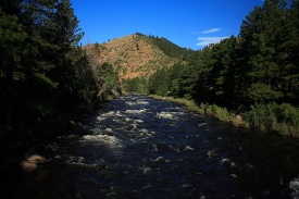
Poudre River from the bridge to Greyrock

Greyrock Mt peaks, CO
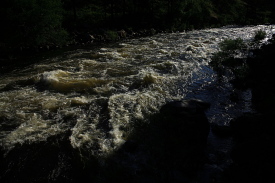
Poudre River

Greyrock Mt peaks, CO
Poudre River

Greyrock Mt peaks, CO
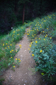
Heading up the meadow trail towards Greyrock

Greyrock Mt peaks, CO
The meadow trail to Greyrock

Greyrock Mt peaks, CO
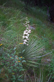
Yucca along the trail

Greyrock Mt peaks, CO
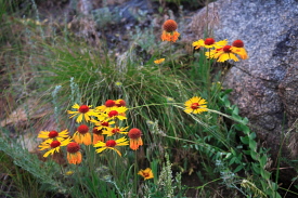
Gillardia along the trail

Greyrock Mt peaks, CO
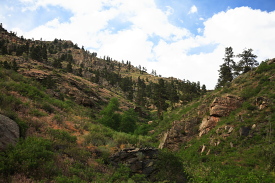
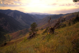
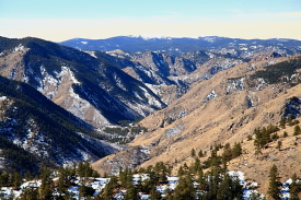
Looking up the Poudre Canyon from the 
south flank of Peak 7180

Greyrock Mt peaks, CO
Fire on Peak 7456

Greyrock Mt peaks, CO
Greyrock Mt

Greyrock Mt peaks, CO
Greyrock Mt

Greyrock Mt peaks, CO
Sunset on Peak 7180

Greyrock Mt peaks, CO
Looking south at sunset from Peak 7180


Peaks 7309 and 6740
February 15, 2010
Henry and Makenzie, my 4-legged friends, joined me on a sunny but cool President’s Day for a little hiking around Greyrock. It was only about 30 degrees when we left the car, but once in the sun on the uphill trail from the bridge over the Poudre, it felt like 50, and I was soon down to my flannel shirt. Snow was sparse, but the trail had been utilized so much that it was pure ice in the shade of the giant Ponderosa pines that lined the lower portions of the trail, smooth as glass, and the going was slow and treacherous. 

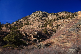
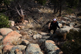
At the Meadow Trail junction, we turned right and started up the rocky canyon trail, which had much less ice, thankfully. A low, slanted sunlight peeked in onto the trail at intervals. About halfway to the upper junction, we veered off the trail and began heading east, up the northwestern flank of peak 7309 through Ponderosa pine and Douglas fir. It was steep, but the ground was dry and loose, so there was plenty of traction. Also, there were lots of deer trails to follow, the principle attraction of these was that limbs had been broken off at least to a height of 5 feet along their routes, so there was less ducking involved, though I still had my hat knocked off my head multiple times by sneaky branches. 

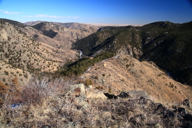
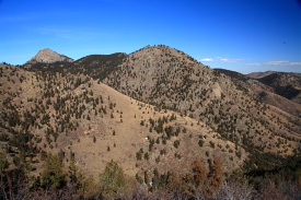
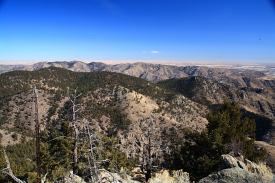
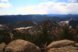
We continued on up and reached a nice lookout point of open rocks on the western side of the mountain, about ¾ of the way up. Henry and Makenzie made me very nervous by straying perilously close to the dropoff edge, but both seemed completely unconcerned, and of course, were no more likely to jump off the edge that I was. The last push to the summit went quickly, and about 1.5 hours after starting, we hit the open, flat, grassy summit ridge. I followed this to the east for some ways before finding a pile of rock that was the obvious high point. The wind was blowing briskly from the south, but I found that if I sat behind some of the high rocks it was perfectly calm and warm, so I relaxed for some time, snacking on granola and a fantastic HoneyCrisp apple. The summit ridge was fairly long, so we continued on east for quite a ways to another lesser high point that offered a nice view of ranked peak 6712 to the east, as well as views down into the lower Poudre Canyon. The location embodied everything that is awesome about the lower Poudre Canyon in winter: snow-free south slopes, tawny grass and cactus, lots of lichen-splattered boulders, blue sky, fair weather, and fabulous unobstructed views for miles. 

We turned around, retraced our steps to the summit, then headed straight north to the saddle with the next peak to the north. Instead of heading down the gulch to the west to rejoin the trail, I sidehilled along the isoline to the northwest until I hit the official trail further towards Greyrock, then continued on to the junction at the base of Greyrock. From there, we followed the Meadow Trail over ranked peak 7180, though I didn’t hit the summit on this particular day, and then downhill to the south through the very large grassy south slope where the trail does a big switchback. 

Just before the trail left the ridge and jumped off into the conifer-cloaked gulch, I split off and headed south along the ridgeline towards peak 6740. I bypassed a couple of knobs on the ridge, and had to put my gators on as I got closer to peak 6740 because of the snow. The afternoon was warm and sunny, and it was a pleasant scramble through thick brush into the trees, then up a steep slope with thick conifers to the grassy summit. Makenzie and Henry, masters of all-wheel drive, trotted up ahead of me with a nonchalance that only dogs can muster in such territory. I find that hiking with them is so enjoyable because I can live vicariously through their free-spirited roving, as it takes them across terrain with an ease and grace that is completely unknown to me. From the top of Peak 6740, all of Poudre Park lay below, and it was the first time I’d ever gotten a good idea of how this little settlement is laid out, since you can’t see much from the highway. We all walked west a bit to a lesser high point of flat rocks laid on end, and though the dogs couldn’t get up there, I could, though views to the west were still hampered by pines and junipers. 

There is a tempting ridge to the southeast from this summit, and I considered heading down that way. I feared getting into steep, snowy slopes on the return to the trail via the north face of the ridge further down, so I ultimately simply retraced my steps to the first saddle, and then followed the drainage down to the trail, where it was easy walking back to the car. In all, a wonderful 4.5-hour trip. I imagine that one could include Greyrock and Peak 7180 in a single hike and add no more than another hour to the trip, making an impressive 4-peak hike in under 6 hours. 

Greyrock Mt peaks, CO
Looking east from Peak 6740

Greyrock Mt peaks, CO
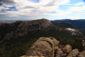
 Greyrock and Peak 7309

 
Greyrock Mt peaks, CO
Peaks 7456, 7681 and Greyrock

Greyrock Mt peaks, CO
Poudre Canyon from the summit of Peak 7309

Greyrock Mt peaks, CO
Summit of Peak 7309

Greyrock Mt peaks, CO
Looking east towards the plains from Peak 7309

Greyrock Mt peaks, CO
Henry checks out the view to the southeast from Peak 7309

Greyrock Mt peaks, CO
Poudre Canyon from Peak 7309

Greyrock Mt peaks, CO
Looking east from Peak 7309

Greyrock Mt peaks, CO
Peaks 7456 and 7681 from Greyrock meadow
Greyrock Mt peaks, CO
The south slope of Peak 7180
 

Ranked peaks in the area of Greyrock Mt in the lower Poudre Canyon


Peak 7681 (North Greyrock)
November 12, 2011
On a last-minute whim, I called Christine and we met at Ted's place an hour later, then carpooled up the Greyrock parking lot. The forecast had called for high winds and a winter storm warning for the mountains, but the sky was blue and the air was very calm as we marched across the bridge over the River Poudre. "Ha! Those silly meteorologists!", we laughed, and enjoyed the wonderful hike up the canyon trail to Greyrock Meadows. The wind arrived around that time, and put to rest any more talk of missed forecast. Holy Moses, did the wind come! Estes Park to the south clocked 77mph gusts, and a bit east of that, and only 8-10 miles due south of us, a weather station saw a 99 mph gust. Further south still, Frisco saw 115 mph. It was just insane. Not a perfect day to try topping bald, exposed peaks. But, we tried anyway. 

From the meadow, we headed north across open grass strafed by sheets of wind. We veered to the east of Peak 7681, entered the trees, and picked up an informal trail that headed north. At some point, we turned due west, and began a straight uphill walk through pine trees, Douglas fir and large granite boulders towards the summit. It was steep, but not technically difficult, and actually very fun, despite the wind. Greyrock was over our shoulders the entire time, and the blasts of wind kept things very interesting. 

We reached a summit, but turns out it was not THE summit, being a bump no more than 80ft lower than the true summit to the north. Peak 7681 is a nice, challenging peak for many reasons. It's taller than Greyrock, has greater prominence, and there is no trail to the summit. That last reason kind of fouled us up, but I wasn't too disappointed. A nice adventure to a false summit is still a nice adventure. The view was great, the wind was terrible. To  get to the summit, we would have to drop down about 150', then climb up a very steep, rocky and challenging pitch in an area very exposed to the wind. We opted not to. Another day. We'll come at it from the west, and it should be easier. 

We rolled down a very steep incline littered with boulders and dead trees, backtracking twice after getting cliffed out. We heard a tree blow down somewhere below us, and kept a very wary eye on any snags we passed. We reached the saddle between Peak 7681 and 7456, and from there it was easy strolling through relatively light wind to the meadow. Had it been good weather, this would have been a good spot to try for the summit again on the western side, but the weather was very, very bad for such activities. We resumed the trail, and decided to take the Meadow Trail back down, completing the loop. The southwest slopes above Hewlett Gulch that this trail traverses were phenomenally windy. It was like boxing with an invisible opponent. So many times I'd take a step, and my foot wouldn't go down where I wanted it to. It was hilarious, and so much fun to experience such a force of nature. By the time we got back down in the trees, simply hiking in a straight line felt like resting. The downside was that the pressure variations really killed my ears, even through my knit cap, and for a week I had pretty intense vertigo that even regular treats of decongestant couldn't' solve. I'll bring ear plugs in my pack from now on!

Greyrock Mt peaks, CO
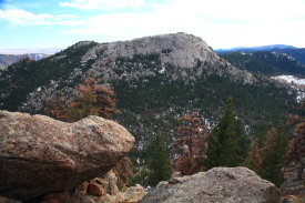
Looking south at Peak 7456

Greyrock Mt peaks, CO
Another shot of Greyrock


Greyrock Mt peaks, CO
Up the Greyrock Trail

Greyrock Mt peaks, CO
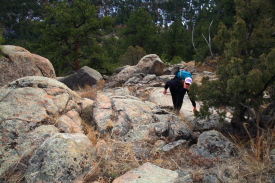
Stein picking her way up the rocks on 7681

Greyrock Mt peaks, CO
Higher up on the slopes, the wind became a factor

Greyrock Mt peaks, CO
From a false summit, we caught really 
unique views Greyrock's North Face

Greyrock Mt peaks, CO
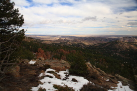
Looking east towards the plains
 

Peak 7456
Oct 10, 2011
From the established loop trail for Greyrock, the summit of this peak is a scant 0.8 miles off the trail as it passed by Greyrock Meadow, with a nominal elevation gain of 736’ from Greyrock Meadow.

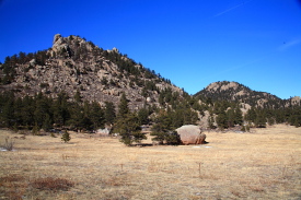
This peak sits due east of Greyrock, and by line of sight, is the closest peak to Greyrock. I took a trip to this one on a crisp fall Monday that followed two mucky snow days. It was good to see the sun shining, and I took full advantage of it. I started around 10:15, and took the shorter of the two optional routes to the trail junction just below Greyrock Mt. I continued on to the west, dropping down in elevation to Greyrock Meadow, and crossed the tawny wetland grass to the east side of Peak 7456. Several fire rings dotted the shady areas under Ponderosa Pines. I stopped to have a snack and slather some sunscreen on my neck and face. The route I took was pretty simple: up. Numerous rocks provided ample traction and a stair-like approach  to gaining elevation. I took a mental picture of where the true summit was as I began the ascent, and before long it was out of sight, so I just aimed to where I thought it would be. A few tricky parts called for some minor bouldering, but otherwise it was pretty easy going to the base of the summit pinnacle. Then I was stymied. The actual summit sits on a small point atop a near-vertical granite protrusion. I’m sure there are plenty of folks who would skip right up there, but it’s just not in my repertoire to do such things. Nope, I’m content with the slow and easy thrill of simple hiking, and I leave the climbing to those who know how to do it, or to those who are not destined to make continued and sustained contributions to humanity. I circled around the high point, and found the closest I could get was about 20 feet, from the north side, where a crack in the rock allowed easy access up a little chute shaded by large Ponderosas. I retreated a bit from this area, and made my way south to the summit that, while lesser in elevation, provided a much more satisfying summit experience. The flat, open rocks of this summit beckoned me to sit awhile, and I obliged, downing an apple and half a peanut butter sandwich before feeling my welcome was worn, and the trail was calling. Getting down was trickier than I had anticipated, as several routes I started down proved too dicey to go through with. In the end, I simply retreated down my ascent route for most of the way, breaking off to the west when I was sure the rough stuff was over. Joining the Meadow Trail, I followed it back down to the river, the parking lot, and my trusty mechanized steed waiting to ferry me home in style. 

Greyrock Mt peaks, CO
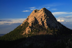
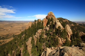
Summit of Peak 7456 as seen from 
the false summit to the south

Greyrock Mt peaks, CO
Looking west across Hewlett Gulch to Peak 7231

Greyrock Mt peaks, CO
Another shot of Greyrock from the false 
summit of Peak 7456

Greyrock Mt peaks, CO
Up the south slopes of Peak 7456

Greyrock Mt peaks, CO
Greyrock's western flank from near the summit of 7456

Greyrock Mt peaks, CO
Fantastic views to the west from this rugged peak

Greyrock Mt peaks, CO
The final pitch to the summit...not for me

Greyrock Mt peaks, CO
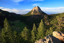
Greyrock, from across Greyrock Meadow


BACK             NEXT


Page created 1-23-11
Updated 1-2-12
Comments