| Location:
Roosevelt National Forest, northwest of Fort Collins, Colorado
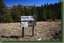
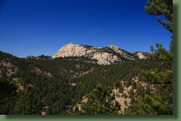
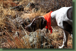
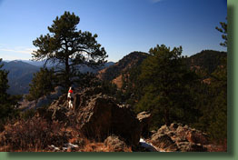
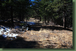
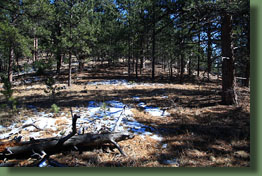
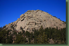
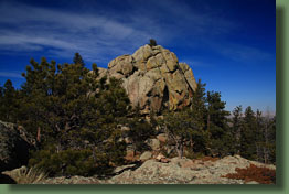
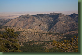
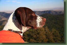
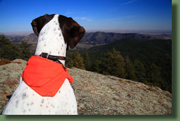
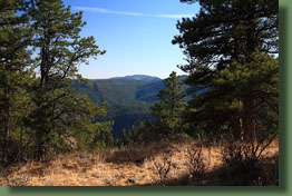
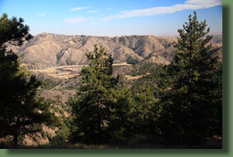
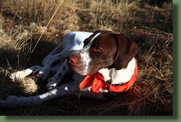
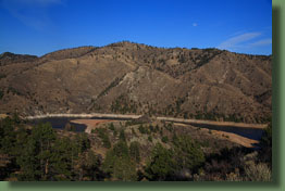
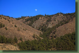
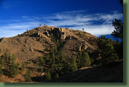
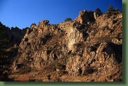
Access: From Ted’s Place at Hwy14 x Hwy 287, head west on Hwy 287 5.4 miles and then turn north into Fort Collins’ Gateway Park. Drive past the first picnic grounds and park near the second picnic area, 100 yards west of the gate across the road. Maps: USGS 1:24K Poudre Park & Laporte // A Trail Map Trail: Follow the access road one mile to the west side of the Seaman Reservoir dam. The Wintersteen trail, an un-maintained, un-signed route, skirts the reservoir for ½ mile, then plunges uphill to the west towards Greyrock Mt. It is primarily a faint trail that is often entirely unrecognizable and I lost it multiple times. There are some rock cairns, some posts, some neon ribbon. Nevertheless, a map and compass are essential for this hike. A GPS unit would probably be useful. I cannot say for sure how much I followed the Wintersteen Trail as it is shown on the USGS quad, but the approximate routes I took are shown on the trail map above. Terrain is steep. Near Seaman Reservoir, thick mountain mahogany slows progress, while at higher elevations the walking is open and pleasant through park-like Ponderosa pine stands. Once the summit of 6840’ is reached, Greyrock Mt provides a useful landmark for the remainder of the hike, which joins the Greyrock Canyon trail near the picnic bench at the junction of the canyon and meadow trails. I spent 7.3 hours on the roundtrip from Gateway Park to Greyrock Mt summit. Distance one –way to junction with Greyrock Canyon trail = 5.25 miles Distance on-way to summit of Greyrock Mt = 6 miles Elevation gain to summit of Greyrock Mt = 2,255’ Fees: $5/vehicle Mar1-Nov30; Gateway Park is open dawn>dusk, 365 days a year Dogs: Must be leashed in Gateway Park. Off-leash OK beyond Reservoir, but Greyrock Trail requires leash Weather: Stove Prairie weather station NWS Point Forecast March 8, 2009 I’d never taken the turn down into Gateway Park before, though I’ve passed it a hundred times on the Poudre Canyon highway. Years ago this is where our rafting trip ended on Poudre River Day when we got a super-cheap short raft ride that ended with a picnic lunch at the picnic area here, but otherwise I’d never been down here. I got on the internet the morning of to check to see if it cost money to go in. It does. So I pulled $5 cash out of the kitty (rarely carry cash unless I know I’ll need it) and hit the road with Henry the squirmy pointer pup, who wiggled back and forth over the back seat into the cargo area to sit facing rearward and watch the cars behind me, no doubt providing entertainment for them. We arrived at Gateway Park around 11:25 on this first day of Daylight Savings Time, my personal favorite Time, stopped to pay the fee at the self-service fee station, and found a parking spot at the end of the road farther on. It seemed to take an extravagantly long time to get my pack in order. I kept forgetting to pack certain things, and once I did have everything packed, decided it was too warm to be wearing my sweatshirt so I took off my pack again to stow it. That sort of thing. Finally around 11:40 we were on the trail. The only other people around belonged to a family of 4 + a dog that started ahead of me. I walked along the road towards Seaman Reservoir and saw the family off to the side. Henry saw the dog, and immediately began pulling and wheezing against the leash. Hasn’t figured that one out yet. We kept walking on towards the reservoir along the North Fork of the Poudre River, crossed a bridge to get to the west side, and at mile 1 we stood on the dam of Seaman Reservoir looking north across the diminished winter volume of Greeley’s water supply. Just beyond the dam a narrow dirt trail begins, which I presume is the Wintersteen Trail. No signs or markers give any information beyond this point. So we began. The weather was exceptional, and I grinned at how I’d lucked out to get such a fabulous day for a Sunday, as opposed to a Tuesday or Wednesday when I am contractually obligated to sit in front of a computer and do whatever it is I’m supposed to do. Not a cloud was in sight and the temperature hovered around 45, which is warm enough to feel comfortable, but cool enough to avoid a sweat-fest (that came later). An occasional breeze rustled the dry seeds on the mountain mahogany, but otherwise it was quite calm, which is unusual for March in the foothills. I let Henry run ahead of me off the leash. He’s young, and stupid, so staying close isn’t a concept he’s familiarized himself with yet. Thus, I was constantly whistling to him so he’d come back to me when he got too far ahead. Mostly this worked OK, but on a couple of occasions he took off after something, leaving me wondering which way he’d gone and how far. Those episodes were always followed with several minutes of on-leash time. The initial stretch of the trail was very plain, and I began to hope I wouldn’t need my GPS at all. It was right about then that I remembered I’d left it on the dash of the car, 1.5 miles down the trail. Since I’d never seen any signs for a Wintersteen Trail in all the occasions I’ve been up and down the Greyrock trail, I anticipated having a hard time finding it. Memories of a Coloradoan article from the 1990’s about a guy who spent all day trying to follow it from Greyrock to Seaman Reservoir have stuck around among the cobwebs upstairs, but I also figured it was likely that the trail had been improved a little, or at least marked with cairns, since then. I quickly decided it was too far to go back and anyway, this trail looked pretty good so I reasoned that it shouldn’t be a problem just using the map and compass. Very soon I came to a fork in the trail. This is not on the USGS map. I winged it and took the uphill (left) option. Not long after I came to a ravine that also had a fork. I went downhill into the ravine and up the other side. Not long after that, another fork in the trail, and I took the left option again, knowing I had to go left (west) at some point. This trail was more of an eroded washout than a trail, with soft soil and a straight-up-hill approach that trail designers never warm up to. Dormant mountain mahogany lined the trail, arching over it and scratching my arms as I passed by. To the east, I was able to see more of Seaman Reservoir from my increasingly aerial point of view. Seaman Reservoir is a long, narrow reservoir shaped like an upside-down capital G. As such, the full reservoir cannot be seen from anywhere at water level. I continued up the well-defined path along the ridgeline, stopping once to remove my flannel shirt and grab a hydrogenated oil-laced granola bar. I was feeling pretty good about the navigation up ‘til then, but then it all got kind of hazy. My fatal assumption was that the route marked on the USGS map had at some point existed as it was shown, and would therefore still be recognizable. Yes, the USGS map was last revised 47 years ago. I get it. As I say, it was a fatal assumption. This came into play when my well-defined path appeared to begin heading too far south, and when a more faint path that seemed to lead the correct direction presented itself, I took it. This lasted for about 100 yards before evaporating entirely, leaving me out in the middle of a wide expanse of dormant shrubs with little idea of where any trail might be. I studied the map, found some points of reference, and decided that I shouldn’t be too far off the trail as it was shown. Thus, I continued to follow the route of the old Wintersteen Trail as best I could, from shrubland into pine woods and back again. Many of the dips and gullies in this area are less than the contour interval of the map, and this slowed me down a lot as I pondered every ridge to decide if I should go up the ridge or over. Occasionally, it did seem as though I was on a trail, and I did come across a pile of sticks that looked manmade, but most often, these stretches simply ended, convincing me that they were merely game trails. The one stretch of trail I had faith in was the bit that ran up the ravine some 380 ft of elevation to the saddle just north of Peak 6712’. I was encouraged in this by finding a dilapidated Poudre River State Trust/Wildlife Management sign near the ravine. So I slogged on up this deep and steep ravine that, because it faced north, was still covered in snow that hid every loose rock and branch. There might have been a few falls followed by colorful words through this stretch. Once in awhile, I’d catch something that acted like a trail, and did fine for that purpose, but always these stretches were short lived and vanished. Finally, I made it to the saddle just north of Peak 6712’ and picked out what was plainly a route that, if not traveled frequently, was at least traveled once. A neon ribbon hung from a tree branch, and up the ridge I could see a stack of rocks such as only humans tend to build. The ringer was a tall wooden post that stuck out of the pile of rocks. From then on the route was somewhat defined by occasional neon ribbon, in orange, pink and yellow varieties, as well as occasional cairns or posts. Even without these, the going would have been easier since the only logical route from there was to hug the ridge up to the summit of Peak 6958’, then head west along the ridgeline to Greyrock Meadow. I marched up the ridgeline towards the summit of the first peak, vaguely following the route outlined on the map. At the summit of Peak 6820’, Greyrock Mt came into view, and I headed south (the wrong way) for a bit to get a clear shot of the mountain. I found a great rock outcrop that served this purpose on the far south end of the long, flat summit, and since I had been hiking for exactly 2 hours, it seemed like an appropriate time to sit and have a snack. I ate some peanuts and Reese’s Pieces while Henry ate the shredded wheat squares I brought for him. From there we headed north along the summit under a very pleasant open canopy of Ponderosa Pine to Peak 6958’, then followed the ridge heading to the west through more Ponderosa Pine on a south-facing slope that had an abundance of yucca. I kept my eyes peeled for the Brinkhoff Mine, but did not see any sign of it. Nearing the final ridge before the Greyrock Trail intersection, I came upon another hiker coming at me. I was startled, to put it mildly, to find anyone else out traipsing along this defunct ”trail”, but there he was. I greeted him and smiled, and he looked past me and nodded slightly, as if trying to ignore my presence. Surly hiker. I guess he didn’t expect to see anyone here, either. His passing created momentary confusion since Henry was off-leash and off-trail when we passed, so when I did catch sight of him, he was racing up the hill towards the other hiker. I called to him, and he seemed to think I was a stranger trying to eat him, and he ran away from me. I whistled to him, and he stopped, and warily approached, as if I were trying to lure him in by pretending to be Sam. Silly dog. I pulled out my leash to prevent him from suddenly bolting off after the other hiker, and as I learned later, my map also came out of my pocket without my notice. We continued on through the pines and an abundance of downed timber to the intersection with the Greyrock Trail, just behind the picnic bench that has been there for twenty years. Even knowing where it is, I cannot see any reasonable semblance of a trail from this picnic bench, which explains why I never did before. I made the last part without any map by virtue of Greyrock being such an obvious landmark, but fretting a little about efficiently getting all the way back to Seaman Reservoir without it. I hadn’t anticipated going to the summit of Greyrock, but seeing it there shining in the sun on such a warm spring day put a spring in my step, and after leashing up Henry, I filed us into the line of small groups progressing up the trail. In front of me were two groups of two, both with dogs, and behind me were two groups of 2, one with dogs. Henry found renewed vigor in the presence of other dogs, and pulled heroically in an attempt to catch up with the boxer in front of us. I kept a safe distance behind, but I couldn’t hang back too much because two humans and two more dogs were right behind me. So, we hiked up the mountain with me trying to maintain equal space between the two groups of dogs, and Henry literally falling over himself trying to pull me up faster. Since last I was on the summit of Greyrock, the Forest Service has installed multiple trail marker signs that still fail to clearly direct a hiker to the summit. I was among three groups of folks who all took the same wrong dead-end turn near the summit. I had no memory of the wrong turn before I took it, but as evidence of a prankster controlling my brain, I instantly recalled the wrong turn when I got to the dead-end. I’ve made that wrong turn many times. If you’ve ever hiked up Greyrock, I give you a one in three chance of having made the same wrong turn. Soon we were back on course, and heading up the narrow last patch to the dried up pond on top. We crossed this, and then headed southwest for the summit, being closely followed by a couple with their dog. Henry was new to rock-hopping, and didn’t show much aptitude on his first attempt. He slid down rock faces, missed his intended jump targets and would have probably run right off the north face of the mountain had he not been leashed. I managed to get him to the summit where 6 other hikers lounged about. The air was dead calm and warm, and just perfect for enjoying the summit of Greyrock. Henry positioned himself to apply maximum force on the leash in an attempt to go mingle with the other hikers and their dogs, while I held him back and attempted to take photographs of the view. If you’ve ever attempted to hold a dog leash and hold a camera for a photograph at the same time you know the futility of this operation. After having my hand jerked 4 times during composition, I gave up and put my camera away, unfortunately in the process failing to secure my 3rd lens cap to the camera, and thus discovering ½ mile later that I had donated yet another one to the old man of the mountain. We headed down to the meadow at the summit, and found a more secluded vista to enjoy while the crowd thinned at the exit point. Then we made our way down towards the trail junction, retracing our steps back to the picnic bench and back east along the ridge. The sun was getting lower, and orange sunlight slanted in beneath the trees, casting long black shadows behind the pine tree trunks. I began to feel a little tired at this point, but still happy, especially after I found my map lying beside the faint trail that runs along this ridge. I figured out at that point how I’d lost it to begin with. Like clockwork, minutes later I ran into the same guy as before, at almost the exact same point. And, as before, he said nothing to my verbal greeting and avoided all eye contact. I followed the route down the ridge to the saddle north of Peak 6712’, as before, but this time I decided to avoid the snowy, slippery ravine I had come up, and instead stay on the faint path that continued across the saddle. This path also had the advantage that it was periodically marked with neon ribbon. Surprisingly, it went uphill towards Peak 6712’, and just about the time I was considering bailing off to head downhill, it did too, heading across an open grassy area bounded by rocks on the south that offered a great vantage of the Poudre River and highway below. We followed the neon ribbon and faint trail for a while longer, then lost it again. From there I just headed east through woods and mountain mahogany until we were suddenly on the trail again. This last find turned out to be the trail I had started on, and it led us back down to the reservoir dam. From there, we had no problem following the road back to the car, which we reached at 7:05. This trail is a long slog, and a true challenge for route finding if using just a map and compass. Actually I never used my compass since either Seaman Reservoir to the east or Greyrock Mt to the west were always visible landmarks. The going might have been easier with a GPS, but that presupposes that the coordinates I lifted off the USGS map for the Wintersteen Trail actually lay on a usable trail. From what I saw, the Wintersteen Trail, if it ever existed beyond theory, is long gone, and the new route to Greyrock that has been intermittently-defined by neon ribbon and cairns is similar, but not the same. Therefore, it may have been serendipitous that I left my GPS in the car since it forced me to pay more attention to the terrain and the map. Except that I learned later that night that I did not, in fact, leave the GPS in the car. Instead of leaving it on the card dash, I had put it in my sweatshirt pocket just before I put my sweatshirt in my pack that I carried with me the entire time. The prankster who controls my brain strikes again! |
 |
