| Virgin Falls State Natural
Area
Location: Virgin
Falls State Natural Area, near Sparta, Tennessee
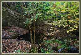
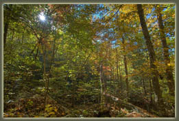
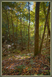
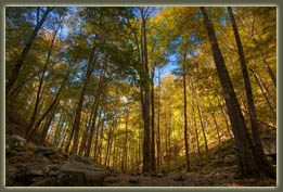
September 17, 2010 We started our hike around 9 in the morning, with the sun shining brightly through gaps in the forest canopy. Oaks, hickories and tuliptrees dominated the forest, and a solid green wall rose up in every direction from my gaze. Very green, very still and very humid; I began to sweat almost immediately. Ada was in the pack on my back, cooing and jangling her little toy. Mom was down for a visit from New Hampshire, and she and Andra walked ahead of me. We followed a well-defined trail across a dry creekbed and over another muddy creekbed with a little water puddle in places. Ferns lined the banks of these seasonal watercourses. A hundred meters from the trail the native hardwood forest ended, and a dense, nearly-impenetrable stand of loblolly pine took its place. Loblolly pine (Pinus taeda) is a beautiful tree, native to coastal states from Texas to New Jersey. It grows well on a wide variety of sites, and this has promoted it to the head of commercially-important timber species in the southeastern United States. Because loblolly pine produces biomass at double or even triple the rate of native forest associates, such as oak or hickory, privately-owned timberlands are most profitable if all trees except loblolly pine are removed. As loblolly pine is not native to the Cumberland Plateau of middle Tennessee, it has been common practice for many decades to clearcut the native hardwood forest, and replant it with a monoculture of closely-spaced loblolly pines that can be harvested on a 30-year cycle. Between 1981 and 2001, about 14% of the native forest on the southern Cumberland Platueau in middle Tennessee was converted to loblolly pine plantation. The softwood lumber is used either for construction or paper production. Most of the timberland on the Cumberland Plateau is privately-owned, and as such is available for conversion to pine plantation. We all like paper and wooden-frame houses, and the upside to pine plantations is that far more timber can be produced per acre than by harvesting native forests. On the other hand, wildlife adapted to native hardwood forests find pine monocultures unappealing, and so the amount of wildlife supported per acre of pine plantation is lower than native hardwood forest. Erosion is exacerbated by clearing of native forest on steep terrain, negatively impacting water quality for both wildlife and communities downstream. And, as far as hikers are concerned, pine plantations are not appealing places to recreate (this is my personal judgment, but I feel pretty confident in stating it). As a large bulk of the paper produced goes into producing such trifling and ignoble products as glossy newspaper ads, paper towells and clothing catalogs, the loss of beautiful native hardwood forests is difficult to approve of. Tennessee bought 1,133 acres of native timberland surrounding Virgin Falls from Bowater, a timber and pulp company, in 1996, just before the company was merged into an even larger multinational conglomerate. That area is now protected from pine plantation conversion, and provides excellent wildlife habitat, water quality and recreational outlets for humans. We walked along the shady trail through a stand of rhododendrons along a dry creekbed, and then steeply downhill towards Laurel Creek, which we crossed with the aid of a steel cable. A campsite sits just beyond the crossing, and a few people were set up there. The lazy waters of Laurel Creek slid along through the limestone gulch to our left, and before long we reached a junction with the overlook trail. I wasn’t exactly sure where it went, or how long it was, but who can pass up an overlook? So, up we went. The overlook trail turned out to be fairly steep, but fun. It snaked up through the limestone ledges and oak forest and, after a few wrong turns, we found ourselves at the bottom of a rickety wooden ladder with the bottom step missing. We carefully ascended to the shaded ledges above, and continued another few hundred yards to a fantastic rock overlook of Scotts Gulf named Martha’s Pretty Point. We had snacks, took photographs and enjoyed the wonderful vista for quite some time before loading up and heading back down. Rather than return exactly the way we’d come, we saw a fork of the trail that was labeled as a route back to the main trail, so we took it. Sure enough, after a steep descent with lots of washed-out wooden steps, it spilled us out onto the main trail right along Laurel Creek. From there it was a short distance downhill through cool, moss-covered boulders to Big Laurel Falls. Laurel Creek falls over a cliff in the streambed with a drop of about 45 feet. The cliff face behind the falls has eroded to form a cave that sinks back into the rock some 100 feet, and slopes downward. The water that falls from above crashes down onto jagged rocks, and then sinks underground, only to reappear quite a bit further downstream, a disappearing act common for streams in this limestone area. We walked behind the falls and into the cave. What a cool spot, especially on a hot September day! We discussed continuing on
down to Virgin Falls, which was our original intent, but we had been hiking
so far without any urgency, and the day had grown old very quickly. We
decided it was best to head back and leave Virgin Falls for another day.
The walk back was actually a bit shorter since we skipped the overlook
trail, but it was just about all uphill, and though the distance isn’t
that far, the addition of the baby carrier and Ada’s 23 lbs on my back
sure made for a sore back. I was awfully glad to see the car at the end
of it.
October 15, 2010 Less than a month after the first trip, I was back to finish what we’d started, and make it to Virgin Falls. This time I was alone except for my canine companions, Makenzie and Henry, who were both extremely eager to get out on the trail for the first time in almost 6 weeks. We followed the main route downhill to Big Laurel Falls, just as before. From there we headed further on down the valley towards Virgin Falls. The day was fantastic: much cooler than the September visit, and with a bit of a breeze that brought the feeling of fall. Many of the trees had dropped their leaves, but most still had a full coat of yellow, orange and red leaves to display. The crimson leaves of the sourwood trees, backlit as they were with the white fall sunlight, were particularly beguiling. The first fork in the trail brought us to Sheep Cave, and this was a completely unexpected surprise. Henry, Makenzie and I took the short spur trail to the cave, where a thin sluice of clear, cold water emerged from the 10-foot tall cave opening. I walked in a couple dozen feet before the light grew too dim to see very well. I didn't know it at the time, but because of white nose syndrome in brown bats, all caves on state-owned lands in Tennessee are closed, with the thought of trying to prevent the bat colonies from being infected and dying off. White nose syndrome, which was first spotted killing entire colonies of brown bats in New England in 2007, is still apparently a bit of a mystery as to both its origin and its exact mechanism of death, though probably this sentence will be out of date by the time anyone reads it. Near the entrance to Sheep Cave, the water spills off a cliff and tumbles down a series of waterfalls below until it reaches the bottom of what is, in essence, a very large sinkhole, and slips back underground. There appears to be no easy way to get to the bottom of the sinkhole. Moving on, we cruised downhill to a shallow creek crossing, then back up over a minor ridge to Virgin Falls. Like Sheep Creek, Virgin Falls is maintained by water that emerges from a cave, falls 110 feet into a large sinkhole, and slides back underground. The difference is that there is much more water falling here, and you can easily walk down to the bottom of the falls, and even behind it, which I did. It got pretty slick behind the falls, so I told Makenzie and Henry to stay in front of the falls while I checked things out. Very cool spot there. The hike out was fun, and
much less grueling without baby on board. The cool air helped with that,
too. The entire trip took about 5 hours.
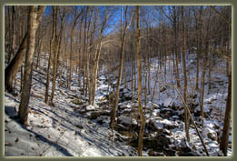
January 15, 2011 Desiring to see Virgin Falls partially frozen, I hiked there again with Makenzie and Henry on a warm January day following a wicked cold spell. It was nice and sunny, but most shaded areas of every streambed were frozen, and the entire effect was very nice. One section of the trail that passes by a cliff was so loaded with icicles that we literally walked behind a wall of ice to get beyond. Big Laurel Falls was running, but had lots of feathery ice built up on the edges of the water. A group of campers had set up their tents deep in the cave, and though that might offer a bit more shelter at night, it seemed like an awfully cold place to be hanging out during the day with the sun shining. Virgin Falls was indeed adorned with lots of ice, and the effect was very cool. References
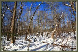
Virgin Falls trail under snow 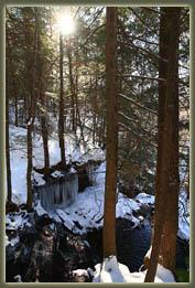
Laurel Creek 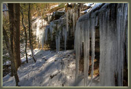
Very large icicles 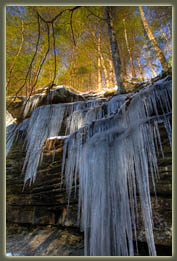
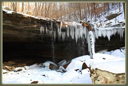
Big Laurel Falls 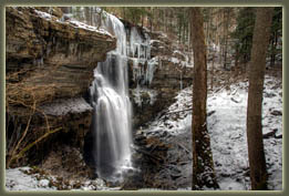
Virgin Falls 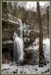
Virgin Falls 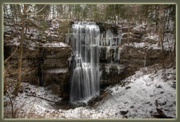
Virgin Falls 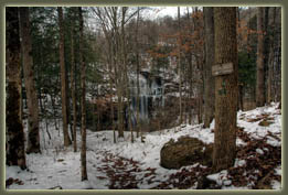
Virgin Falls 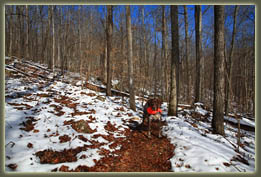
Makenzie on the Virgin Falls Trail 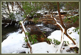
At the Laurel Creek crossing |
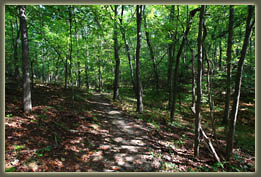
Beginning of the Virgin Falls Trail 
Ada at Martha's Pretty Point 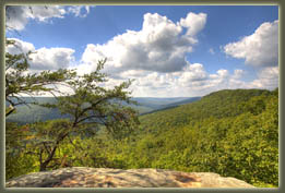
Martha's Pretty Point 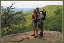
Andra, Sam & Ada at Martha's Pretty Point 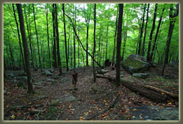
Descending the Overlook Trail 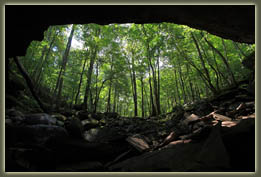
Inside the Big Laurel Falls Cave 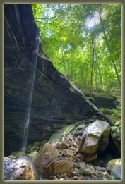
Big Laurel Falls 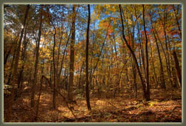
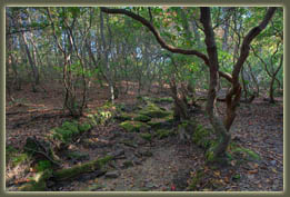
Rhododendron forest 
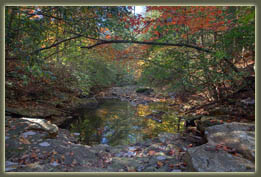
Laurel Creek 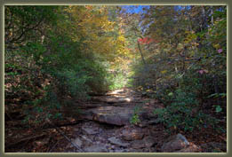
Laurel Creek at the crossing 
Below Big Laurel Falls 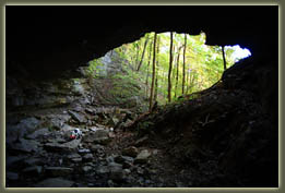
From inside Sheep Cave 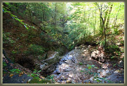
Falls below Sheep Cave 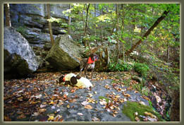
Makenzie and Henry above Sheep Cave Falls 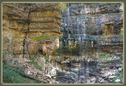
Virgin Falls 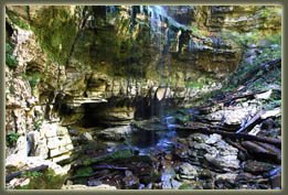
Virgin Falls 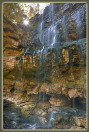
Virgin Falls 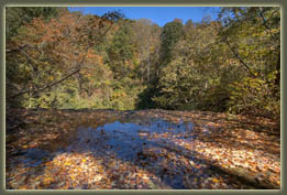
At the top of Virgin Falls 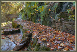
The top of Virgin Falls |
