| Location: Snowy Range,
Medicine Bow National Forest, near Laramie, Wyoming
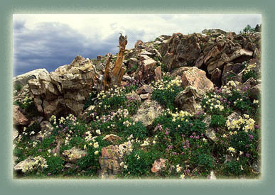
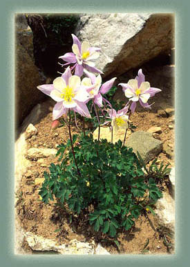
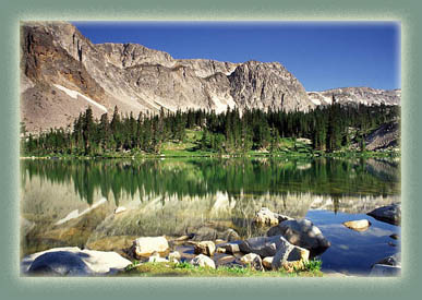
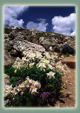
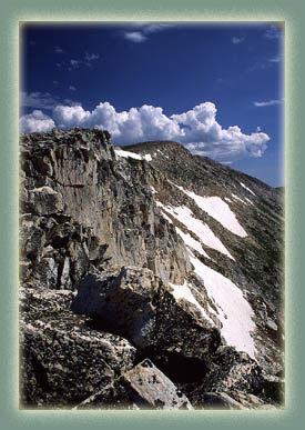
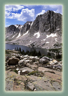
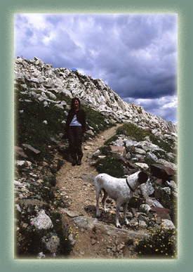
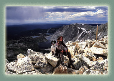
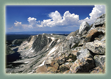
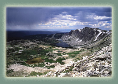
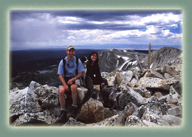
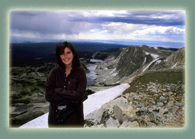
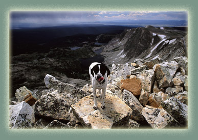
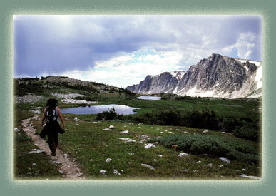
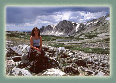
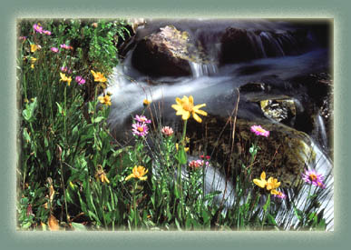
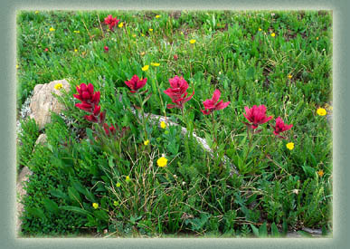
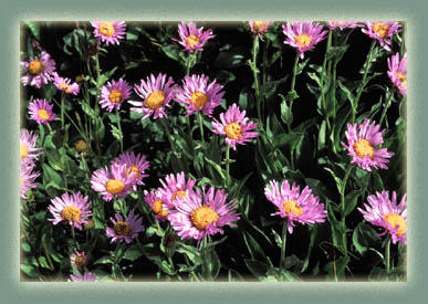
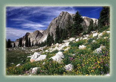
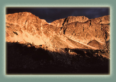
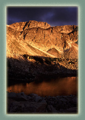
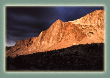
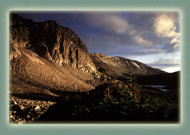
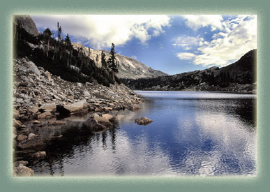
Maps: USGS 1:24K Medicine Bow Peak Trail: F A 6-mile loop hike starting around 10,500' at Lake Marie, curving west along the exposed ridge of the Snowy Range up to 12,013' Medicine Bow Peak, then down lots of switchbacks to the lakes below, and back south to Lake Marie. Elevation gain along the trail is ~1500'. Moderately difficult, very exposed to lightening. Access: From Laramie, take Hwy 130 through Centennial to Snowy Range Pass (seasonally closed). Park at the Lake Marie TH about 1.3 miles past the Pass. Trailhead: NAD83 zone13 389129e 4576363n Elev: 10,480' Fees: None Dogs: Voice control Webcam: Arlington Interchange, 30 miles north Weather: Current & Recent Conditions Snow conditions NWS Forecast After our first trip to the Snowy Range in 2001, Andra and I waited nearly a year before returning. I dont know why, except that it is a little longer drive than Cameron Pass. However, the scenery is well worth it. We passed by it on our way back from the ill-fated Wind River trip in early July, and I spent about half an hour quickly bouncing around the mountainside checking things out, marveling at the wildflowers and snapping photos. We were both very hungry so we left before we had a chance to check things out much so that we could get into town and get some food. I got up at 6 the next morning and drove back up there. Frank cut his paw in the Poudre River pretty severely the day before, so he had to stay home. That was probably fortunate because I would have undoubtedly been very nervous having him next to those precipitous cliffs all day. When I arrived at the Mirror Lake TH, there were only two cars. I walked around Lake Marie on the east side, heading south with the massive peaks to the west, and snapped photos here and there. The lakes were still as ice except for an occasional rising trout creating a series of concentric rings rippling off into nothing. I didnt immediately get on the trail as I went uphill to the west, but instead hung near the edge of the trees so I could watch the lakes and mountains on my way up. Once above treeline, I hit the trail and huffed my way up steep switchbacks to level terrain on the backside of the huge granite blocks. The trail was superfluous at that point since it was all rock and meadow and I branched off and took in sites wherever I had the chance. To the west lay a mostly unbroken carpet of forest (got to have clearcuts..good for the economy) stretching to the sagebrush flats just dimly deiscernable to the Northwest. To the south I could see the cluster of peaks around Cameron Pass, and reflected on how many times I had stood on top of those peaks and looked north to where I now was. All along the hike I was on the brink of a thousand foot drop into glacial lakes below. It was exhilarating. I went slow and tried to carefully compose my photographs. I had my tripod with me, and that really slowed down the pace. Nevertheless, I made it to the top of Medicine Bow Peak before 11 and was rolling down the northeast side before the dark clouds came overhead. I could see it raining in the distance and I marveled at the bravery of those still heading up to the top of a 12,000 foot peak with approaching thunderstorms clearly visible. I reached lake-level far north of the my car and followed a well-marked trail that wove among the many lakes to the south. Two marmots chattered at me from rocks below. Columbines grew in masses all along the trail. It rained lightly on me, but luckily I had a rainjacket to keep dry and warm. I met a forest ranger along the way and answered some survey questions. My final comment was Leave it just the way it is. In August 2007, I returned again to tackle Medicine Bow Peak, this time with Andra, Frank and Makenzie. We started at the Lake Marie TH and followed the same route I had taken before up to the summit. We especially enjoyed Makenzie's antics of dunking in every little puddle of water we came across near the trail. Sometimes we would hear a splash of water, look around and see only her head poking up above the bowl of water her body was sitting in. It seems almost a requirement that any summit attempt of Medicine Bow comes with an approaching thunderstorm. We hit the top, and almost immediately headed down the other side as approaching thunderstorms bore down on us.
|