| Location: Pike National Forest, west of Pikes Peak
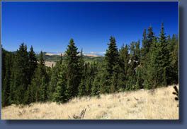
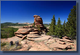
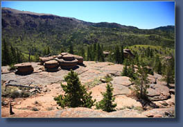
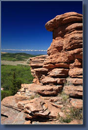
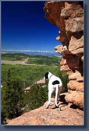
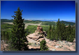
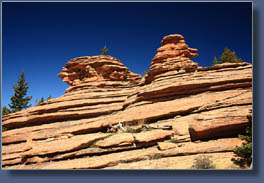
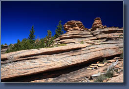
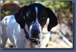
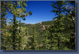
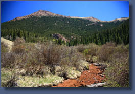
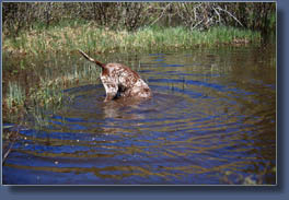
Access: From Divide, CO, take Highway 67 south for 9 miles to a parking area on the east side of the road just beyond a railroad tunnel. Maps: USGS 7.5’ Quads: Cripple Creek North & Pikes Peak Trailhead: NAD83 zone 13 488088e 4298394n Elev: 9690' Trail: 4 miles one-way to the Pancake Rock overlook along a well-marked route with 1500 ft elevation gain. Moderately strenuous. From the parking lot, follow the trail uphill along an old logging road to a fence, continue on the path past the left turnoff for TR 704 (Horsethief Park) and watch for a fork with an old sign pointing up towards Pancake Rocks. Take a right at the fork and continue to the obvious overlook point. Every time I’ve been to this TH, it’s been very busy. Dogs: Voice control Fees: None Weather: National Weather Service Point Forecast NOAA Snow Conditions June 7, 2008 Another wonderful day hiking with my favorite hiking crew: Andra, Frank and Makenzie. We chose to tackle Pancake Rocks, after seeing the turnoff sign from the Horsethief Falls trail the weekend prior. So, under a beautiful sunny day, we hit the trail started up the steep old logging road that bores almost straight uphill for the first mile. Beyond an old barbed wire fence, the grade slacked off a bit and we breathed a little easier. Frank and Makenzie, both possessing that unnatural canine energy, trotted up and down the trail and from side to side with ease, pausing now and again to sniff something obviously interesting, or to leave a little calling card of their own. Their system is pretty efficient, you must admit. We came upon the branch off to Horsethief Park, which we had hiked last weekend, and both dogs took the opportunity to tank up on creek water. Shortly after, we peeled off the trail to the right at the sign for Pancake Rocks. This trail was immediately steeper than the one we left, and soon I was panting for breathe on my way up the switchbacks. Andra and the dogs were unfazed, but I was really laboring. I just didn’t bring my A game and several times I felt dizzy, not an uncommon feeling that weekend…think I was fighting a bug. Anyway, I continued on, slowly, trying not to get too out of breathe, and we made slow progress up the hill. It helped that this section of the trail was almost entirely shaded by pine and spruce. To the north, through the trees, we could see Sentinel Point, the westernmost peak of the Pikes Peak massif. We reached a summit, and saw a group of folks lounging on some large boulders to the west. Keeping the dogs in tow, we continued on the trail as it descended through a sun-drenched gully with a puddle of water in the crease of the drainage (which both dogs found quickly). Views of the Sawatch Range to the west began to open up, and with the absolute clearness of the air that day, the mountains stood out sharp and crisp on the horizon, still coated with snow. The trail hauled back up through the trees, and reached a steady downhill section that pulled through a drier, south-facing slope covered with smaller lodgepole pines. Abruptly, we reached the end of the trail, at a point overlooking a valley that was obviously Pancake Rocks, since the rocks looked like stacks of pancakes, especially the misshapen, ugly pancakes that typically result from my breakfast chef efforts. My mom used to be really good at making animal-shaped pancakes, and even took requests. All my pancakes resemble amoebas. I snapped lots of photographs of the rocks quickly, since I heard a big group of folks hiking in. I got a dozen shots in of the rock formations against the blue sky and the incomparable Sawatch Range backdrop before a group of about 20 hikers appeared. Andra and I retreated downhill a little with the dogs to enjoy lunch in the shade of a stunted pine tree. We could overhear the group uphill as they set about cooking pancakes…fitting. We snacked on Doritos while the dogs begged and we threw them a few chips. Makeznie has always been a fiend for Doritos; comes running when she hears the crinkle of a bag. Frank and Makenzie positioned themselves for rock-fetching, a favorite game they adopt when there are no balls or Frisbees around. We sat in the shade and indulged their doggy wishes for 20 minutes or so, then headed back up the trail. I felt infinitely better with a dozen Dorito ships in my belly, and the hiking went quick under a perfectly-blue sky. We reached the first summit we had come to and took up a position in the sun near the big boulders to eat the PBJ sandwiches we had packed. We had a great lunch at the summit, then began hiking back down. We passed lots and lots of people on their way up, and I was glad we had gotten a nice, early start to our hike so that the trail was quiet and clear on the way up. When we reached the junction with Horsethief Falls Trail, we lead the dogs over to the creek where we threw rocks into the water for Makenzie to fetch and sticks into the water for Frank to catch. They each have their own preferred water-games. After the dogs were thoroughly soaked and mud-caked, we started back to the car. The trail down went pretty quickly, uneventfully, and we were back in the car headed for Woodland Park about 4 hours after we had started our trip. |
 |
