

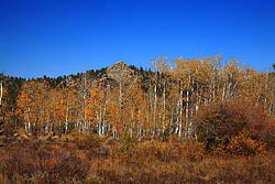
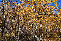
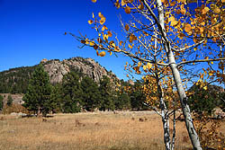
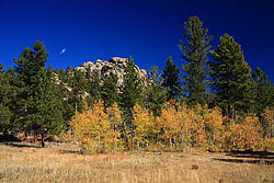
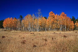
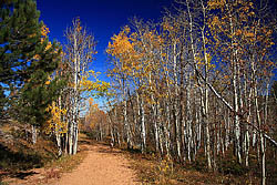
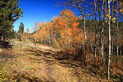
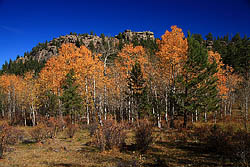
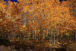
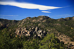
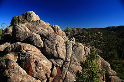
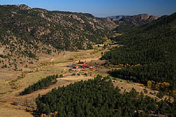
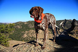
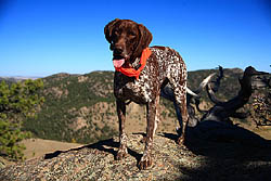
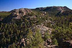
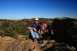
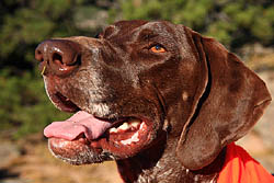
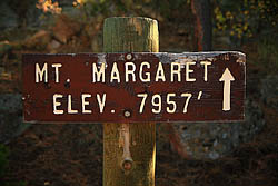
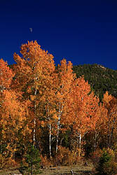
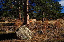
October 7, 2008 The blue sky, 60-degree air and gentle breeze at lunchtime convinced me to take the afternoon off and head for the hills, especially given the forecast for rain and snow in just two days' time. The end of season is here, and the number of great hiking days left in 2008 is almost run down to none. So, I hurriedly shoved essentials in my backpack, outfitted Makenzie with a new day-glo orange bandana in case hunters were around, and zipped off in the Subaru for Red Feather Lakes area, and Mt Margaret, a hike thatís been on my list for a few weeks and which seemed perfect for just this day. Arriving at the trailhead at 1:30, there was only one other car in sight. Makenzie, who is a German Shorthaired Pointer who flat out looooves hiking, whined and pawed at the door of the car while I put on my backpack and slipped my camera over my shoulder. I released the hound, locked the doors, and slipped through the Forest Service gate at the trailhead. The day had not diminished in any respect, and was a perfect specimen of a fall day to be outdoors roaming this great public land of ours (though the Forest Service likes to think it has authority to charge the public to use it, on occasionÖ.the nerve). With the sun well past equinox angle, the slanting yellow afternoon light left the overhead sky even more deeply blue than usual, highlighted even more by the remaining golden aspen leaves that, while mostly fallen, were still present on the branches with enough numbers to impress as they fluttered and winked in the warm southwest breeze. Makenzie raced ahead of me, but her bright orange bandana kept her whereabouts in check as she sniffed and roamed through the tall grass and orange gooseberry shrubs growing beneath the ponderosa pines. Several frosts at this altitude had left the grass tawny and crispy, but many of the forbs and shrubs still had their leaves and were displaying a soothing array of earth-tone reds, oranges and yellows. The trail seemed really to be an old two-track, and was very well-defined and apparently well-used, judging by the density of bootprints, horseshoe prints and bicycle tire tracks. Without straying too much from level, we cornered a pine grove and entered a sweeping meadow with interesting rock outcroppings around the edge, each framed nicely by a strip of colorful aspen at different stages of senescence. Long before I arrived at it, Makenzie was wallowing in the cold water of South Lone Pine Creek. I crossed the shallow current on a log, and continued on the two track heading north, taking pictures as I went. I passed a couple of numbered forest service campsites, and one even looked recently-used, though it doesnít appear cars are allowed access, so it must have been as a backpack. The road bent around to the west, and I walked over to visit an especially vibrantly-colored aspen grove. While off the trail, a woman and her dog passed by on it, waved, and walked on towards the trailhead. Makenzie and I resumed the trail, and headed west towards Dowdy Lake, then curved gradually to the north and back east again. Iím not sure why the trail does this, as thereís no mountain or other apparent obstacle that it is avoiding. But, if the point is to get to the destination by the quickest possible route, there appears to be closer trailheads and closer county roads than the one we started from; if the point is to enjoy the journey, then thereís no reason to begrudge an extra half mile through nice pine woods. Shortly after we resumed an easterly direction, we passed through another Forest Service gate, and a fork in the trail, which required a moment of consideration before I chose to stick to the main artery which requires staying right at the fork. This led us along a string of aspen groves, some completely barren, some still 90% leafed out. I strayed from the trail taking photographs, even trying to get Makenzie to pose regally in front of the nicest groves, but she really had no interest in cooperating and anyway was much more interested in frolicking about in the vicinity of the pocket gopher holes. Sheís a furious digger, and hey, if it gets her energy out, Iím all for it. Big choices came at a 5-way intersection that appeared about 2.5 miles from the trailhead. Fortunately, the route to Mt Margaret was clearly indicated, as were the destinations of all the routes, two heading to Lake Dowdy and the other leading off to Loop ďAĒ, which I wasnít familiar with and so not interested in trying. We hit another couple of intersections, but from there on the route to Mt Margaret was well-signed. After the final intersection, the road led by a large fenced-off riparian area with an unusual isthmus of access to the center, presumably for livestock watering, as there were plenty of signs of cattle in the area (read:shit). The last ½ mile of the trail to the summit was the most interesting. Itís notable that the summit of Mt Margaret is lower than the trailhead, and thereís not much elevation change between, but instead just a nice stroll through rolling hills and rocky outcrops. Near the summit, the road degraded to a single track trail, and the vegetation thickened up considerably. We reached trailís end 90 minutes after starting the hike. The actual summit of Mt Margaret is a smooth granite dome that looked very difficult to summit. I didnít try. Iím sure others have, just as others have summitted K2, but Mt Margaret (and K2) are beyond my comfort zone, so I contented myself with the no-less spectacular views from the surrounding rocks. The valley to the north is very impressive, with viciously-jagged canyon walls, and a serene homestead ranch in the flat meadow near the creek, belonging to the Maxwells at the time of my USGS map printing. To the west another wonderful landscape of granite domes and bubbled rocks stacked on top of one another presented the essence of rugged wilderness. From a distance, the area appears almost impossibly impregnable. I surveyed the area from all vantage points while Makenzie brought me objects that I should throw for her, and I sat for several moments enjoying the tranquility of warm sunshine on a quiet mountaintop in fall, alone with a rabidly-energetic pointer. Good times. We started back at 3:30. Just as we passed the fenced-off riparian area, Makenzie started looking back behind us as we hiked, often stopping to sniff the breeze and stare into the trees. She kept up this behavior so stridently that I began to suspect we were perhaps being followed by a cougar, though she didnít necessarily seemed alarmed when she stopped and watched the grass. It's just very unusual for her to stop moving for anything, so I take it seriously when she stops to stare. My Mom described her pretty well as "Perpetual Motion", although it's true that on another occasion she described her equally well as "Awkwardness in Motion". In the slanting afternoon light, it was enough to keep my own senses up, however, and I kept an alert eye around us for any of the overly-large kitties that are known to roam the woods. Returning to the 5-way intersection, I was a little confused about which way to go, as I hadnít taken good enough mental notes of the direction Iíd come. Who the heck makes 5-way intersections, anway? My USGS map was completely useless as it didnít show a trail one in the area, but all trails were labeled, and I had parked on Red Feather Lakes Rd, so I took that trail, and in a few minutes confirmed my own boot tracks in the sandy road bed. If you hike this trail, take note of this intersection as you pass through! The sun sank lower as the afternoon melted away into early evening, bringing renewed intensity to the harvest colors in the woods, and with sunset at 7:00 this time of year, 5:00 felt pretty late to be getting back to the car. |
 |
 Comments |