![]()
![]()
| Location:
Lake Powell area, near Halls Crossing
Maps: USGS Quads: Halls Crossing NE, Burnt Spring, Mancos Mesa Trail: No official route, just canyon walking. Access points into Moqui are limited. Access: We accessed via Burnt Spring Rd southeast of Burnt Spring Canyon that departs 276 around UTM NAd83 zone12 551312e 4140581n. Most of the canyon proper is too steep to access directly, but many side canyons offer access. Some steep sand slides offer direct canyon access, but would be hell to hike back up. Fees: None, unless you park within the boundary of Glen Canyon NRA Dogs: No regulations posted, but water is scarce
Dave and I planned this trip to Moqui Canyon in the depths of winter, when a warm hike through a sandstone canyon was only a mirage. Well, for me at least. Dave lives in Hawaii, so he pretty much has a warm hike option any day of the year. Originally I had planned heavily for a hike in the Dark Canyon Primitive Area, just south of the Needles District in Canyonlands, but days before leaving on this trip on the last day of April 2007, I called Monticello BLM and a nice woman politely informed me Iíd have to be crazy as a rabid weasel to try driving the Elk Ridge Rd this early in the year. OK, so we fell back to Moqui Canyon..lower elevation, drier, easier to get to. Done.
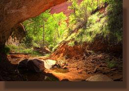
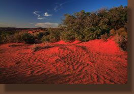
April 28 2007 I picked Dave up from Denver International at 9:10, successfully meeting him in the airport without aid of cell phone, proving that they are not, in fact, indispensable gadgets of the modern lifestyle. After negotiating Denver traffic (ech!) we hit the mountain stretch of I-70 going west. The sky was clear, the sun was high and it was the first day of the year that I could drive comfortably with the windows down. Thatís always a great day of each year. Dave played Brian Reegen and Dane Cook from his iPod, hilarious, and we made good time to Grand Junction for gas, then into crowded Moab by 4:00. It was Saturday, and there appeared to be a parade or something brewing in Moab. At 5:30 we were in Blanding and needing dinner, so we stopped at the A&W/grocery mart. I grabbed chips and a drink, while Dave braved the A&W greasepit and got a burger. And the night before a backpacking tripÖDave is either brave or stupid. Under an orange evening light, we cruised west through an achingly desolate and beautiful sandscape of orange sandstone and orange dunes. The GPS led us astray briefly (it might have been operator error, but whatever) and soon we found the inconspicuous 2-track leading north from the pavement toward Burnt Canyon. Two RVís were parked near the road, and we waved to a couple of old guys standing outside their rigs, undoubtedly talking horsepower and such. I wasnít sure how far this road would take us, since on the map it was simply labeled as "unimproved", but figured we could try our luck and hope not to get stuck and see how close to the canyon we could get before needing to get out and walk. The road was surprisingly good, and even in the Saturn, we were able to cruise along at a pretty good clip. At some point, a dozer had come along and cut a swath out of the rock, and the going was smooth. The GPS confirmed we were nearing the canyon, and we kept our eyes out for a nice spot to park. We turned a corner and hit soft sand, and I gunned the engine to keep the momentum up. This convinced me it was time to stop pressing the luck, and at the next slickrock flat, I pulled off and parked. We loaded our backpacks and filled our water bottles and at 8:05, five minutes after sunset, we started the hike. Late to start, and this was a bit of a concern. We hiked quickly down the road and to an uncertain campsite. I had planned on having hours to reconnoiter a likely site for the night, but as it was we had to hurry. The air was still as a closet, and perfectly quiet. The smell of evening primrose filled the air, and the cool air made you feel like you could hike all night. In no more than a mile, we reached the head of Burnt Spring Canyon, erroneously labeled by Google Earth as Red Cone Spring. The head of the canyon was a box, with no way down. Below, we could see the tops of green cottonwoods in the failing light, and decided to try to pick our way down into the canyon bottom from the east side. This turned out to be possible, and with only minor difficulty crossing a few willow-choked gullies, we made it to a soft dune that rolled down to the water, where we trekked upstream and found a nice little spot to sleep under a giant cottonwood tree with ample water nearby. We set up the tent in the dark using our headlamps and were surrounded by what sounded like twenty million frogs peeping and croaking. The moon was bright on the eastern horizon, and we put the rainfly on merely to block its glare. Once the tent was set up and the sleeping bags unfurled, we hiked upstream through the trickles and pools and checked out the dozens of frogs hopping around or laying placidly in the still water pools. Through heavy thickets of cottonwood and wild roses we pushed on in the dark to the final pool..a still and quiet murky depth at the base of the pouroff from above. From there we could go nowhere but back, but later that night I dreamed that there was a door in the rock hidden behind the shrubs on the far side. Reading too much Stephen King, I guess. After a long dayís drive, I slept great in the cool breeze of the night.
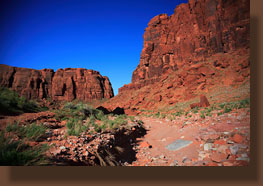
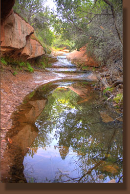
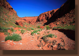
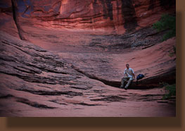
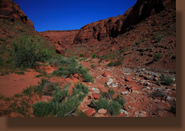
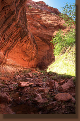
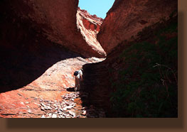
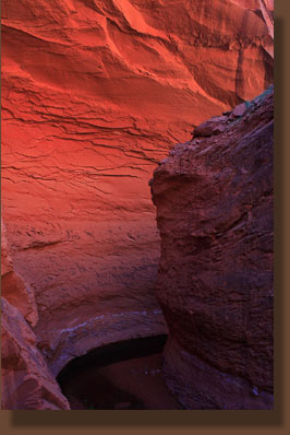
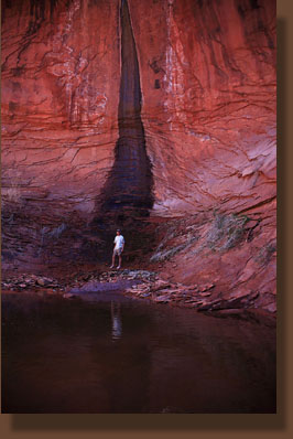
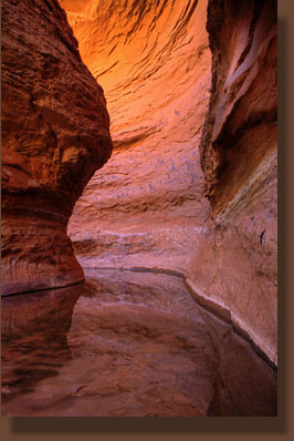
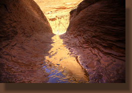
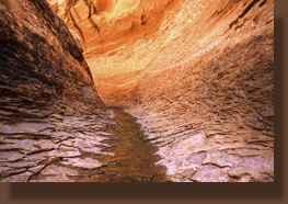
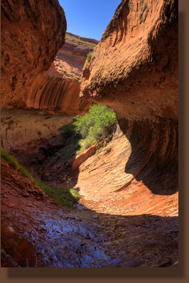
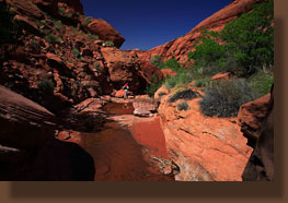
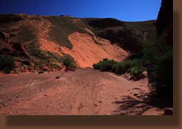
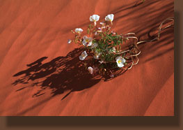
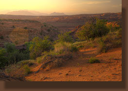
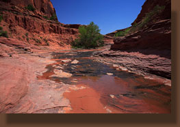
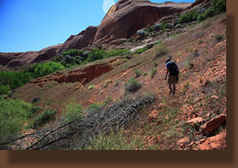
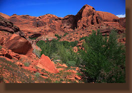
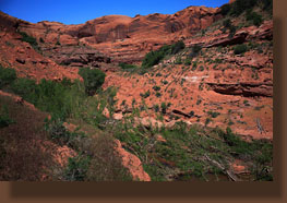
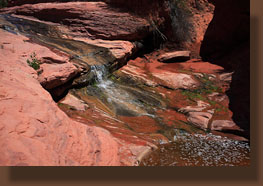
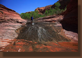
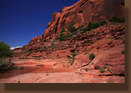
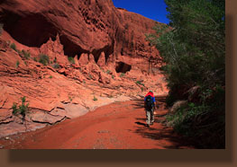
April 29 2007 We were up at 6:45. Andra thinks Iím crazy to set my watch alarm on a vacation, but to avoid the heat, youíve got to get up early. I got up and around, took some photographs, and waited for Dave to get up and moving. I found that I couldn't wait long. At 7:00 I started banging on the tent and he finally got up. It's hard to sleep through someone banging on your tent. Unknown birds flitted and chirped in the white oak thickets near camp. Despite the glare of sunshine on the orange rocks above, down in the canyon it was shaded and cool, and I donned my long sleeve shirt to keep the chill back. This would be a short lived phenomenon. By 7:30 we were hiking downstream through a narrow rocky concourse with a trickle of water in it, a sheen of glitter sliding over a smooth layer of alage. The cottonwoods were left behind, and the only vegetation lining the stream consisted of primrose with as-yet unfaded blossoms, bitterbrush and cliffrose. The hills were covered with brome grass and ground-hugging forbs. About ½ mile downcanyon, we encountered a deep dropoff into a defile where we could not see the bottom. There was absolutely no way around this dropoff on a ledge or something like that, so we retreated a little ways, then hiked up the steep sandy slope to gain the top of the mesa. Once up on top, we found the road we had been hiking on the night before, and followed it towards Moqui Canyon. It curved around to the west and soon peaked out above a side canyon of Moqui Canyon. We could see the narrow road leading down into Moqui Canyon via switchbacks on a huge sandslide. Faint ATV tracks were pressed into the soft sand, but we didnít see any ATVís in the canyon all trip long. We walked down the deep sand track with ease, giving no thought to how tremendously difficult going back up would be. I canít imagine how an ATV can make it up this steep road. We arrived at the dry canyon bottom and made note of the location so we would know where to go up when we got back to this point later in the day. Dave commented that we need to look for the singing bush, and pointed to a lone tamarisk near the mouth of the side canyon. Seemed to me it was singing Born to Be WIld. Yeah. We chose to explore up-canyon, and walked in the shade and dry gravel toward terra incognita. This is always the best part of the trip: early morning, cool air, unimpeded sun throwing down a UV index of about 50 through miles of clear, blue desert sky...so far it's been a cake walk, hardly have broken a sweat...the body is willing and able, and the mind is clear. It doesn't get any better, or if it does, someone please let me in on what chemical makes it happen! Before long we were walking through a thin film of water coming from Burnt Spring Canyon, and as soon as we were east of that, Moqui Canyon was dry again. We hiked up to the first side canyon to the south, and turned into it. It too was dry, and we stumbled occasionally on the loose rocks and unsure footing. I took a spill that landed me on my back, but only got a scraped leg out of it. Just the canyon's way of saying 'How-do'. The first side canyon that came up, we took, and wandered ever-deeper into the labyrinth of canyons, uphill, winding among the forgotton rocks. Following no trail, we wound up the sandy slope just above the streambed (for the stream channel was choked with vegetation) and curved southwest to a narrow crack in the rock. Near the end, the oaks were so thick I had to cache my pack to continue beneath them. The end of the side canyon ended in a smooth curved bowl, too steep to exit in any direction. Back here it was quiet, and shaded completely. We sat and enjoyed the coolness after the hot hike up the canyon, but before long the itch to move on settled in (dang that itch!) and we exited this beautiful side canyon of a side canyon of a side canyon of Glen Canyon and moved on. Ever to return? Upcanyon a little further, we took the second side canyon which turned out to look pretty fruitless after a short time, so we turned back. By fruitless, I mean we could see that it continued at an insane uphill grade, in full sun, all the way to the mesa without ever closing in. After the shaded canyon we had just left, it didn't hold much interest. We consulted the map, and noted a third interesting alcove further up before the canyon took a steep run upstream. We headed upstream in the heat, using bandanas to keep our necks from burning, and made it to the alcove on the east side of the canyon. We scrambled up the rocks and into the shade, and sat down on a giant slab of sandstone under the overhang. The cooling shade gave instant relief and I took off my boots to cool my baking feet. The sound of trickling water reached us from the very back of the alcove like canyon elevator music, but all access to the trickle was maddeningly blocked by a phalanx of poison ivy. From here, we retreated back downcanyon, following our own footsteps in the sand and over the rocks under a blazing sun that had turned the air hot. We reached the wide expanse of Moqui Canyon and decided to head downstream rather than up (the heat might have had something to do with this). We reached the shade of a boulder at 12:30 and decided to have a bit of lunch and water. Shortly after, we reached the mouth of Burnt Spring Canyon, and headed upstream, hoping to find a nice pool of water to refill our bottles. It didnít take long walking upstream to find it. Beneath two cottonwoods lay a deep pool of clearest water, with a tiny waterfall pouring into it from above. We stopped in the shade and filtered water, drinking our fill, and enjoying the coolness which had become rare at this point in the day. We followed the water upstream through undercuts draped with moss and maidenhair fern, through quiet pools, over crumbling ledges and through a refreshing constant stream of clear water. We climbed up a steep wet chute, then climbed up through a crack between the chute and a giant chokestone. Lots of fun obstacles in Burnt Spring Canyon. We finally reached a point where the canyon became a narrow slot completely filled with water. We took off our boots and waded on, around the corner and finally out onto a dry spit of land beyond. After carefully picking our way through several large tamarisks, we came to the end of the line. A large pool lay at the base of a 30 foot waterfall that I think is the dropoff we had come to just that morning. A small spray of water came pouring off the cliff above, and by wading across the shallow pool, I came to it and wet my arms and head under it. Very refreshing. Cold. After a well-deserved break in the shade of this narrow canyon, we slogged back through the mud and cool water in our bare feet to the gravel shore around the bend. After getting our boots back on, we headed off downstream and stopped once again at the pool beneath the cottonwoods to filter more water and rest. I snacked on some crackers and chugged water. It felt very hot. The morning breeze had given way to an afternoon stillness that left sweat beaded up on my forehead. We returned to the open, largely-dry expanse of Moqui Canyon and debated exploring downcanyon, but decided we didnít have enough time to do much in that regard, as it was already around 4:00. So, we simply turned up the ATV road we had come down and started hoofing it up, aiming towards camp. It was soon apparent how difficult this little trek would be. The sand was like flour, and even where the occasional ATV traffic had packed it down, every footstep up was immediately negated by a half step back. We kept up a pretty good clip, and soon sweat was dripping off my nose in the blazing sun. We decided to cheat the vehicle-grade switchbacks and go straight uphill to try to get the ordeal over with faster. This may have been a mistake, but it is a miserable hike in the heat of the sun, regardless. By the time we reached the last switchback, I was feeling chills, sweating profusely, and feeling disproportionately miserable all around. All conversation had ceased, as both of us were so out of breath that words seemed downright silly, and anyway what was there to say about it? Had to be done. We slogged on to the southeast along the road which was lined with thousands of evening primrose in bloom. Noting our footsteps coming in from off the road, we followed them back towards camp and rested against a shaded east-facing wall. I drank some water and vowed that I would never go down that hellish sand road again. Dave brought out his tiny camera to shoot a shot of the canyon, and dropped it in the powdery sand where it buried itself completely. He cleaned it off, trying to brush and blow the sand off, but even after it appeared clean, turning it on elicited a sand-grating noise as the lens extended. It still worked, but sounded horrible. Returning to camp around 5:30 seemed like arriving back at a 4-star hotel. The cottonwood leaves flapped gently in a cool down-canyon breeze, and the still pool of water near camp glittered like a jewel. Here was Shangri-la! I filled my collapsible bucket (wonderful thing) with spring water, stepped away from the stream and bathed from head to toe using my bandana and castille soap. Thatís an awesome way to recover from a long hike. After 10 hours on the trail, it took only a cool bath to cheer me up. Soon, we were both back in good spirits and cooking dinner in the gathering dusk. I heated up several bean/cheese soft tacos and when the beans ran out, we each had a cheese quesadilla. As we ate, a buzz came up in the air sounding so much like a bee swarm that I immediately thought about where the deepest water was to submerge myself in. After listening for several seconds, we gathered that it was merely an ATV whirring along on the road nearby. The chocolate bar that had liquefied on the hike had resumed a solid state, so we had a few misshapen chunks of it. At 8:00, we walked uphill from camp to admire the red sunset, and the orange light on all the primrose flowers. Back in camp the mosquitoes were out and about looking for dinner, and I did everything I could to prevent them from feasting on me. The frogs creaked from the water nearby, and it was an idyllic evening.
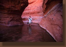
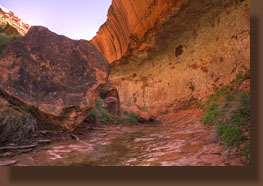
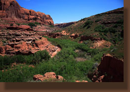
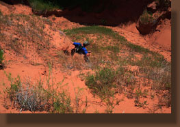
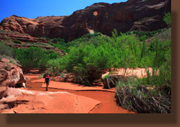
April 30, 2007 We were up at 6:30 to a clear, cool desert morning. I always enjoy getting out of a tent in the morning and being greeted by a uninterrupted blue sky. I hydrated some milk for my Cocoa Krispies and sat in the sand near the softly trickling creek to eat breakfast while Dave readied his pack. We were hiking downcanyon by 7:00, right back to the brink of and down the sand road that less than 14 hours before I had sworn I would never walk down again. We seem to be gluttons for punishment, which is true on every trip because rarely is backpacking a complete comfort-cruise. Lucky that, otherwise everyone would be out here. This day, we once again had the canyon apparently to ourselves, which is a marvelous feeling. Itís not that I dislike my fellow bipeds, but thereís just something really cool about having such a marvelous place all to oneís self. It took us about 1 hour to reach the singing bush in Moqui Canyon, where we turned downcanyon to spend the day seeing what lay in that direction. The canyon was wide, dry and cool in the shade. For the first ½ mile it was sandy, but then a spring added water to the canyon and for the remainder of the day the canyon bed was always at least wet, if not actually flowing with water. ATV tracks were apparent, but not recent. After about an hour, perhaps less, we passed a nice alcove on the left side that begged exploring. Although it ended before it really got started, the short, rounded box that it lead to felt nice and cozy, and we sat in the cool quiet of the sandstone walls to cool off from the heat that was rapidly building between the main canyon walls. A small trickle of water fell about 15 feet from the overhanging lip of the alcove, splattering cold water on a moss-covered swale of sandstone. I endeavored to stop here again on our way back up canyon, but we didnít find it again. There are so many side canyons and clefts, most hidden by the wall of coyote willows in the canyon, that you could spend weeks exploring all of them properly. As we had just the one day, we let most of them pass by. At one point in the early trip planning, I had proposed that we enter the canyon further down than Burnt Spring at a side canyon that had massive sand slides leading down into it from the bench above, as one could obviously see from satellite images. The canyon had no name, but I knew it when we passed it because of the steep sand slides leading upwards, and by the massive amount of sand deposited outside the mouth of the canyon. I am glad we didnít attempt it, for although getting down those sand slides would be a snap, I seriously wonder if would have even been possible to haul a heavy pack back up. It would be hell just trying to haul myself up. We stopped near this area and I took off my boots to wade in the cool water that was flowing pretty good now in the canyon bottom. Dave thought I was suggesting we hike barefoot, and I initially started to correct him, but then thought that sounded like a pretty swell idea. So, off we went, hiking barefoot in 3 to 6 inches of cool water that was running over smooth packed sand. It was awesome. Further downcanyon, being barefoot sped things up as we had to wade across much deeper water that was backed up by beaver dams. Seems unlikely to find beaver in an arid desert canyon, but there were dams upon dams upon dams. We were up to our waists in water multiple times, worried about what slippery logs might be lurking in the murky water. I was particularly worried about my camera, which I held high overhead should I slip. Luckily, no accident of that sort befell me. Nevertheless, after crossing the bloated stream numerous times, we finally reached a point where the stagnant and deep water was so uninviting that we refused to wade in. The willows, braced by the abundance of water, had formed a virtually impenetrable stockade of branches. We bulled through a section of such willow growth once, but it was very unpleasant, and my legs and arms were scratched in a thousand places and itching. Thus it was that we admitted defeat, and turned back upcanyon without ever reaching Lake Powell, though the distance involved dictated that we probably wouldnít have reached it even had the beaver dams not been there. We ate lunch in a shady spot, and then took to the high benches to skirt around the quagmire of willows and beaver dams. This proved pretty effective at speeding our return upcanyon, although progress soon slowed under the increasing heat. By 5:00, we were back to the sand road, but the sun was still very intense and the air very hot, so we decided to wait until things cooled down a little before attempting the infernal climb back up to camp. Neither of us wanted a repeat of the previous dayís experience. We both dozed on a large flat rock situated in the shade, although large red ants occasionally woke me up with sharp stings. Remember what I said about backpacking as a comfort-cruise? Providence smiled on us within a short time, however, and by 5:45, a massive cloud bank intercepted the sun, and the temperature seemed to drop 10 degrees at once. We took the opportunity to take off up the sand road, this time taking it slow and steady. I had worked it up in my head as being such a dreaded thing, but without the sun beating down on me, it really wasnít that bad. Before I knew it, we were up top, still breathing normally and far from the miserable state I was anticipating. We even stopped to take photos using the timer and tripod. We were back in camp fairly early, and I bathed again using my indispensable fabric bucket. Love that thing. Ramen noodles and a couple of tortillas for dinner: anything goes while backpacking. The mosquitoes were active and the frogs were singing a chorus in the pools up the canyon from the tent. It was a beautiful clear and calm evening. I finally went to bed around 9:00.
May 1, 2007 We were up by 6:40. It had been hot all night with no breeze, and sleep was fitful. We were both eager to get up and get moving. The itch returns, always. We packed camp pretty quickly under a hazy sky and left the canyon at 7:15. After a brisk 30-minute hike, we arrived at the car. The drive back to pavement was uneventful. Not much for a final day of action, but there you go. On we went to Natural Bridges National Monument.
|
 |
|
Page created 12-29-07 Comments |