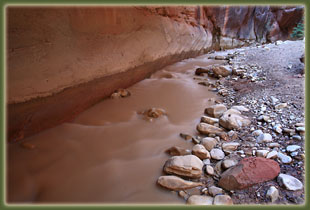
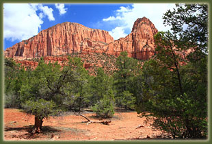
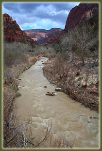
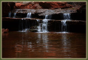
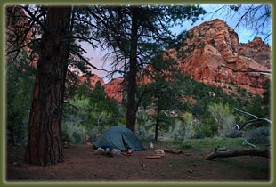
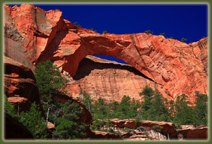
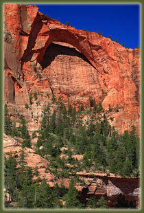
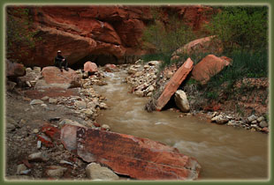
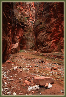
April 25, 2009 Saturday From the cozy office chair at home where I first planned this excursion into Zionís backcountry, I envisioned blue skies, red rock and green cottonwoods, a scene that only barely resembles the scene I encounter when I park my car at Lee Pass Trailhead under a brooding gray sky that mutes the color in the rocks and seems to highlight the gray, barren branches of the few cottonwoods and choke cherry trees at this elevation. A persistent wind and 50-degree air temp reminds me that it is April at 6000 feet, after all, and even at 37 degrees latitude itís still just barely spring. In fact, the rangers at yonder Park Service outpost inform me that a weatherman somewhere has predicted snow tonight. Again, not quite what I was expecting nor hoping for, but Iím not in the least deterred from continuing. I just pack more warm clothes and take my 3-season tent rather than the summer tent. This adds lots of weight, but at the start of a trip oneís enthusiasm blocks out such trifling matters as a pack that will seem like it contains bowling balls by the end of the hike. I plod off down the trail that enters a broad ravine heavily wooded with juniper and oak. The parking lot is in sight for a long time and I can hear the chatter from tourists content to remain on the graveled scenic overlook to enjoy their national park. I thank what gods there may be that not everyone in this country wants to slap on a backpack and hike deep into the woods. Thereís just not enough woods for everyone to do it. I read recently that backpacking continues to decline in popularity, while so-called ďmotorized recreationĒ (off-road vehicles, motorcycles, recreational vehicles and campers) is enjoying a boom in popularity. Personally, in the last 15 years Iíve seen no decrease in backpackers on the trails, but I have seen, and heard, the increase in the motorized crowd. Iím fine with it. The motorized crowd generally donít stray too far from trailheads or established roads, and that means even fewer people out here in the backcountry, where the really good stuff is. The deep gray clouds blot out the sky beyond and create a sense of closed space that I share, exclusively, it seems, with massive canyons that cut down through the Navajo sandstone to the east, none of them named. Despite the chill breeze, I have to stop and shed my sweatshirt. At least the cool air keeps bugs away. Blue sky glows to the south, and seems to be moving this way. The narrow trail crosses tiny, clear Timber Creek several times, then leaves the creek to cross over a ridge and down into the LaVerkin Creek drainage. By the time I reach the crest of the juniper-covered ridge overlooking the LaVerkin Creek valley, the sun is full out, but the heavy breeze remains to keep it chilly. I plod along the sandy trail, and encounter a couple of backpacking parties on their way out. Everyone is friendly, as people who have not seen too many other people in a few days are apt to be (Itís the city dweller who sees nothing but other people all day long who is likely to be cranky). I stop at a spot along LaVerkin creek and shed my pack for the first time in 2 hours to take a break and a snack. A slanted rock near the creek provides a great spot to relax. Unlike Timber Creek, LaVerkin Creek is heavily laden with silt, and runs along like foamy chocolate milk. I finish off a Snickers bar, gulp water, and hit the trail again. Campsites are designated in most of Zion, as is the case in most national parks. There are 17 designated camps along LaVerkin Creek, and I have a piece of paper that says I can stay at camp 13 for the next two nights. The camps are not spread equally along the trail, but are largely clustered near the side canyon that leads up to Kolob Arch. I keep track of camps as I pass them, and after a winter spent largely indoors and off the trail, Iím more than ready to get to camp and rest a little. I reach the signpost for camps 12 &13, and see a tricky creek crossing is required to get there. A few boulders hold two slippery wet logs in place, and the whole works looks ready to collapse and float downstream. I trade my boots for sandals and walk across without issue. Camp 12 is situated directly across from the stream that flows out from Kolob Arch, on a bench sitting about 10 feet above LaVerkin Creek, surrounded by pine and cottonwood. In the middle of the camp space there is a giant ponderosa pine with deeply-fissured reddish bark that smells of sweet vanilla. Over the past hour the sky has darkened and rain looks imminent, so I waste no time in getting the tent set up and staked down, and all my stuff under the rainfly. The wind makes this operation a little tricky, but with the help of stones to weight things down, I get it all arranged properly. Rangers advise hanging food to keep it safe from ringtail cats and squirrels, so I comply, using a thick branch from the giant camp-center ponderosa pine as the hanging point. The sprinkles begin as if on cue, and I hop into the tent to rest in dry comfort. I endeavor to make a few notes on my trip so far, and that takes all of 5 minutes. Not much has happened, yet. I examine the novel I brought with me, but decide instead to just lie down and rest my back a little, which turns into a luxurious hour-long nap. A steady white noise of tiny water droplets dancing on the nylon rainfly continues throughout. At around 4:00 I wake up refreshed and ready to walk some more. I slide into my rain jacket and hike up the creek toward Kolob Arch. Rain continues lightly on my walk, and I keep my camera hidden beneath my light rain jacket. Three hikers come down the trail that follows the creek, and because of the thick growth of maples, willows and pines, I donít see them until theyíre only a dozen yards away. The lead fellow asks me where good spots are to photograph the arch, and I admit that Iíve actually never been there before. We part, and I continue upstream, stopping occasionally to drop down into the shallow stream for photographs. Itís cool and quiet in the canyon, with thick clouds overhead and a steady light drizzle. After 20 minutes of hiking and inspecting the various rock formations on display, I come upon a viewpoint for Kolob Arch that sits far down a side-canyon. There appears to be no way to get closer to the arch, but I reason that an unofficial route must exist somewhere. I poke around west of the clearing, but the vegetation is extremely thick and the slope is too great to make easy progress. I turn around and make my way down to the mouth of the small stream that comes down the draw leading up to Kolob Arch. I pick my way around logs and rocks up this stream as it leads west, then bends around south and right towards the arch. This route definitely gets you good views of the arch, and I continue on over a thin flow of water until I am stymied by a steep and slick waterfall. The spot is a good one, but the lighting is all wrong for a good photograph, which is what Iím after. Kolob Arch is huge, maybe the largest in the world, but it is not a very open arch like Delicate Arch. Instead, this arch sits right against a cliff, so that only a small portion of sky can be seen through the apex, and that only if you are standing in the right spot. From the trail viewpoint, there is no sky visible at all through the arch. I head back downstream to the confluence with the larger canyon, and head upstream in that canyon further. A shallow falls catches my interest a little ways on, and several other falls beyond that keep me occupied for a while. There are some tricky spots requiring a little bouldering, and since everything is wet, I take it slow and cautiously. Finally, I reach a spot that is too tricky to negotiate, and I turn back, down the canyon, all the way back to LaVerkin Creek. I hop across the swift-moving dishwater-gray stream and walk back into camp. A nice sunset develops through the thick, low-hanging clouds as I cook Ramen noodles and chicken. In the tent by 9 and asleep shortly after. April 26, 2009 Sunday
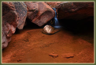
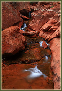
A little trickle of water flows out of this canyon, but it soon peters out and the narrow V-shape canyon is dry most of the way up, and choked with boulders. I head west up the steep, sandy canyon slope through a thick oak forest. Most of the oaks have not leafed out yet, but the dogwood, water birch and maple all have small, intensely-green leaves. I continue up the steep slope, switchbacking to make it easier, hoping to get to the ridge up above and get a nice view down-canyon. But, reaching the sandstone block that is the ridge, I find that it is too steep to safely get to the top, and I content myself instead with a very high-up view of camp below. Back in camp by 9:20 and it has warmed up a lot. I ditch my sweathshirt and slather on sunscreen. The sun is still out, but thick clouds are building to the west. I hike up Kolob Canyon to the spot where I was the evening before and Iím there right at 10:00, and as planned, this is a pretty good time to view Kolob Arch. The sun is hitting it full on at this time of day, with few shadows, and the sky beyond is deep blue. I snap some photographs and then retrace back to the main stem and try to find the right fork of the creek that appears on the topographic map to head north into interesting-looking territory. I retrace the same section of creek twice, looking for the branch, but find none. Finally, I simply head uphill to the east, and once I get up high enough, I recognize that Iím already on that right branch and that I hiked it last night. Itís the left fork that I want, but I can see right away that the left fork leads nowhere very quickly, so I give up the pursuit. Back in camp by 11:00, scarfing down a lunch of crackers and tuna. I pack up some gear in my bag and head up LaVerkin Creek. The going is slow since I have to repeatedly cross LaVerkin Creek, and it is too deep to do so without getting shins wet and all footwear lying below that point. I should have brought sneakers for this portion of the hike, but I manage OK in my boots by jumping rocks, though I feel my back stiffening with some of the landings from longer-leaps. I pass by several backcountry camps, and then enter a south side-canyon that I initially believe is Bear Trap Canyon. Itís not, but it has a wonderful overhanging curve before a jumble of boulders and an impassable dryfall. I wiggle through the thick oaks on the steep side of the canyon to get around the dryfall, but the passage beyond is so choked with boulders and so steep, I conclude this canít be Bear Trap Canyon, and that progress will be extremely slow in this canyon, and turn back. Back at LaVerkin Creek, I continue upstream, crossing frequently, sometimes using my tripod for balance since I have no walking stick. A walking stick would be very good to have here. This canyon holds the largest Ponderosa pines Iíve ever seen. Some have diameters of 4 feet. I get to Bear Trap Canyon and it is narrow and tall, with a smooth, easy-walking kind of floor with a thin layer of water running out. A deer carcass fouls the air near the entrance, but Iím soon beyond that and all is well. Vertical walls 30-feet apart close in as I walk upcanyon. Snowbanks linger in the canyon, and the vegetation is still largely dormant. I can hear the waterfall long before I see it, and it is even larger than I expected. Fantastic falls here. I photograph this a lot, assisted by the now-cloudy sky that eliminates shadows. It soon begins to rain, and I take shelter under an overhang until it lightens, snacking on a Clif bar. I throw on my rain jacket, and head back to LaVerkin Creek Ė there is no bypassing this waterfall. I resume my up-canyon trek and make it to the junction with Willis Creek, and determine this has not been worth the trouble of so many creek crossings. Plus it is raining now, which makes any hiker a little less thrilled, I think. At 4:00, I begin to head back to camp, and after a long, hike through intermittent rain, I reach camp at 6:30. Those creek crossings really slowed me down. Iím very hungry upon return, so I start dinner immediately. Halel, a young guy from Israel on a fantastic 8-month vacation of this hemisphere, stops by from his camp next to mine and we chat for awhile. He shows me pictures on his digital camera of his adventures in Colorado and central Utah so far. Nice guy, and Iím envious of his ability to take 8-months and be a vagabond in the western US. I finish my spicy rice dinner, and sit back against he log and savor a Snickers bar before washing up dishes and my face, and hopping in the tent to avoid the light rain that begins at 8:30. Itís not hard to fall asleep. April 27, 2009 Monday
|
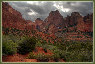
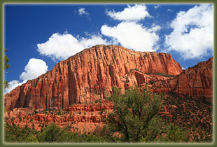
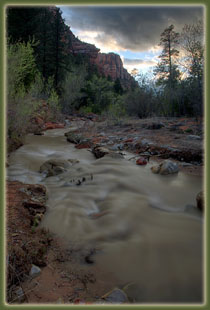
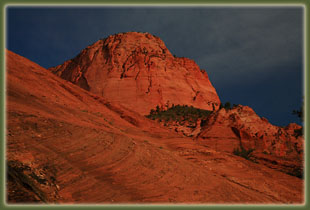
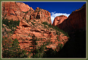
Nagunt Mesa from the La Verkin Creek Trail
|
