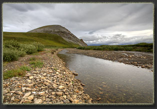
| Ivotuk Hills
Location: National
Petroleum Reserve-Alaska UTM NAD83 z5 389097e 7598641e 2444’
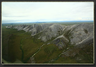
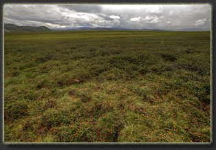
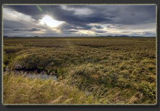
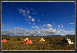
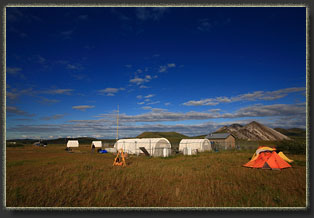
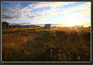
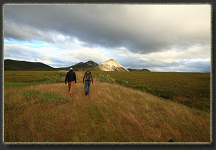
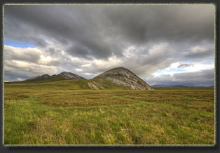
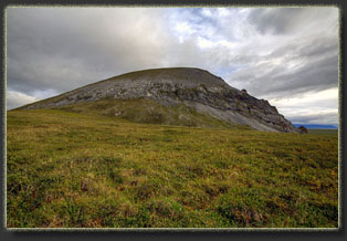
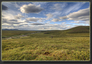
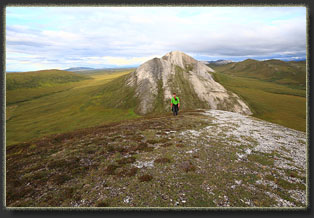
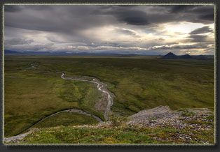
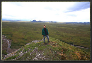
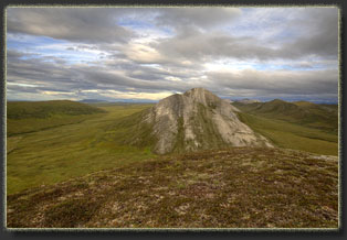
View Larger Map August 3, 2012 This may be the most northerly hike I ever get to take. It’s not often anybody finds themselves north of the Arctic Circle, and it was only by happy circumstances at work that I found myself living out of a tent at a government camp near Otuk Creek, about 10 miles north of the Gates of the Arctic National Park’s northern border. The landscape was bereft of trees, with only some short shrubby willows along the waterways achieving anything taller than a foot. Most of the area surrounding the camp was tussock tundra, a uniform expanse of peat moss overlaying permafrost with rounded clumps of grass, snowberries and a mixture of other plants. With every step your foot sinks down a few inches, revealing open water that rises up the sides of your boots, which are hopefully rubber. Ivotuk camp, just north of the Brooks Range, was created by an oil company decades ago at the behest of the US government who, at the time, was interested in finding out how much oil might lie below this expanse of tussock tundra and coastal plain called the National Petroleum Reserve Alaska. Ivotuk Camp is actually closer to Otuk Creek, but perhaps it was originally intended to be along Ivotuk Creek and the first arrivals were confused. Ivotuk consists of an airstrip and a camping area with one permanent wooden shed, 2 wooden outhouses and a fuel tank, all raised up above the tussock tundra a few feet to avoid sodden camping. Several wall tents on plywood foundations provided creature comforts like dining quarters and electrical equipment storage and charging. An old road, also raised above the tundra a few feet, leads a mile away across Otuk Creek to a cluster of foothills that rise up about 1000’ above the plain called the Ivotuk Hills, so named because they are split through the middle by Ivotuk Creek, one of the larger creeks in the area that heads north to the Colville River. The nearest summit from camp is only about 500’ higher than the runway, and about a mile away. Since arriving and admiring the summit from my tent, I wanted to hike it, yet work kept us busy until 9 or 10 at night, every night. Being so far north, it was plenty light enough to go hike it even then (the sun technically sets here in summer, but it never gets “dark”), but after such long work days, I passed on it day after day. Finally, on the final evening of our stay, I stopped work early and convinced others to do the same and we left camp at 8:00 PM for the hike. One of the guys carried a shotgun in case we encountered Grizz, and I was packing bear spray, but no bears had been seen near camp, so it wasn’t a real worry. We walked east along the deteriorating tundra road towards the old drill pad. The road was made with bulldozers that rolled up the tundra into a linear form, then flattened enough to make it passable to trucks. The result was a raised road, but as it was made largely from frozen peat, over the years much of it melted away. Consequently, there is no “road” remaining, only a rough route that is more often than not easier going than across the tundra. At Otuk Creek, only the center truss of an old bridge remains standing, though the western approach washed out long enough back that no trace of it remains. Ben and Matt scaled the railroad timbers that buttressed the 15-foot bridge truss and crossed the creek with dry feet. I chose to take the less-strenuous route up stream to the first riffle, and cross the 8” water in my leather boots. The willows were actually taller than I was in the creek bottom, and I briefly considered Grizz as I walked alone through the willow jungle. No excitement, though, and we all met up on the other side. Jason and Ben decided to forgo a summit attempt and instead went to investigate reports of fossils upstream. JT, Matt and I headed uphill to the east, where the slope provided drainage and firmer ground. The alpine terrain was almost exactly like what you’d see at 13,000 feet in Colorado, only we were at 2,000 feet. Blueberries grew in profusion, and I stopped often to fill a handful of the small but tasty berries for a quick bite. Not filling, but sweet. Silvery lupines and stunted willows 6” tall dotted the hillside, but no trees anywhere in sight. We reached the base of the mountain, and JT decided he’d better head back to continue work. I had no such loyalty to the computer, and neither did Matt. We worked up the steep, rocky north face towards the ridgeline. What little vegetation existed on the north face became exceedingly rare on the ridge, where a swath of sharp white and gray rock with the consistency of lava rock lead us up to the summit. The wind was terrible at the summit, and I quickly became chilled in the fading light. It was quite an ordeal to get my jacket on in the wind without losing it, but I managed (good thing, it's not like I could drive to town and get a replacement!). The impossibly isolated Brooks Range sat to the south, clearly in view only 9 miles away. The higher summits of the ridge we were on stretched to the east, and if only there was time, I’d have gladly walked the entire 4 miles of the ridge to Ivotuk Creek. It’s quite possible nobody has ever done that. Crazy thought. We snapped some pictures, examined camp a mile distant, and then beat a hasty retreat. In less than 20 minutes we were back at the creek where we met up with Ben and Jason, who had enjoyed the hike upstream, as well as JT, who had decided he didn’t need to get back so soon after all. I think the realization of where we were, and that most of us likely would never be back, really sank in as we crossed back over Otuk creek and tromped back to camp in the deeply slanted orange sunlight that spilled over the tundra, still bright at 10:00.
|
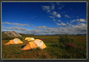
Ivotuk Camp with Brooks Range on the horizon
|
