
View Larger Map 9-11-2011 Early morning in summer, and the orange sun is slanting through the Ponderosa pines that line Hwy 34 in Rocky Mt National Park. A clear blue gulf of space gapes overhead, cloudless. Andra and I drive up Trail Ridge Rd, empty this time of day, and descend a bit to Milner Pass, where a shallow skate of a lake forms the headwaters for the Poudre River. We park the car, and I lace up my boots in the 45-degree air, while a couple of travelers take pictures of themselves at the Continenel Divide, where a sign points left to the Atlantic, and right to the Pacific. Given all the demands on water, I wonder how many water molecules of water that are present here will ever reach either destination. I shoulder the pack and by 9:00 we are walking past the info kiosk and onto the trail that bends around the south side of Poudre Lake. Andra, by virtue of pregnancy, gets a pass on carrying anything external. This is Baby #2ís second hike, the first being a beautiful tour through the Tetons a few weeks ago. We take it slowly up the steep switchbacks that wind through the alpine forest of lodgepole pine, fir and spruce. Large mossy patches hold pools of water, boglike. Itís late in the year, but some of the flowers are in full bloom, leaves coated in frost, and petals showing off shades of pink and yellow. Some of the flowers have not even had a chance to bloom, and are already facing freezing nights. In about 0.6 miles, the trail presents a fork in the road, and we take a right turn to head up towards Mt Ida. A sign warns hikers of a trail that is easy to lose and terrain that has few landmarks. The trail soon leads above treeline, and with the unfettered views in almost all directions over a grassy tundra, itís hard to imagine losing oneís way. With a little effort, however, I can picture the terrain draped in snow, with whiteout conditions obscuring all surrounding peaks, reducing the world to one vast expanse of white. Unlike trails on the tundra in other parts of the park, there are no large cairns to mark this route. But, on a fair-weather day such as we have, we give it no other thought (though my GPS is logging the whole time). The sun rises a bit higher, and with it comes higher temps. We stop to shed layers, and watch a few fat marmots sunning themselves on boulders, either too lazy or too tame to care that we are standing only a few feet away. Probably they have come to learn that hikers donít eat marmots, though that holds true with the pikas as well, yet they scatter at our approach like terrified mice, squeaking the entire time. We hike south, along a ridgeline that slopes gently, but steeply, down to the west towards Kawaneechee Valley, and the Never Summer Range beyond. To the east, the land drops away, carved out by glaciers that formed on the lee side of the divide, leaving deep eviscerated cirques of broken rock and remnant ice fields. We walk along in the quiet of the morning on a very mild uphill slope, enjoying the almost total lack of wind, and the fantastic unobscured views of the mountians. After 3.5 miles, we reach the last uphill stretch to the summit, and the trail steepens up as it enters a stabilized boulder field with small patches of cropped grass. Small cairns mark multiple routes, but itís pretty easy going no matter how you go, and as long as youíre going up, youíll get there. We follow cairns haphazardly, and itís tough to tell if the going is any easier by taking efforts to follow the routes laid out them. At around 11:30, we reach the summit, and meet a fellow who has been there enjoying the view to the east for some time. We exchange a few words about the crop of low clouds that has sprung up and rapidly multiplied on the western horizon, and he is off. Andra and I check out the lakes below, Inkwell and Arrowhead on the current map, Gorge Lakes on older maps, both sporting the aquamarine color of glacial melt, the color of cold. I check out my map and match topographic highpoints to the view spread before us: Mt Julian, Cracktop, Chief Cheley. We both search for Highest Lake, and canít find it. Odd. Then I notice it sitting almost level with us, much higher than we were looking, and seemingly in hiding, so that only a thin slice of water peaks out from above the rock crest that retains it. Highest Lake appears to still be almost completely covered with ice. As the clouds build in the west, we descend the boulderfield. Though we encountered only the fellow at the summit on our ascent, we see bodies stretched out on the trail far below, two groups of two, and the man from the summit heading down. There are no obstacles out here, and we can see the trail snake off in the distance for several miles. The clouds are thickening, and the wind picks up. Iím glad weíre heading down. Trekking along, chatting with Andra, I put a hand on her shoulder to get her to stop, and I point out the line of a dozen bighorn sheep crossing the slope from south to north, ahead and below our position. We watch the line of sheep trot along, then hop on the trail and follow it north. The man from the summit is hiking north, so he doesnít see the sheep coming up behind him, and they donít seem to care that heís there. The wind must be obscuring their hooves, because they approach within 20 feet f him on the trail before he takes notice. Heís far away, a quarter mile perhaps, but I clearly see him start when he sees the herd, and as they diverge from the trail a bit to pass him, I see the camera come out to snap photographs as they trot by him, giving him no more than a 50-foot berth. By the time we reach treeline, rain is clearly falling in the valley below, and heading our way. We meet a group of hikers rounding the corner from the trees below, and the lead hiker comments that he feels the clouds are breaking up. We must have very big differences of opinion on what breaking clouds means, but I donít quibble with his assessment. Small talk is just that. Once in the trees, the rain comes, lightly but steadily, for the remainder of the hike. We reach the car around 1:45,
for a total trip time of and point it east to head back to Boulder
to pick up Ada and the doggies.
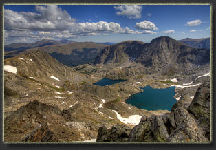
Gorge Lakes: Arrowhed and Inkwell 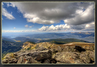
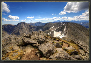
Mt Julian, Cracktop and Chief Cheley Peak 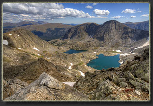
Mt Julian overlooks Arrowhead and Inkwell Lakes 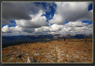
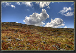
Fall colors on the tundra 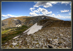 |
A marmot says "Hello" on our hike up. 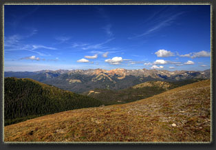
Never Summer Range 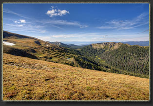
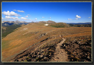
Looking north along the route we've come up 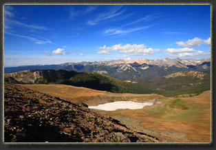
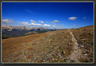
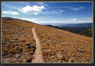
Andra gets far ahead on the trail 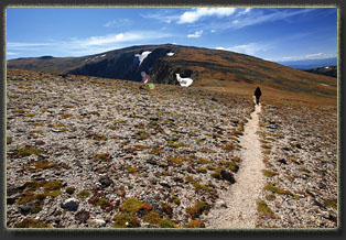
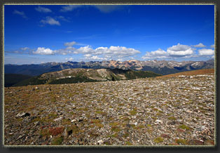
Typical view of the Never Summer Range from the Mt Ida trail 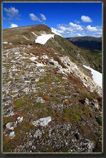
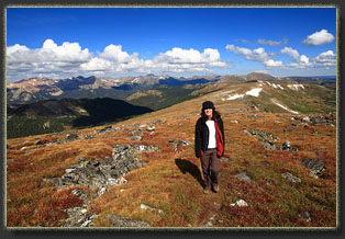
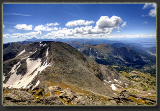
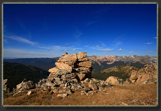
Looking south from Mt Ida past Chief Cheley Peak 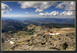
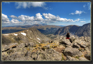
Andra enjoys the Mt Ida summit view 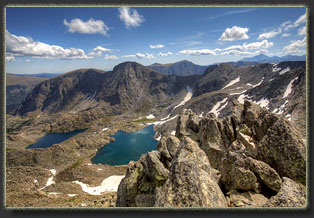
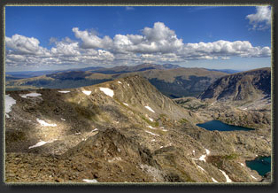
Hagues Peak tops the horizon to the north of Mt Ida 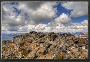
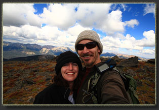
Andra at the summit 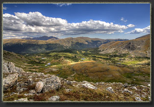 |
