Fall Mountain
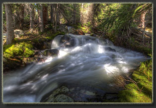
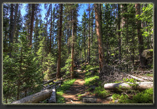
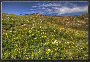
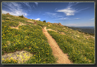
June 30, 2015 Under a clear blue sky, I finalize my pack and slip on worn leather boots that have seen many miles of trail. Might have to replace these soon, as the tread is getting thin, like an old tire. Wonder if I could cut pieces of old tire and glue them on the bottom? I saw some hippy sandals made that way once, with the steel belting visible in the cross section. At around 8:15, I hit the trail. The trailhead from above Joe Bennet campground near Pingree Park has changed since I last hiked it a couple of years ago. Pine beetle has killed off huge swaths of trees, and the USFS has been busy cutting them down along the road, rendering this particular area sunny and open where formerly it was shady and closed. I didnít recognize it, and in fact drove right past it before seeing my error and flipping a U turn in the gravel road to get back to the trailhead. The trailhead is vague. I always park on the main road, but there is a narrow spur road that heads west a quarter mile further, 4x4 grade, to a locked gate, and some opt to trundle up this route for a few hundred yards before parking. A rare few make it all the way to the locked gate. I find I can walk faster than trundle in the car, and walking is what I came to do anyway. So, I park the car off the main road and begin walking. The sky is uncompromised with clouds or haze, and itís hovering around 72, which is pretty warm for 9500 feet at 8 in the morning. I hike up the road, passing a few intrepid 4x4s that have crept their way up the road and parked along its side when the going got too rough (when the going gets rough, the rough stop and walk). I pass through a skeleton forest of dead lodgepole pine, where only 1 out of every 20 trees is yet alive, and emerge beyond the locked gate into the open aspen forest of the 1994 Hourglass Fire. The aspen are not as large here as you might imagine for having 20 years to recover from the burn. Most are not more than 10 feet tall. I hit a good quick pace up this section of road/wide trail and my footsteps crunch on the dry sandy gravel of the grade. Steadily gaining elevation, I look to the south through the short aspen into the South Fork Poudre valley, where the CSU Pingree Park campus is nestled, and where I spent a couple of weekends almost 20 years ago, when summer hiking seemed like an exotic novelty that one did on rare occasions, instead of something one needed to do to keep from going insane after days seated in a fluorescently-lit cubicle. Passing beyond the burn, the path entered the shade of a conifer forest with a larger spruce component that was unfazed by mountain pine beetle, and so the shade is thicker and cooler. I hear rushing water off the trail and canít help but slip down the hill to the creek and investigate. An icy torrent of clear water sluices over rocks, spilling white foam into deep black pockets of water where brook trout lurk. A huge rusted metal pipe juts out of the ground, and I can only speculate as to its purpose: water supply for Pingree Park from the 1960ís? Whatever it was, itís nothing but junk now, slowly returning iron back into the soil. I pass over the log bridge that spans the wide creek, watching trout dart and flit in water so clear they seem to be floating in mid air. Shortly after, 45 minutes after starting, I reach the trail fork to Mummy Pass. On at least 6 occasions Iíve passed this point, always heading right to Lake Emmaline. Today, for the first time, I take the left fork, the ďroad less traveledĒ and head uphill through the cool shade of ancient conifers, towards the pass. The cool shade of the conifers, and the proximity of the wet meadow up the Lake Emmaline trail, are also comfortable environs for mosquitoes, which come out in hordes to feast on my arms and legs. All par for the course. Their swarms are not bad enough to induce me to bring out the deet. I prefer a few mosquito bites to a burning, greasy deet application. There is a threshold of mosquito density that requires deet for sanity, and on this morning it is not there. It is sincerely warm out, and Iím sweating freely, even in the dry summer air. An occasional breeze blows puffs of yellow pollen from the male pine strobili, creating clouds of what looks like sulfur dust. Luckily, I have no allergy at all for pine pollen, and pass unmolested through such yellow vaporous clouds. Gaining elevation, the trail enters open wetlands on the mountainside, and I slog through mud and small freshets of water. At 10:45 I reach a ridgeline that affords a great view of the Emmaline Cirque, and I position myself to snap a few pleasing photographs of the Emmaline Cirque from an angle Iíve never seen before. Comanche Peak sits on the horizon to the north. The wind is fierce, and I have to hold the tripod down to keep it steady. I can see puffy cumulous clouds growing on the horizon, and I hope that the stiff breeze will break them apart before they can become thunderstorms. Back on the trail, I head uphill to an even better view of the cirque. The gusty wind frequently carries an intense floral aroma to me, but after several minutes of closely sniffing every visible flower, I canít find the source of such a sweet aroma. The phlox and daisies that dominate the area seem to have no scent at all. At 11:00, I enter Rocky Mountain National Park, and there is no admission fee at this entrance, nor are there crowds. Mountains come into view to the south, and a pika starts barking at me, almost as if in welcome, from one of the nearby rocky outcroppings. The trail continues downhill from here into the park and splits off in various directions. My destination has no trail leading towards it, so I slip through a large meadow of grass towards Fall Mountain, and up I go. The northeast flank of Fall Mountain is the park boundary, and the brightly-colored poles indicate the boundary, I think. Why else would people put brightly colored poles on a mountain flank? I trudge uphill through a boulderfield, which is one of my favorite substrates for hiking, and reach a flattish grassy bench that just screams to be my lunch table. I take out my sandwich, good old PBJ, and wolf it down with the enthusiasm born of hiking miles at high altitude, then follow that with a granola bar and generous gulps of water. The apple is saved for later. I savor the view to the north, over ridges and valleys draped in a carpet of conifers, many dead and gray, but enough yet alive and green to give the scene a general cheery forest look. The wind slides over the rocky ridgeline like a river of air. I enjoy the view, but am content for only a few moments before needing to feed my urge to get moving. I continue up Fall Mountain, a steep face with stable blocks of rock that provide perfect hopping towards the summit. Orb weaver spider webs span crevices amongst the rocks, and I look around at the complete lack of vegetation and wonder just what they are planning on catching. What wayward insects come around here? Unfortunate flies caught in updrafts from the valley below? The sky is clouding up with big puffy cumulonimbus that forebode precipitation, yet I am foolishly comforted by the forecast I read earlier that predicted 0% chance of rain. Not the usual 20% hedging forecast, but 0. As in no chance at all. Right? Thatís how I read it. I reach a false summit at 12:25 that perches above a vertical cliff plunging down several hundred meters to the rocks below, and follow this cliff further west to the true summit, reaching it around 12:30 (about 4: 15 after starting). Magnificent view in all directions. The summit is uncluttered with monuments or summit logs, so far as I can tell. It seems pristine. From the summit, I recognize that, forecast notwithstanding, Iím going to get wet. I head south down the gentle grassy slope littered with flowers, taking a different route down than I took to get up to the summit. To the south I can see the main Mummy Range group: Ramsey, Rowe, Hague, Fairchild. I enterain ideas of reaching Mummy Pass directly below, and then hiking up to Rowe Peak, but the weather is deteriorating rapidly, and within 30 minutes my goal devolved to simply getting below treeline before the lightning makes a stage appearance. Itís very slow going down to the valley. The slope is steep, intersected by wide bands of very thick conifers with dense, interwoven branches that are almost impossible to walk through. I feel like Link in Legend of Zelda videogame, winding my way through a maze of vegetation. I reach Mummy Pass from above, then begin walking down the valley to the north, following the South Fork Cache La Poudre River in its infancy. Thick willows slow me down, tugging at my boots, and the occasional peat bog sucks at my boots and forces me on a few detours. All factors conspire to slow me down enough that by 2:00, when the rain starts flicking in, I am still well shy of the second, unnamed pass at the park boundary, let alone below treeline. I poke around for a bit before finding the trail. Itís harder to locate than I anticipated, and the pass isnít as obvious as Iíd thought either. Large snowfields hang on in the valley, slowing my pace even more as I posthole in the soft slush. There are not many footprints in this snow. I stop to filter water and fill my dry bottles, watching raindrops splat on the rocks around me as I pump the water. I throw on my rain jacket, and continue. I reach the unnamed pass and head over to the north side, then see the meadow through which Iíd detoured a few hours previously. Down the trail I go, fast, as rain pelts my jacket and hood-covered head. I reach the park boundary by 2:30 and now I can see lightning on Comanche Peak. There is nothing like lightning to get you going, no matter how tired you are. Thereís a little command center deep down in the primordial lizard center of your brain that has prerogative to override all other functions when lightning starts cracking the air. I hit a new high gear I didnít think I had left, and zip down the muddy trail at about 6 mph, almost jogging. Thunder rolls across the valley on a stiff breeze that smells like wet sage, but the lightning luckily stays on the north side, far enough away that all the action is visible in one glance. A veil of heavy rain drapes the Comanche Peak massif, and seems to be coming my way. With no slackening of pace, I continue barreling down the trail, paying no regard to my boots splashing and slopping in the mud, soaking my legs. I reach the perceived safety of the trees, and immediately slow down; feels like coming out of warp speed. Lightning could still strike here, but it wonít hit me directly with the conifers overhead. Statistically, Iím in the clear. Yet the lightning comes, and itís impossible to feel too cocky with all that electricity jazzing about, exploding air and smoking trees on yonder ridgeline. Ground-shaking thunderclaps explode overhead, and the rain comes down in waves. Benefit: the excitement keeps me from feeling tired. I hike along, hunched over, watching raindrops patter on the trail, feeling the water slide down my arms and drip onto my hands and off my fingers. This rain continues for half an hour before passing on to the east. The hike through this portion is pretty monotonous. By the time I reached the Mummy Pass turnoff at 3:50, the rain had stopped and the sun is beginning to make an encore appearance. The threat of electrocution from above had motivated me to hike very swiftly down the mountain, and at the time the duress of the storm put all sensations of pain out of mind, but towards the end of the hike, without such duress, the pain in my feet begins to make itself known. My heels and especially the balls of my feet feel hot, and I feel the unmistakable burn of blisters, though I havenít had blisters in years. Also, my left hamstring is aching. By the time I reach the car at 4:30 I am as sore as I think Iíve ever been after a hike, and I pull off my boots and socks to find deep blisters on my heels from the rapid pace down the mountain, and the hot weather up high. I take a few minutes to heat a needle and lance the bubbles of fluid from the side; a temporary sting that relieves hours of discomfort later on. I look in the rearview mirror to see my nose and brows caked white with salt, and my head is aching from the hours of exposure to wind, UV, altitude and a general lack of water. Sore and tired, I shut the door and begin driving home. But will I do again? Absolutely!
|
The Emmaline Cirque 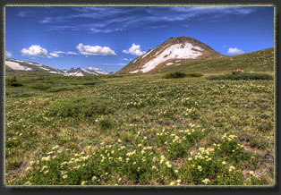
Northeast flank of Fall Mt 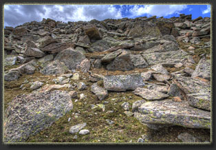
Boulder-strewn north face of Fall Mt 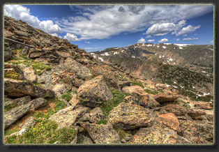
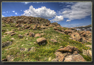
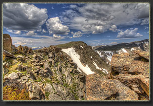
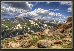
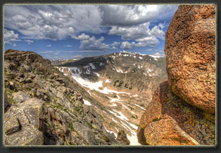
Comanche Peak on the horizon 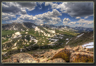
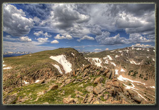
Fall Mt summit 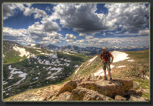
On Fall Mt 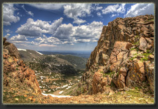
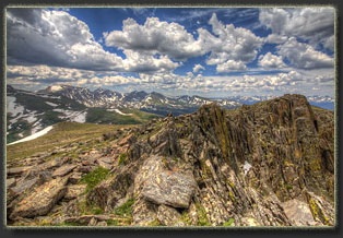
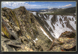
Looking down into the Emmaline Cirque from near the summit of Fall Mt. Mirror Lake cirque is in the distance 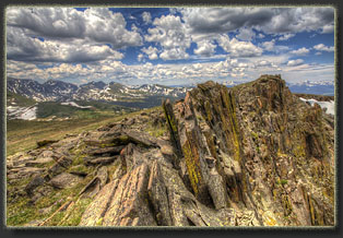
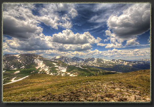
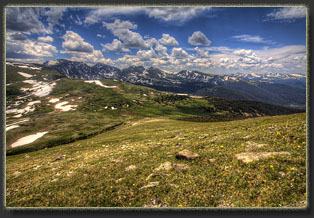
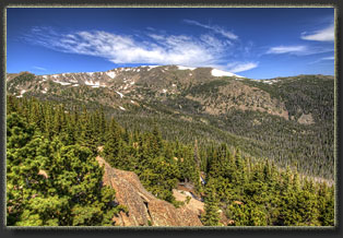
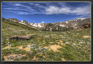
Looking south to Mummy Pass and the Mummy Range, with miles of Rocky Mts beyond 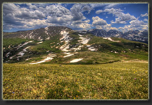
Rowe Peak is the closest, but still far away 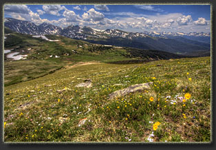
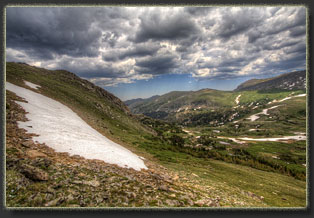
Stormclouds moving in 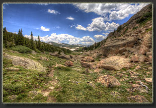
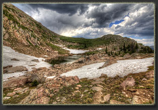
Unnamed lake at an unnamed pass 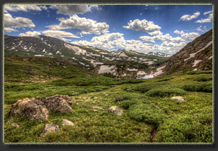 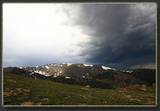
Stormclouds over Comanche Peak |
