![]()
![]()
| Location:
Cross Mountain, northwest Colorado on the Yampa River near Elk Springs
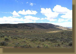
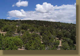
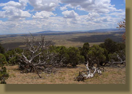
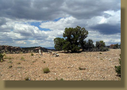
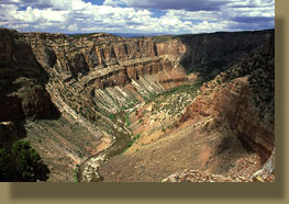
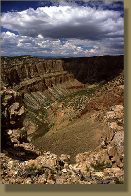
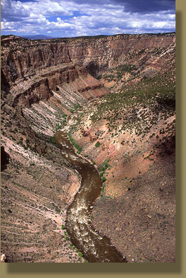
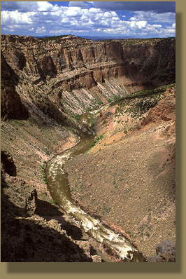
Access: Tricky! From Maybell, Colorado, take Hwy 40 west about 16 miles and take CR 85 north. Hereís a tip: CR85 is marked by a large cottonwood tree that is so markedly out of place you canít miss it (727154e 4477611n). Itís the only cottonwood tree on Hwy 40 from Maybell to Massadona. Take CR 85 north 2 miles and take a left, cross the cattleguard and drive another 2 miles. The road splits again. At this point you are so close to the gorge you can take either fork or park right there and hike west. If you continue down the road, you lose elevation fast, so itís best to park on the right fork just past the fork. Once youíre to that point, hiking to the gorge is like shooting fish in a barrel. Hike northwest and uphill and you canít miss it. Other access points are described in Coloradoís Canyon Country by Pearson & Fielder. Maps: USGS 1:24,000 scale Cross Mt Canyon Trail: No trails; easy bushwacking through PJ forest; no water except in river Dogs: No restrictions Weather: Recent Conditions Pinpoint Forecast The Yampa River is said to be the last major tributary of the Colorado River to remain undammed. Thatís a difficult statement to quantify, primarily because "major tributary" is a pretty subjective term, and varies by the season. At its terminus in Dinosaur National Monument in Northwest Colorado, the Yampa River current is so strong in May it creates Class V whitewater, and so weak in September you can walk across it without getting your knees wet. Partly because it is not dammed (damned?), the Yampa is a muddy river. It moves tons of sediment from the sagebrush flats of northwest Colorado into the clear, dam-filtered flow of the Green, which it meets at Echo Park, and where the two currents remain distinct for about half a mile before finally merging into one color. I followed the road directions I had gotten from the guys at the Colorado Environmental Coalition office in Craig, noting each turn, and driving slowly not only to make sure I didnít miss the roads, but also to avoid any sudden ruts that might open in the dirt road. Driving on desert 2-track is an art. You've got to go slow enough to avoid being rushed into a bad navigation decision, but fast enough to outrun the rooster tail of dust your car is kicking up, and you've got to be especially mindful of that dust if the road curves you right into your own dustcloud; gotta be fast on the draw with the window roller. Yeah, I guess you could say I'm pretty good at it. The smell of grass and pinyons floated on the warm June breeze, under the sun and dollops of white clouds. The massive limestone mound that is Cross Mt is visible from US Highway 40, as is the gash in the rock that indicates the beginning of Cross Mt Canyon. Here the Yampa River has cut a 1200-foot cleft through the uplifting mountain. In the 1950ís, the Bureau of Reclamation proposed a hydroelectric dam in Cross Mt Canyon as part of the 10-dam Colorado River Storage Project that included two other dams on the Yampa downstream at Echo Park and Whirlpool Canyon, both sites that lay within the boundaries of Dinosaur National Monument. A national campaign to halt the Whirlpool Canyon and Echo Park Dams was spearheaded by the fledgling Sierra Club, arguing that dams are incompatible with the aims of the National Park Service. Years of legal wrangling resulted in the Bureau of Reclamation dropping plans for the two dams inside the monument, but as Cross Mt was outside the monument, it remained vulnerable. Plans to build the dam were still active, though stalled, through the 1980ís, when public pressure and local politics finally converged to a decision by the BLM to designate Cross Mt as a 14,000-acre Wilderness Study Area, to the everlasting ire of Moffat County officials. Congress has yet to ratify wilderness status for Cross Mt, but the BLM has remained committed to WSA status for Cross Mt, even while it opened up virtually all of its holdings in NW Colorado to oil and gas exploration in 2006 and 2007. Keeping my eye on the
canyon mouth, I followed the road I was on until I could see it was taking
me the wrong way, at which point I pulled off the narrow dirt grade, and
parked in the grass and sagebrush to the side. I hopped out of the car,
loaded my day pack with water and snacks and began hiking northwest toward
the canyon. From a distance, it looks like you should be able to simply
hike up the slope and arrive at south rim, no sweat. As I hiked through
the pinyon-juniper forest, several folds and washes appeared that made
the going a little more difficult. It was a nice, hot summer day, with
fierce convective activity producing massive cumulous clouds. I hiked on,
aware that my time under open sky would be limited today. I plodded along
with heavy breaths up the steep slope through gnarled, ancient junipers
and finally made it to the south rim. A fantastic dropoff to the quiet
river below greeted my eyes. I stopped in the shade of a juniper and ate
a Clif Bar and gulped water. When I had cooled down, I picked my way along
the south rim, heading west, enjoying the views below from my spine-tingling
perch. The deep canyon section is not long, only a couple of miles. I reached
the high point of the south slope, then opted to retreat back to the car
before the thunderstorms, which were clearly visible on the horizon, caught
up to me. The hike back down was quick and easy, as it was all downhill.
|
 |
|
Page created 12-29-07 Comments |