

| Location: Yellowstone National
Park, Wyoming
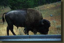
Trailhead: Upper Falls, just south of Canyon Village (NAD83 z12 539589e 4950613n Elevation 7740') Trail: 16 miles to Wapiti Lake, flat except for a few steep sections Maps: USGS 1:24K quads White Lake, Canyon Village; Trails Illustrated #201 Yellowstone (1:126K) This map scale is too small to be useful for anything but overall trip planning...no good for back country navigation. Fees: $20 park entrance fee + $20 backcountry fee Dogs: Not allowed Webcam: Closest webcam I find is in West Yellowstone, 35 miles west Weather: Local Forecast Current Conditions August 2, 2006 The day was bright and sunny, with nary a cloud in sight, as we drove west through Yellowstone National Park past Yellowstone Lake. Andra snoozed in the car as I slowed down for a deer that walked nonchalantly out of the lodgepole pine forest and across the pavement towards the water. Turning north, I drove to Canyon Village, and after a few minutes of confusion, located the NPS portion of the small town and parked accordingly. A swell of people congregated near the entrance, but being August 30, I guessed the current bulge was smaller than that possible throughout most of the summer. Indoors, amidst the steeley scent of air-conditioned air, Andra and I sought the front desk and asked where the backcountry office was. The elderly man pointed behind me, and I turned to note a large and obvious sign: Backcountry Office. I thanked the fellow as we walked off into the lesser-populated corridor. At the end of it, two women were sitting down behind a large counter, apparently pretty bored. The elder woman asked us what we needed and when she heard we were here to backpack, she went off immediately to cue up the safety video in an adjoining room. The younger woman, Meredith, began to read our itinerary and fill out a form. Always more forms. With the government, you need a form to do anything. We had made reservations for a few campsites months ago while snow was still on the ground. I remember the weekend distinctly. Meredith commented, "You guys have a nice trip planned. Nobody ever goes back there." I smiled, hoping it would be so. I had picked one of the most remote places I could find on the giant Yellowstone trail map. Andra had agreed to come along without me telling her this last piece of information. While Meredith made out the permit which was to be displayed at all times on a pack or tent under penalty of caning, I looked over the laminated topo maps on the counter. "What's this?" I asked, pointing to the gray shading near Broad Creek. "That's burned area. Don't worry, your camp is just outside the burn, " responded Meredith. "Oh, that's good," I said, "I hadn't even though about our camp being in a burned area." "Yeah, it's nice to look at, but I'd hate to spend the night there," she said. Satisfied that my luck had influenced my decision to the point of magically choosing a camp outside of the burned area, we followed the elderly lady into the adjoining room to view the safety video. Apparently this room was built for no other purpose than to watch this video, and we sat on a hard bench and watched the poor production of what appeared to be a DVD copy of a VHS tape recording of a film strip movie reel from about 1975, a recap of A/V technology right before our eyes. The safety video went over such mysterious things as not approaching bears or bison, wearing warm clothes, and taking plenty of food. After the movie we picked up the completed permit and left. The Wapiti Lake trailhead was not very far
south of Canyon Village, and we arrived there in just a few moments. The
parking lot was fairly empty, so I parked right up at the trailhead sign.
We began to load last minute items into our packs and put on boots. Two
fly fishermen strolled up from another trail, one large man and another
small, and we talked about our trip.
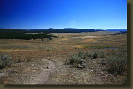
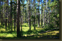
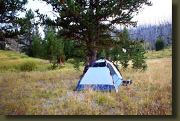
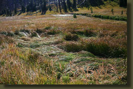
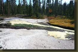
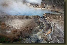
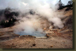
The trail started out on the upper reaches of a large grassy plain that sloped gently down into a broad, flat valley to the southeast. Everything was brown. The park ranger had told us to expect bison on the trail, but we saw none. The day was very warm, and sweat soon beaded up on my forehead. After passing in and out of small lodgepole pine islands, we finally entered into what appeared to be the forest proper. A thin reek of sulfur curled my nose as we walked around a denuded area that emitted a steady whisp of steam. Yellow sulfur was caked around the openings in the ground. The stench of the sulfur followed us for a long time like an annoying hiker. In the Yellowstone backcountry, you are free to fart without suspicion from your hiking mates. The trail was well maintained, and we made good time over the relatively flat terrain. On both sides, lodgepole pine marched into the distance. The air was still and very quiet. We passed by the turnoff to Ribbon Lake in about an hour and continued east. We finally took a break near the first stream we came to, and I had the misfortune of sitting down on a kinikinik berry that left a pretty red stain spot right in the middle of my ass (readers will be pleased to learn that it did come out in the wash). We filtered some water, since it was obviously scarce in these woods, and moved on. Even over flat terrain, 8 miles with a pack can start to get old. It was close to early dinner time by the time we crossed the absurdly sound bridge over Moss Creek and split off the main trail to the designated camp site. It was still warm and sunny, so we took our time setting up the tent and fluffing up sleeping bags. I pulled some water from the creek and carried it to camp in a collapsible bucket, whereupon we washed our socks and sweat-soaked shirts and hung them to dry. Dinner of freeze-dried lasagna and chocolate mousse followed. I compliment Mountain House for crafting a delicious lasagna, but the chocolate mousse (from a brand I won't mention since I can't remember) was messy and inordinately time-consuming to prepare, which somewhat negated its great taste. Utilizing the handy food pole lashed between two pine trees, we hoisted our food up to about 20 feet above ground level and retired to the tent as dusk settled. I began reading Needful Things, but didn't get very far since the batteries in my flashlight died within 10 minutes of turning it on. Dang. The air was warm all night, and most of it was spent outside the sleeping bag. I slept great, despite the faint odor of sulfur floating in from the steam vents nearby, and it was a shocking 9:00 in the morning before we both awoke. Actually, Andra claims she was up for hours reading before I woke up but this claim is not subject to independent verification. Part of this was that the campsite had been cleverly placed on the western slope of the hillside, so that the sun didn't actually hit the camp until near noon because of the dense canopy of lodgepole pine. We ate a quick breakfast of fruit bars and packed up camp, clothing still damp, and headed east on the trail. I'm happy to report there were no bear incidents during the night. August 3, 2006
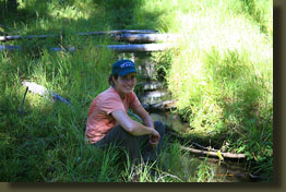
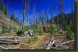
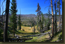
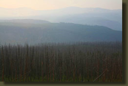
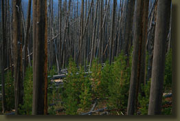
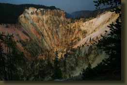
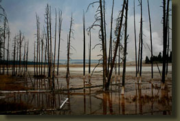
I returned and fetched my pack, and with Andra leading, we hiked to camp. It was still early in the day, but we were tired. We set up the tent in the only shade available and napped for a couple of hours until the sun circumvented the trees and transformed the tent into a solar oven, the kind you might use to warm up hotdogs at a tailgate party. We got up and while Andra read her book in the shade by a startlingly cold sidestream, I washed my face, arms and chest in a bucket of said startlingly cold water. Then I washed my shirt and socks and foolishly placed the shirt over the top of a live lodgepole pine growing nearby which apparently had a prodigious glob of sap on it's apical meristem that was just waiting for a shirt to come and take it away. Glad I could help. An early dinner of Jamaican style chicken and rice was mixed in with various puttering on equipment and packing, followed by a stroll through the grassy valley along the meandering banks of the wide creek. The opposite hillside was a long slope of barren sand that was predominantly bright white but sported hues of yellow and red. A few live pines held on in areas where the vast expanses of soil prevented the fire from reaching them, but by far the vast majority of large trees were dead. Thousands of small pine trees, 3-6 feet tall, grew in the understory, but the overall effect was not lushness or grandeur. In this respect I was a tad disappointed. I understand fire is a part of the cycle, and that it's needed and all that, but it doesn't mean I have to enjoy spending my vacation in a burn. One thinks of Yellowstone and one envisions rolling hills of lush majestic evergreen forests, crashing waterfalls and spewing geysers. One doesn't immediately consider that half the park was burned to nothing in 1988, and even still is showing pains to recover, 18 summers later. As the sun sank, it grew cold very fast and I enjoyed a snug and restful evening in my warm down bag. August 4, 2006
Despite our vow to tackle the sun-baked ravine in early morning, we found ourselves hiking it around 11:00, in the sun. The sweat flowed freely, but it was not quite as bad as had been anticipated. For the next 5 hours we hiked west along the relatively flat trail, stopping frequently for reading breaks to dry socks and have a snack. As we were now completely disregarding our planned itinerary, we felt suddenly free to do whatever we wanted to, including being lazy and reading books by the trailside. My feet were complaining quite a lot, and I didnít realize until a post-hike trip to REI just how worn out my boots had become. Not having a plan, we reached Moss Creek again by around 5:00 and nobody was there. We rested by the creek and had dinner of some new chicken/rice concoction. The sky clouded up, or rather smoked up. I enjoyed a good soapy sponge bath from my collapsible bucket (a fantastic item to have on a multi-night trip), and washed my shirt and socks again. By 6:30 nobody had showed up at the camp, so we decided nobody was likely to and so we set up camp ourselves. I spent an extra long time reading my book in the failing light and used Andra's flashlight after she had gone to sleep to read more. It was another warm night. August 5, 2006
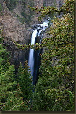
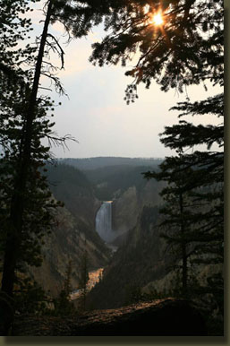
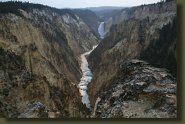
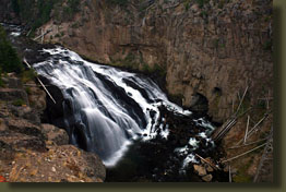
We reached the car around 2:00 and our first thoughts were of securing a place to stay for the evening. Motoring north to Canyon Village, we inquired at the Lodge if we could bum our reservations up a couple of days since we had arrived early. No go on that front. The Canyon Village Lodge is a very popular place. So, we decided to have a burger at the diner and ponder our options. We dove into the greasy burgers with a zest only one who has been on the trail for a few days can empathize with. Delicious. Our heads thus cleared and our bloodstreams zinging with saturated fat, we decided to get a campsite at the car camp across the street. No problem there: the camp was scheduled to shut down in less than a week and most campers had already come and gone. Most of the campsites were vacant, which makes me wonder why we were assigned a site with folks on all sides. I suppose their goal was to group everyone together to lessen their cleanup jobs later on. We threw our tent together and slipped our sleeping bags inside before rolling back down south to check out Yellowstone Falls. We parked near Artist's Point, and here were the crowds. Oceans of folks disembarking from tour buses and schooner-sized RV's flowed like a river towards the designated and securely-railed overlooks. I was impressed with the falls, but wished the sky wasn't so smoky. After examining several professional photographs and paintings of the falls in the lodge, what we actually saw was a little diminished in grandeur. We drove north to Tower, and walked the short distance to Tower Falls. We inquired about Lost Creek Falls, but nobody seemed to know anything about it. We drove to the ranger station, but it was closed. Instead, we had icecream at Tower Junction in the weird red light of afternoon. Back in camp we took a long walk, then settled down in our tent for the evening. I put aside Needful Things and read A Bend in the River for awhile. Around dark, the party really geared up next door and a group of 6 people created a dull roar that lasted for hours. At 10:30 I walked over and asked them to quiet down, and to their credit, they did. I longed for the solitude of the deep backcountry from the night before. August 6, 2006
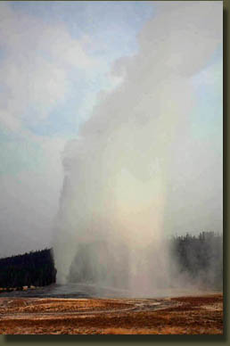
From Old Faithful, we drove south through a light rain to slightly sunnier skies in Jackson, Wyoming, where we had lunch at a pizza place and inspected the local art galleries. The smoke was less thick, but still the Tetons were only barely visible from the park road. After lunch, we drove south and onto another adventure in Colorado. |
 |
Page Created 1-16-07
Updated 7-25-11
Comments