| Location: Wildcat Hills State Park,
western Nebraska
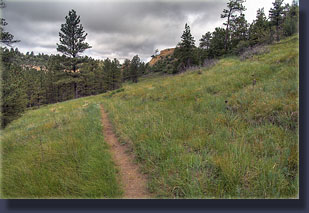
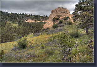
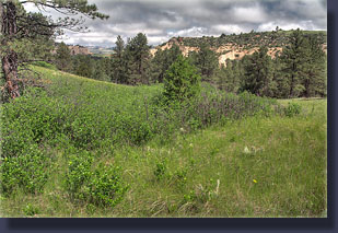
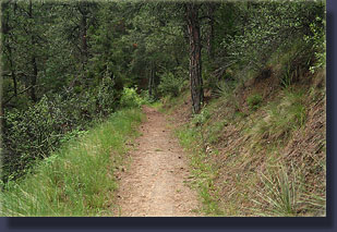
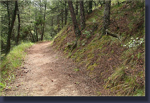
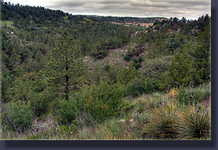
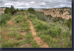
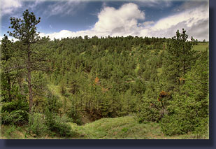
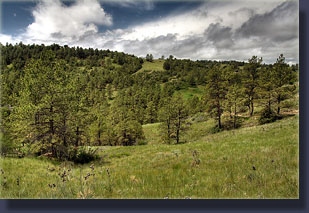
Access: From Kimball, NE on I-80, drive north 34.5 miles and turn east into the state park. Maps: Drawn Trail Map or USGS 1:24K-scale Wildcat Hills Trailhead: UTM NAD83 Zone 13 609976e 4618120n Trails: Many short trails totalling 3 or 4 miles weave a network through bluffs covered with pines and open grassland. Elevation: High point: 4660í Low Point: 4400í Fees: $2/person Official webpage Weather: Current conditions Local Forecast June 7, 2009 Living in Cheyenne, we are little more than a stoneís throw away from Nebraska, and when the wind is blowing west at 65mph thatís not much of an exaggeration. For a variety of reasons, though, we seldom get across the border. The mountains to the west and south always seem to draw my attention, so it had actually been roughly 6 years since I crossed the state line and ventured east. The morning of our planned departure was gray and foggy, but we decided to go ahead anyway. Andra and I drove out on I-80 and the weather actually seemed pretty nice, with low clouds and intermittent blue sky. We passed into Nebraska without fanfare, and briefly debated visiting Panorama Point, Nebraskaís highest point at 5,424 ft. After tallying the county road mileage required to get there at over 25, we decided it wasnít really worth an hourís detour to see a tall hill, especially when the hills are much taller just across the border. Moving on then, we found ourselves in Kimball in no time, and stopped at the Sinclair station just off the interstate to buy drinks from a surly gas station attendant. I chuckled at the ďShoplifters Will Be ProsecutedĒ sign hung over the Little Debbie snack case, and thought it might be more appropriate if it were hung over the cigarette-lighter display, which clearly housed the storeís most-expensive product line. After cruising through the quaint town of Kimball, we drove north through verdant green fields of open grazing land and some cropland and the fog closed in around the car until we were in a small bubble of reality extending only about 200 feet in any direction. Through gaps in the moisture, I could see the topography slowly becoming more interesting with each mile. By the time we reached the state park we were out of the fog, but heavy, low clouds persisted. We parked the car and paid our fee at the counter inside the large visitor center, and then off we went up the Nature Trail that begins at the main parking lot. Wildcat Hills State Recreation Area is small at 700 acres, but made up of interesting, badlands-like terrain of steep gullies and forested draws. Itís not a place to go if you want to get somewhere, because there really isnít anything to get to. Itís more of a place to enjoy the ancient art of leisurely walking through green woods. There is a trail map available at the visitorís center, although Iím not convinced of its accuracy. Several trails seemed to have gone missing since the map was printed. No problem, we managed just fine. There are only 3 to 4 miles total trail in the park, so itís never very far from anywhere. The rain and fog that had passed through earlier in the day caused the brome grass that lined the trail to droop with water droplets, and my shoes were soaked in minutes of beginning the walk. Still, it was warm and calm, and overall very comfortable. Yellow salsify bloomed everywhere, with flower stalks up to 3 feet high in the shadier areas. Chokecherry and poison ivy covered large portions of the understory. We followed the Nature Trail to White Tail to Turkey Run, the longest trail in the park, which we followed to its terminus at the road. These routes wound up and down on a sandy grade around and over steep draws lined with ponderosa pine. We doublebacked along the trail when we reached the road at the end of Turkey Run, and took the spur trail up to the big shelter, a rough-hewn stone building built in the 1930ís by the Civilian Conservation Corp. Soot from countless fires blackened the walls and roof timbers above the fireplace, and on a cloudy day such as it was, seemed a dreary, dark place to be. We did not stay more than a few seconds before returning to the trail. We headed north, attempting the Muley loop, but there are no trail signs in this area of the park, and little side trails head off regularly, so itís not clear what route actually loops around. We found a little trail that headed off along an open grassy ridgeline dotted with pines and yucca that looked down on houses to the north, and followed it, Andra insisting I walk first to knock the water out of the grass since her feet were getting too wet. After ¼ mile or so, the ridge dropped off steeply, and though a faint trail headed downhill, we went no farther. To the west we could see Hwy 71 and we could almost glimpse Scotts Bluff to the north, but another ridge was in the way. We turned back and retraced our steps to the loop trail, but after following that for a few hundred yards, found that it simply ended at the road and a swing set. Boy thereís just nothing better than a good swing session at the end of a brisk hike. I suppose if you lived nearby youíd get to know the trails, but they seemed to be in a bit of disarray to me. We decided to just turn around and follow our tracks back to the visitorís center. The sun came out on the way back, and it grew very warm and, though it had been humid all day, began also to feel very muggy. We saw a single woman hiker on her way into the area, and that was it for trail-traffic. We got back to the car after about 2.5 hours of easy walking, about 6 miles. We considered hiking Scotts Bluff, but lightening
to the west and ominous storm clouds convinced us to call it a day and
head home.
|
 |
