
| Location: West White Pine Mt, Roosevelt
National Forest west of Fort Collins
Maps: Trails Illustrated 1:40K -scale #101 Cache La Poudre / Big Thompson; USGS quad: Crystal Mt Access: From Teds Place on Highway 287 at the mouth of the Poudre, drive 15 miles and turn south on Stove Prairie Rd. Drive ~8 miles and turn west on Buckhorn Rd (Pennock Pass). If you get to Masonville, turn around. Drive 11 miles to the Buckhorn Ranger Station, and turn right at the poorly-marked road north of the Ranger Station. You can park just off Buckhorn Rd, or drive in another 200 meters to a small parking area. Intrepid souls can drive all the way to the top.You can also reach the TH by taking the Pingree Park Rd south from Hwy 14 for 12 miles, then turning back east on Buckhorn Rd and driving east another 6.3 miles to the trailhead. This route is definitely more scenic driving. Trailhead: NAD83 zone 13 460298e 4492439n Elev: 8300' Trail: Steep, 3.5-mile jeep track through lodgepole/aspen forest to summit with limited views. Impossible to lose this trail as it is 8-feet wide. Elevation gain is 2000 feet, so be ready. Fees: None Dogs: Voice control Webcam: Pingree Park 8 miles west (spring-fall only) Weather: Current and recent conditions (NOAA) Local forecast (NWS) 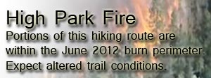
August 28, 2007 I woke up one morning in late August and decided after looking outside at the clear dark blue sky of dawn that I couldnt possibly be at work that day. After calling in, I quickly threw some gear together and packed the dogs into the backseat of the Toyota and then I was off. I drove down to the mouth of the Poudre and headed west to Stove Prairie Rd, south to Buckhorn Rd, and then west again to the Buckhorn Ranger Station. The turnoff for the road to the White Pine Mountains is just north of the ranger station. I wasnt aware when I started the hike that it was a road clear to the top, and this was initially a little disappointing since it opened up the possibility that after sweating and grunting my way to the top, some jeep would pull up with fresh, smiling yuppies and a cooler full of beer. Nevertheless, I parked the car right off the road and, shouldering my pack, started walking under a mostly cloudy sky at 9:00. The dogs frittered about on the road, and I had to keep them from diving under the private property boundary fence on the west of the road until we were well past it. The road started out smooth and the grade was shallow. Aspen lined both sides of the road, and the scenery was pleasant. I hiked at a brisk pace, feeling almost chilled in the early morning breeze. The road passed a small parking area on the left, and a sign reading "White Pine Saddle, 3 miles". If I had any notion of being able to drive a passenger car up this road any further, it was quickly abandoned when we encountered the first real ruts of the road. Slightly further on, the road steepened, and Im quite sure it would be impossible for any regular passenger car to go further. The road led steeply through lodgepole pine for most of the next two miles, and at times the road was deeply rutted and other times covered with loose rocks. Even in a jeep, it would be slow going. Youd be better off walking, I think. Sometimes I would think that it looked like a good road for mountain bikes, other times I would consider that it would be strenuous going up, and dangerous going down. Conclusion: Not real good for bikes either. I cheered up a little at the thought that given the difficulty of the road, I would probably be the only one up at the top, and though I saw some faint tire tracks (ATV?) all the way to the saddle, I didnt encounter any other humans the entire hike. The trail broke into a large meadow, and about that time the sun rose above the morning clouds in the east and everything was lit up fresh and bright. The aspen leaves were particularly vibrant in the cool morning light. Despite the lushness of the meadow, there was no water, and I stopped to pour a trickle of water out of my bottle for Frank and Makenzie. The road reentered the pine forest, and took a sharp west turn at the saddle between east and west White Pine Mountains. One could easily find a way to the top of the eastern peak, though with the amount of downed timber, it might be slow going. However, the road leads west, and that was the direction I went, as well. The shadows on the road were dark in contrast to the dry, tawny dirt on the road. The air was still, and I dripped sweat from my nose constantly. I could feel my shirt becoming drenched. Even on this shady trail, it became quite warm. Finally, after about 1:20 of constant hiking, we reached the summit. Although the Trails Illustrated map indicates a fire tower is present, it has unfortunately been torn down. This is unfortunate primarily because West White Pine Mt (and East, too) is not a bald mountain, and so the 300-degree view that would greet someone from the top of a firetower is unfortunately largely blocked from view by large limber pines. The only feature that is unblocked and particularly impressive is the Mummy Range. From this vantage, it looked more like a Mummy than Id ever noted before. The pilings for the guy anchors as well as the concrete foundations of the tower are still present, as are broken wooden remnants of the tower itself. I inspected the water catchment that was situated just a little downhill, and the old outhouse situated a little further downhill, curiously off the foundation and sitting on open ground. A small shed sat a few feet away. Nothing really too interesting to look at. The sun was out fully at this point, and the air was warm and pleasant. I dropped my pack in the shade, and took off my tshirt and laid it on a slanted rock facing the sun to dry out a little. I watered the dogs their fill, and snacked on dried mangoes while reading a book for about 45 minutes. After discovering half a dozen ladybugs crawling on me, I looked around to find a mating frenzy of lady bugs going on in a cleft of a rock. Thousands of them were stacked two to three deep in a concentrated wall of moving insects. It was very cool. At intervals, some of them would crawl up to the top of the rock and fly away. Thunderclouds started building over the Mummy Range, and taking note of that, I pulled my damp shirt on and we all headed downhill. Within 20 minutes it was completely overcast, though it didnt feel like an imminent threat of rain so we didnt hurry. In fact, I took about 10 minutes to pick wild raspberries just south of the meadow, and theres really nothing more satisfying than eating wild berries on a hike. It took exactly the same amount of time hiking down as hiking up, and we were back at the car by around 12:30. I made it about 6 miles back down Buckhorn Rd before drowsniness overtook me, and I pulled the car off the road and took a 20-minute nap. Very relaxing, and I was for once thankful of the dark, cloudy sky to keep it cool enough in the car for a nap. The drive home took a long time, and I reflected that I actually spent 4 hours driving for a 3.5-hour hike. I guess sometimes you have to give a lot to get a lot.
|
TRIP 1
;)
;)
;)
;)
;)
;)
;)
;)
;)
;)
;)
;)
;)
;)
;)
;) |
|
|
| September 28, 2007
After my fantastic trip in August, I wanted to get back to see the aspen stands along the trail to West White Pine Mt in their fall regalia. So, early one cloudy morning as all the aspen leaves in the forest hung tenuously, waiting for that first snow to come along and knock them all off, I once again drove the car up to Buckhorn and hiked along the trail into the aspen. I was initially fretful that the clouds would hang around all day and dull the spectacular colors of the aspen, but within a couple of hours of dawn, the clouds peeled back and as I entered the first stands of yellow leaves, the sun burst out from behind a cloud (perhaps I heard a choir singing in a major key somewhere) and lit up the leaves all around. To an easterner, perhaps the annual aspen color is a bit lacking, but to us westerners, that orangey-yellow wave that sweeps through the ranks of conifers every fall calls for nothing less than a full-day holiday. Makenzie and Frank are great hiking pals, but they have a preternatural ability to put themselves in the field of view I intend to photograph, sometimes before I even know I intend to photograph it. They have superstar complexes, or something. Anyway, as they make it virtually impossible to get dog-free photos, I left them at home on this day so I could leisurely photograph this once-a-year event. I hiked slowly along the trail, stepping off into the woods frequently to check things out. The sun shone low through the white aspen trunks, creating interesting shadows. So, absorbed in the lofty, airy feeling of wandering aimlessly through a dreamland of orange and yellow, I whiled away 4 hours and filled up my compact flash card. I didnt even make it to the saddle between east and west white pine mountains, but then theres not much aspen up that way to see. As noon approached, I headed back down to the car, and back towards home.
|
TRIP 2
;)
;)
;)
;)
;)
;)
;)
;) |


Have you seen the plethora of awesome nature shots over at  ?
?
Comments |
;)
;)
;)
;)
;)
;)
;)
;)
;)
;)
;)