| Location:
Pecos Wilderness, Santa Fe National Forest, northeast of Santa Fe, New
Mexico
Access: From I-25, take exit 307 north on Hwy 53 through Pecos and all the way to the end of road at the Jackís Creek Campground, a distance of about 25 miles. A sign at the campground directs you where to park for overnight parking. Maps: USGS 1:24,000 Cowles & Truchas Peak, but they arenít current on trails. The Santa Fe National Forest Map (2006) is useful for showing current trails and roads, is weather-resistant, and costs $10 from any of the Santa Fe NF Ranger Station, by mail or in person. Trailhead: Jacks Creek Campground UTM Trail: There is an extensive network of trails in the area. To get to Truchas Peak: Take TR25 from the Jackís Creek campground, turn left onto TR257 after ~1 mile and head another 6 miles to Pecos Baldy Lake. Continue another mile to the junction with the Skyline Trail (TR251) and follow that north another 3 miles to the junction with TR255, then cross-country north 1 mile to the summit of Truchas Peak (there is a scratch trail along portions of that route). Truchas Peak is a class I hike, pretty straightforward and not scary. Truchas Peak is 2nd highest peak in the state: Wheeler Peak is #1 at 13, 161í; Mount Walter and Old Mike Peak, though taller than Truchas, are sub-peaks of Wheeler with <300í prominence, so common accounting does not consider them separate from Wheeler Peak, which puts Truchas Peak officially at #2, at 13, 102í (and 4001í prominence, 5th among New Mexico peaks). One way-distance from Jackís Creek CG to Truchas Peak is 12 miles with a net elevation gain of 4,279í. To get to Truchas Lake: Take the directions for the first 11 miles of Truchas Peak, but at the last trail junction, stay on Skyline Trail (TR251) another 2 miles north to Truchas Lake. The return trip can be made into a semi-loop by taking the Rito Azul Trail (TR264) turnoff just south of Truchas Lake, and following it south until it dumps into Jackís Creek Trail (TR257) that leads back to Pecos Baldy Lake. TR264 stays east of Trail Riders Wall and maintains a lower, forested elevation, and is a less-exposed route to Pecos Baldy Lake. Fees: $2/day to park at the trailhead Dogs: Voice or leash control Weather: National Weather Service Forecast Snow depth information (NOHRSC) [ensure correct date] August 14 2009
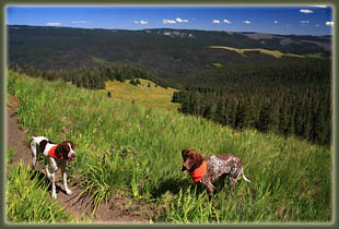
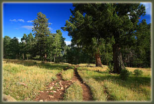
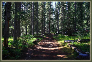
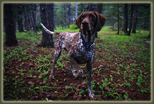
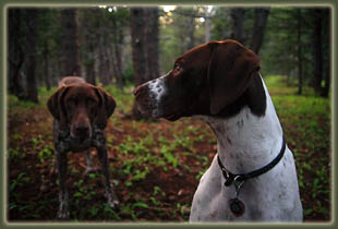
I leashed the dogs, Makenzie and Henry, and then we started on up the trail. I passed a couple of returning backpackers right away, and that was it for the evening. Pretty quiet. The first part of TR25 was pretty steep, with lots of switchbacks that wound up through a nice conifer forest. Deep puddles on the trail spoke to a heavy recent rain. After the first 20 minutes, I let the dogs off their leashes to explore a little more freely. After an hour, I reached the junction with the Jacks Creek Trail (TR 527) and took a left turn on that one to head north more directly. I passed through wonderful aspen groves and large meadows bordered by dark spruces. A scattered herd of cows mulled about in the tall grass and amongst the white aspen trunks. The trail through this area was extremely degraded, in places nothing but a sloppy swamp of mud, trampled utterly by cattle and horses. I tried following the adage of keeping to the trail, but when my boot sunk past the toe laces, I decided to go around. The sunlight was getting low, and cast a nice orange sheen over everything. All in all, a beautiful evening. As time wore on, I recognized
that Iíd not make it to Pecos Baldy before dark, so I decided to find a
spot to camp when I reached the Jack Creek crossing around 6:45. I headed
up the trail another few hundred yards, then turned east, crossed shallow
Jack Creek via a few mossy rocks, and headed uphill into the thick spruce
woods until I was over a couple of short ridges and out of sight. I found
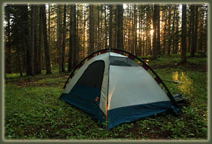
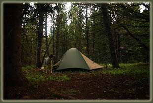
a nice clearing in the trees and pitched my tent. An ancient fire ring,
now serving as a flower planter, spoke to someone camping here years ago.
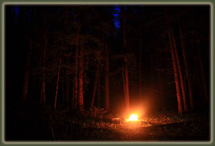
I couldnít resist the urge to spark my own fire in the ring, and gathered
up some twigs and epiphytic moss to get one going. The twigs were damp,
and smoked a lot, but I really enjoyed the cheery light dancing on the
spruce trunks as night fell. I cooked ramen noodles and added the contents
of a can of cooked chicken as sap popped and crackled in the flames. The
dogs crunched on their kibbles nearby, and I heated water for tea. Pretty
nice scene. Well after dark, I let the fire die out, covered over the embers
with soil Iíd scraped aside when I first started it, and went to sleep
in the tent.
August 15
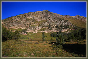
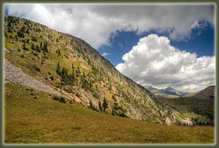
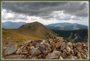
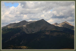
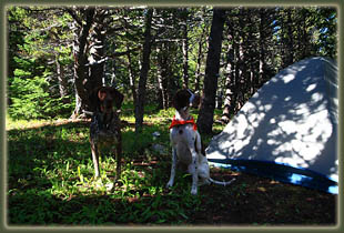
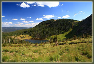
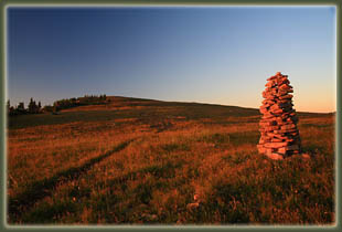
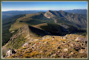
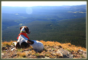
I hiked for half an hour, then stopped at the next fork in the trail and ate breakfast of cereal and powdered milk, filtered more water, and fed kibbles to the dogs. The sun was out, and it was pretty warm, but I could hear a stiff wind blowing in the tree tops that spoke to colder times ahead. Upon resuming the hike, we passed a lone horseman in a thick jacket who had just come from Pecos Baldy Lake, and warned me that it was pretty chilly up that way. We reached Pecos Baldy Lake at 10:30, a lot quicker than I had expected to, and hiked north of the lake about ¼ mile into the trees to set up camp. It was a nice spot, with lots of short pines and a cheery understory of verdant green forbs, not flowering. We ate lunch, hung food and hiked to the lake to filter water from the inlet stream on the west side. The lake itself was several feet low, exposing a wide ring of muddy, goopy shoreline in which the dogs sank up to their hocks when they walked through. A couple of other hikers sat along the far shore of the lake, and I could see a tent going up very near the trail junction by the lake. Watering holes are pretty spread out along the route to Truchas Peak, so I can understand that Pecos Baldy gets a lot of use. It got pretty cloudy around noon, with low-flying, dark wet clouds sagging along just over the tip of East Pecos Baldy Peak. Bored for something to do, I decided to try for the summit of that peak, so the dogs and I walked around the east side of the lake and uphill through the trees around 12:30. The map showed a trail heading this way, but I didnít find it on the way up. It was easy enough going up through the trees, and soon we reached a flat saddle where I picked up a trail leading to the top. The trees were sparse on the flank of the mountain. The trail was steep, with lots of switchbacks. The dogs ran ahead, unfazed by the difficult terrain, and I had a hard time keeping them reigned in and close to me. We reached the 12,529-foot top at 1:25, about an hour after we left the lake, and although I enjoyed reaching the summit, the wind was so fierce and cold that I spent only a moment or two at the summit monument before hightailing it back down. Dark grey clouds were looming in from the west, and they looked like they could bring rain, so I was anxious to get off the exposed peak. A little ways down, I encountered a family of 3 hiking to the top, and further on I encountered a backpacker on the Skyline Trail. I got back to the trail junction above the lake at 1:45 (downhill goes very fast), and from there I followed the advertised trail back to the Jack Creek Trail and then back to camp. I played pine cone fetch with Henry, and tennis-ball fetch with Makenzie, and tried to read a book in between throws, a trick Iíve had years of practice at. Hiking to Truchas Peak on such a cloudy, windy day was out of the question, so there was little to do for the afternoon. We napped for an hour around 3:30. At 4:30, the clouds had largely dissipated and the sun encouraged me to hike up to the saddle north of East Pecos Baldy for a look to the northwest at Truchas Peaks, which we did. The wind was a malevolent force at the saddle. I couldnít even hear the shutter on my camera releasing. My ears ached after only a moment in that wind, and the dogs seemed eager to go back. So, we did. As soon as we dropped back down below the saddle, the wind dissipated and it was pleasant hiking again. Back in camp I noticed for the first time two odd features in the woods. The first was a pair of shredded blue jeans wadded up and crammed into the crotch of a tree about 7 feet above ground. The second was a crushed cookset, jammed into the crotch of a tree about ground level that caught my eye by the way it mirrored sunlight. I have no explanation for these two items, and I canít conceive of what crushed the cookset. Bears? There werenít teeth marks, but it looked like it had gotten run over by a truck. I decided to leave the jeans alone, but carry the crushed cookset back for the garbage. Or rather, I put it in Makenzieís Sherpa pack so she could carry it back to the garbage. At 5:45 I made dinner of
ramen noodles and chicken, and the dogs enjoyed their kibbles once again.
Itís sad for them that they must eat the same meal, 3 times a day, every
day of the year, but thatís part of the dogís life, balanced in part by
the freedom to do no work at all, and sleep anytime the desire hits. After
dinner I made some hot apple cider and enjoyed the sweet drink while I
read my book. Makenzie chased squirrels through the woods, watching them
jump from tree to tree in the dense conifer canopy, hoping one would clumsily
fall to the ground. Iím not sure what would happen then. The only squirrel
she ever caught bit her fiercely, and she dropped it and lost interest
as the squirrel ran away. Still, the little squirrels provided hours of
entertainment, kind of like tennis balls with legs. Meanwhile, Henry scratched
out a small patch of duff, circled around about 38 times, then laid down
and went to sleep. The wind died down to allow a nice, quiet evening as
the sun fell. I found a nice double-trunked tree to lean against comfortably
and read my book until it got too dark to do so. Then it was time for bed.
August 16
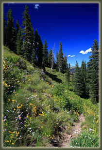
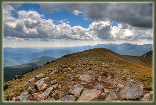
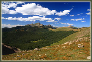
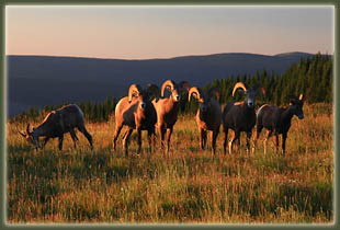
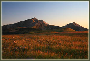
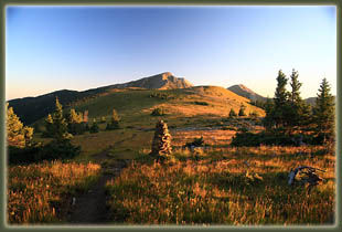
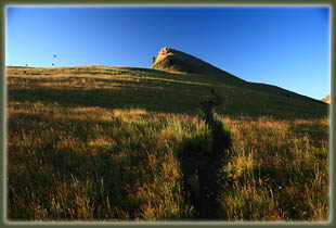
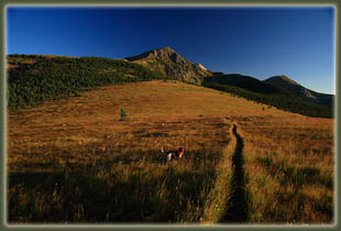
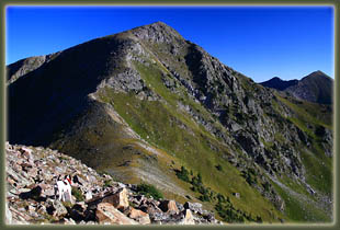
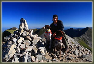
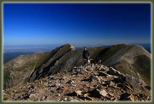
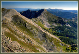
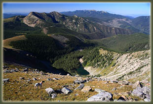
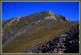
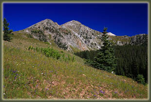
I reached another trail junction closer to Truchas Peak, and there was no trail leading up to the mountain, so we left the trail and headed north across the grass. The route was obvious enough. We passed into a band of conifers, and took shelter from the moderate wind on the east side of a thick grove to eat breakfast in the warm sun. Beyond that I did pick up a trail, though it was faint, and followed it on up through the trees and back into the tundra. Along the ridgeline on the way to Truchas, thereís a fairly significant hump to get over. I was disappointed to have to lose 400 feet to get to Truchas from that point, but there was no way around it. I walked down to the saddle, and the wind funneling up from Jose Vigil Lake was a monster. I wondered if Iíd be able to summit at all. I dropped down on the east side of the saddle for relief from the wind and to throw on an extra sweatshirt. Then we hit it, and headed up the flank of Truchas. Oddly, after getting about 100 feet above the saddle, the wind calmed down, and by 200 feet above, the wind was just moderate, and I took off my sweatshirt. I suppose the saddle was the constriction point for the wind, and it ran with greater velocity there than up higher. I was pleased, and with the calmer air came greater confidence of making the summit. I slogged up through the boulder field, following what appeared to be a faint path but could have just been my imagination. Another bighorn ram monitored our progress from his craggy outlook to the east, completely unnoticed by Makenzie and Henry. At 8:30 I was on top, enjoying the views all around from 13,102í under a pristine blue sky. I snapped photographs, made some notes and had a snack, in all spending about 30 minutes of quality alone-time at the summit. East Pecos Baldy sat to the south, and the other Truchas Peaks: West, North and an unnamed compatriot in the middle, rose up nearly as high as South Truchas (on the map South Truchas is simply labeled as Truchas, and is the tallest of the group). Below North Truchas sat Truchas Lake, and I surveyed the land for an easy way to get there from here, but none presented itself. Far to the west, civilization spread out on the flatland. Chimayo? Santa Cruz? Maybe Santa Fe herself? Hard to tell, and I wasnít very interested in that, anyway. The Colorado 14ers have so much glamour, but when was the last time you had a 14er summit all to yourself for half an hour on a clear August morning? It was quite a treat. I headed back down, quickly stripping down to my short sleeve shirt, and reached the trail junction at 10:10. Another herd of bighorns lingered near the junction, though they all appeared much younger than the ones Iíd seen earlier. Instead of heading back the way Iíd come, I decided to prolong the hike with a trip to Truchas Lake, so I veered north and went downhill into the trees. This section of the trail was extremely nice, though not well-maintained. The trail itself did not show up on my USGS map, but it was clear enough to follow and the sign said it was going to Truchas Lake, so I plodded along happily with Henry and Makenzie, who made short side forays into the boulder fields to check on pika squeaks. At 11:30 we reached Truchas Lake and I found a nice log by the shoreline to lean against while I had a nice lunch of cheese, crackers and tuna, and removed my boots and socks to cool off my feet. Makenzie salivated while watching me eat, so I threw her and Henry a few crackers as well. Iím a sucker. Truchas Peaks lined the horizon, and looked very impressive from the elevation of the lake. The sky was still clear and the wind by the lake was almost non-existent. Just before I left, a couple of anglers showed up from the other direction I had come, and I left the lake to them at 12:00. Half an hour down the trail, the post-lunch drowsiness hit, and I veered off into the shade of the forest to find a grassy incline to nap on for 20 minutes. I could hear the wind above me, and could imagine the pounding I was going to take returning to camp via the Skyline Trail. Fortunately my USGS map showed an alternative route that paralleled the Skyline Trail, but ran east of Trail Riders Wall a thousand feet lower in the woods. This sounded like just the way to go, but the trail junctions I ran into didnít jive with my USGS map, so I was hesitant. I continued retracing my steps until I was nearly back to treeline, when I saw an unmarked trail veering east. I took it. For a while it was clear, but it grew more faint and several times Iím not even sure I was following a trail, just an absence of trees in a linear direction conducive to travel. I kept at it, but when I reached a wet meadow any semblance of trail disappeared entirely. The USGS map was vague enough to be of no help. I scanned the edge of the meadow 50 yards away, but saw no sign of a trail. I was about to turn back and head to the Skyline Trail and take my lumps above treeline when I recalled that I had uploaded the topographic map of the area to my new GPS. I fired it up, and it directed me right to the trail. What a convenience! From there I followed the path down to the Rito Azul Trail, which was much-better marked. I think the cutoff I took is a trail the USFS is letting die, and in another couple of decades, it wonít exist as a travel route at all. Through the thick trees over many downed logs, we headed south along Trail Riders Wall and a small, silty pond that provided one of the very few watering places for Makenzie and Henry. We plodded along, reached Jackís Creek Trail and took that back towards Pecos Baldy Lake. I was glad that the afternoon stayed clear and warm. Wildflowers along the trail were fantastic, even at this time of year when they were clearly past prime. I met one guy along the Jacks Creek Trail near Pecos Baldy Lake. Overall, outside of time spent at the lakes, I hardly saw anyone. As we neared the turnoff to where my tent was, I kept Makenzie and Henry close and fired up the GPS to make sure I didnít pass the point I marked at 5:50 that morning, but Makenzie knew the spot more accurately than my GPS did, and she trotted off the trail without hesitation, and drew a bead on our camp from several hundred yards away. Iím pretty confident that it would be impossible to lose her in the woods. How she remembered where to turn after hiking 12 miles and 9 hours is hard to say. Dogs are pretty amazing. Back in camp at 3:30, Henry, who is only a year old, collapsed next to the tent and fell asleep. Makenzie, the indomitable tank of energy with a steel plate in her leg, brought me her tennis ball, ready for fetch games. I washed my face, then my sweaty shirt and socks in the fabric bucket and hung them in the sun, changed into fresh clothes and took a nap. I donít think Makenzie even put her head down, but Henry slept like the dead, snoring loudly. At 5:00, we hiked to the lake and filtered more water from the inlet, and I talked with a couple of backpackers by the lake for awhile. I got back to camp and made dinner, same as the night before, and had a cup of hot apple cider, same as the night before. One can get into a routine very quickly. I added an oatmeal cookie and some M&Mís to my meal. Very tasty. I fed the dogs almost all the remaining kibbles, holding back just enough for a small snack in the morning to hold them over until we got to the car and the big bag of dog food awaiting in the trunk. Back at the tent, I sat outside
reading, leaning against the comfortable, double-trunked pine tree. Henry
pawed to get in the tent, so I let him in, and he immediately curled up
and went to sleep. While I read, Makenzie brought me rocks to throw for
her, her tennis ball nothing but a mangled collection of rubber shards
by this point. I tossed the rock in different directions, and she always
brought the same one back. Itís one of her skills. Sometimes she would
see something, a squirrel I presume, and gallop off pell-mell, be gone
for a few minutes, then come galloping back from the complete opposite
direction from which she left. Guess she was just making the rounds. As
it grew dark around 8:30, I got in the tent and laid down. This time, Makenzie
fell right asleep.
August 17
|
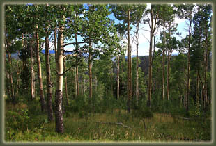
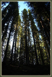
Aspen near the junction with Jacks Creek Trail
|
