Sweetwater
Canyon
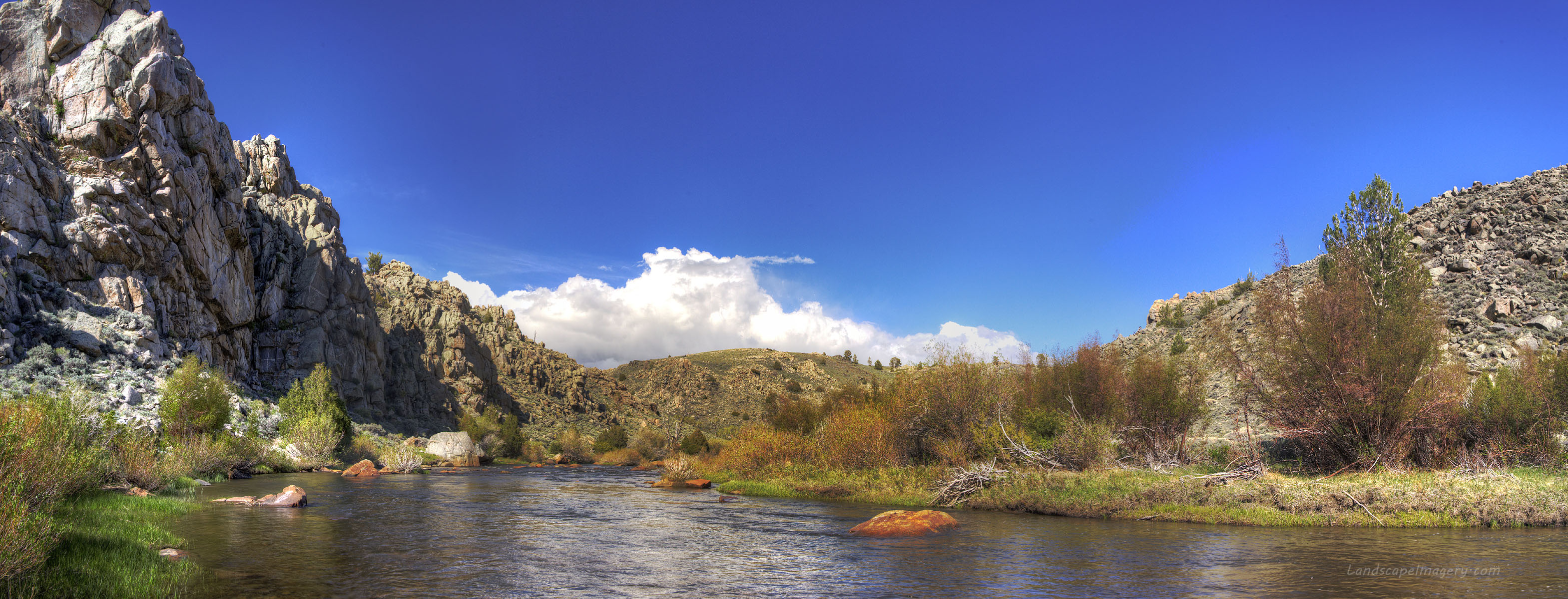
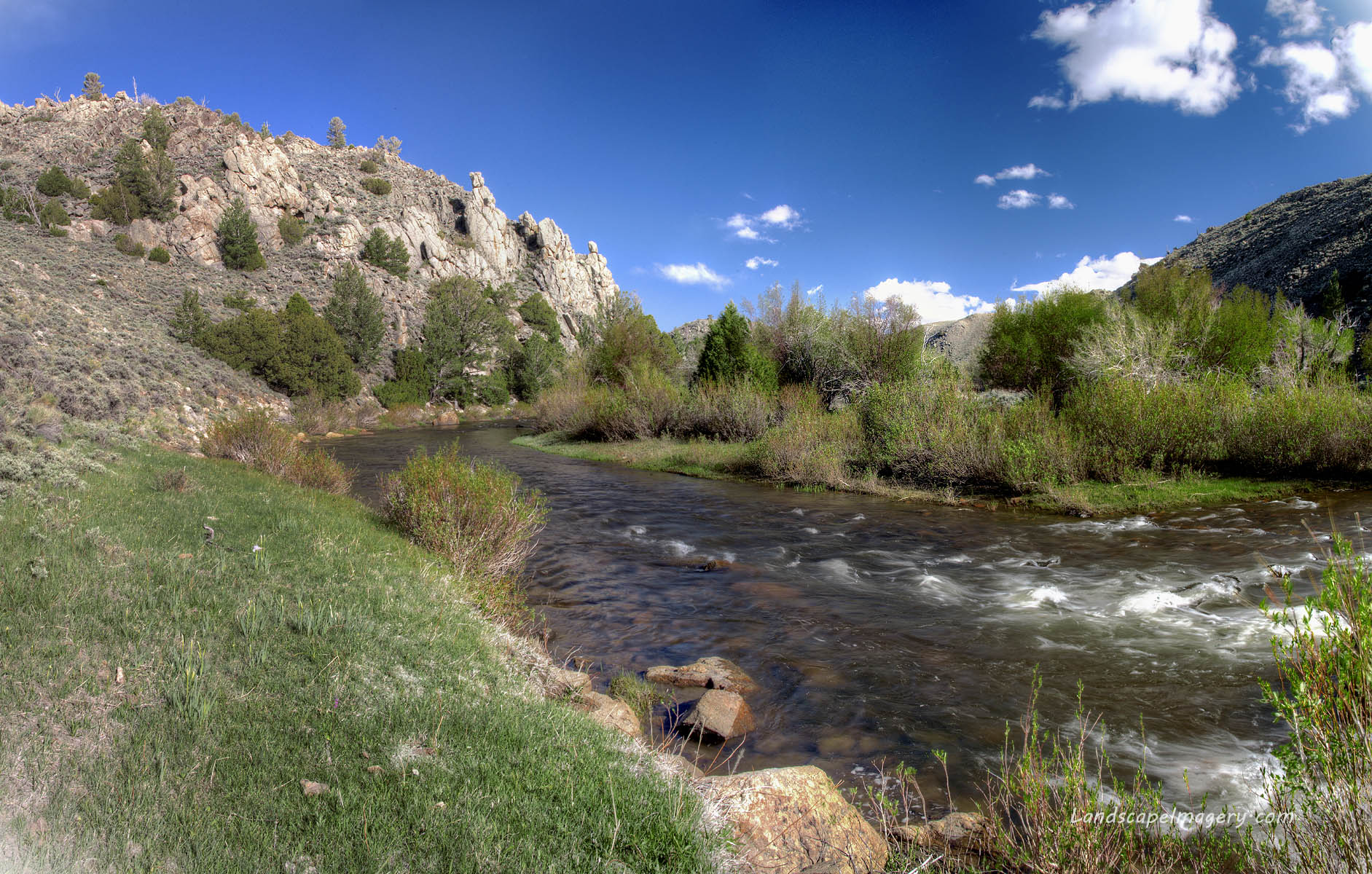
May 30 2013 Terry and I were working in the Green Mountain allotment, one of the largest unfenced public land areas left in the country. To save travel funds, we elected to camp out on the range each night, and at the end of one particular day, we found ourselves fairly close to the Sweetwater Canyon. John instructed us on the best roads to use to get to the rim, and after we all finished up work around 3:00, Terry and I drove south to the rim. The Sweetwater Canyon wilderness study area is managed by the Bureau of Land Management, and it is very remote, with the only access by way of at least 20 miles over rough dirt roads requiring high clearance and dry conditions. Terry and I came down by way of the Hudson-Atlantic City Rd, and entered the WSA via a state section east of Radium Springs. Unlike most WSAs, vehicular travel is permitted inside. This was surprising to me. As they still allow some cattle grazing inside the WSA, I suppose the allowance for vehicles accommodates the permitees, but Im not altogether sure. I could find out if I really cared, but I dont. The fact remains, the sign at the WSA boundary clearly states its OK to drive as far as the canyon rim. When we got to the canyon rim a mile later, it was clear that most folks just keep right on going down into the canyon bottom, effectively making this the only WSA Ive ever seen that you can drive right across. If you cared to, you can drive right down to within 2 feet of the river and park. We didnt care to. Terry parked his camper-laden truck on a gravelly swell on the canyon rim, just off the two track. Not wanting to waste any daylight, we immediately gathered our fishing gear and walked down the steep slope towards the river, which was plainly in view the entire time, losing about 130 feet of elevation. The sun was shining brightly, but the wind and chilly spring air left it feeling anything but warm. We agreed to part ways and Terry opted to fish upstream, while I walked downstream. I had my waders with me, but I opted not to wear them and instead just fish from shore. I wanted to see a few miles of the canyon, and I didnt want to have to walk that far in waders. Mindful of the willows and the whipping wind, I casted carefully and drifted nymphs in the current. Im sure the water here is thick with trout, but they were wary. I pulled in two rainbow trout from the same hole, and that was it. I felt several others tug the line, though I couldnt set the hook. But the fish were only a bonus, as they always should be when fishing a beautiful spot like the Sweetwater. I enjoyed the exploration of a couple of miles of canyon much more than the fish on the hook. The canyon is not extremely deep, only 100-200 feet from rim to water in most places, but its very interesting to look at and walk through. The walls of the canyon are blocky granite, split through by fissures and deep cracks. As I was walking below one such cliff, a prairie falcon streaked out and flew over me, crying shrilly. On the benches above, the tallest plant is usually a 3-foot basin big sagebrush, even in the moist draws, but in the river bottom, large cottonwoods, aspen, willow, river birch, limber pine and even Douglas fir grow thickly. Walking downstream was relatively easy, however, as I followed a path worn in the brush and grass. By whom? Probably a combination of people, cows and wildlife, with strongest emphasis on wildlife, given the amounts of various scat piles I observed. I made my way downstream, fishing holes and hiking the riffles until the sun dipped below the canyon rim and cast the entire canyon in shadow. On my hike back upstream, there was one remaining hole still bathed in sunlight, and I fished it until the canyon wall shadow overcame it, also. Then I trudged up to the road, uphill to the truck, and spent some athletic moments trying to pitch my tent in 45-mph gusts.
|
;)
Rainbow Trout pulled from the river
;)
The old outpost at Radium Springs |
;)
;)
;)
;)
;)
;)
;)
;)
;)
;)
;)
;)
;)
;)
;)
;)
;)
;)
;)
;)
;)
;)
;)
;)
;)
;)
;)
;)
;)
;)