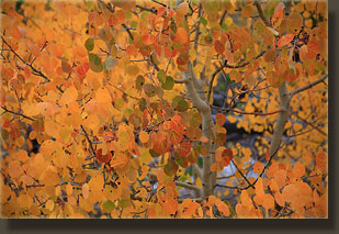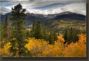
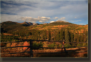
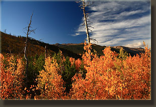
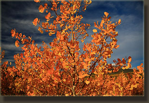
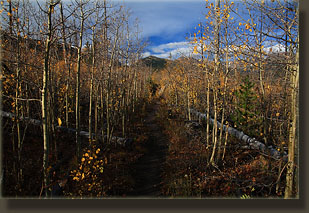
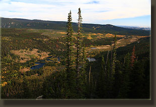
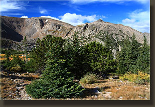
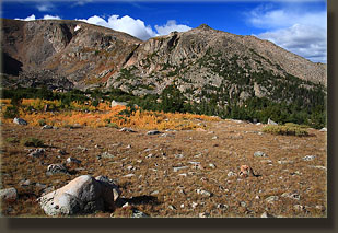
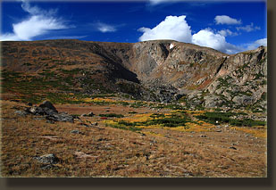
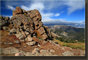
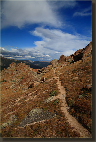
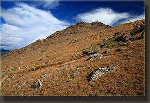
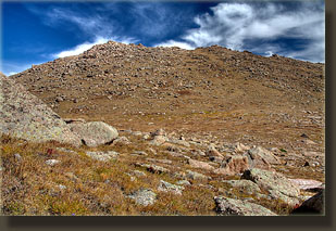
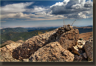
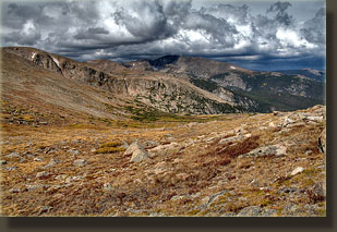
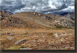
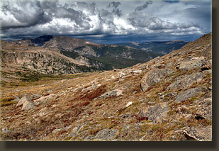
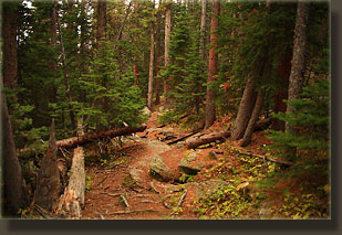
Location: Rocky Mountain National Park, northern boundary & Comanche Peak Wilderness Maps: USGS Pingree Park (1:24K scale) or Trails Illustrated #112 Poudre River / Cameron Pass (1:40K scale). The Trails Illustrated #200 RMNP map also shows most of the trail. Access: From Ted's place at the junction of Hwy's 287 and 14, drive 25.1 miles west and turn south onto Pingree Park Rd (CR 63 E). Drive south 16 miles to the end of the road. Instead of entering Pingree Park, turn left and drive another 200 yards to the parking lot. Trailhead: UTM NAD83 zone13 450211e 4491223n, 9015ft Trail: Itís 5.4 miles to Stormy Pass and another 0.4 miles to Stormy Peak (12,148í) for a total one-way trip of 5.8 miles and 3133í. A quarter of the trail is above treeline. The trail begins in National Forest, crosses the Comanche Peak Wilderness, and runs into Rocky Mountain National Park. Trail is well marked most of the way, with one slightly hazy section just after the Park boundary. No trail to the summit, but itís obvious where to go and requires only minimal rock scrambling to get to the summit. Fees: None Dogs: Leashes required in the Wilderness. Dogs are not allowed on RMNP trails. In other words, donít bring your dog if you want to make the summit (and not break their rules). Weather: National Weather Service forecast September 20, 2009; Sunday Itís painfully early when the alarm beeps at 4:30, but the weather forecast seems resolute about clouds and possible thunderstorms by noon. There can be no delay. I hop out of bed and shower quickly, eat a quick breakfast while the doggies look on, and pack up some gear for the hike. Makenzie and Henry, tails wagging tentatively, wait with baited breath for me to give some sign they are to come along. None comes, and when I shut the door and walk out through the dark back yard, I can feel little dog eyes boring into my back. Well anyway, they got to go hiking two days ago to Lake Emmaline, so my conscience is clear. I cruise down south, over the state line into Colorado, and then head west towards the Poudre Canyon. As daylight is breaking at 6:30, I stop at Tedís Place for a coffee and a pastry. Caffeine and sugar make a magical pairing, especially at 6:30 AM. Up the canyon, and up the Pingree Park Road, which has recently been treated with magnesium chloride to dampen the dust. Nice. I arrive at the Stormy Peaks Trailhead at 7:35, and park the car. Two cars are already sitting at the trailhead. One is a red Toyota truck with a camper shell festooned with stickers. ďNo Pain, No JaneĒ reads one. Now what the hell does that mean? Wind gusts from the west, and rocks my Subaru, making it feel like a cozy, comfortable cocoon. Though the sun is up, it is weak and dim, both due to the lateness of the season, and the high, thin film of cloud that blankets the sky, almost like a stratospheric fog. I enjoy a few last moments of quiet in the still air of the Forester cabin. The thermometer measures the outside air at 52 degrees. Itís going to be chilly. I step out into the wind rushing down the Fall Creek valley. I throw on my socks and boots, don my knit cap and gloves, swing my pack onto my back and sling my camera over my shoulder. Iím on the trail by 7:50. Not a bad start. The trailhead sits immediately adjacent to CSUís mountain campus at Pingree Park, a location I have had the pleasure of staying at on a couple of occasions in the beautiful summers of 1996 and í97, when the aspen were just beginning to cover the soil after the 1994 hourglass burn. A wooden rail fence separates the parking lot from the campus ropes course, and the trail leads southwest, away from the area. Even now, 15 years and a bit after the Hourglass fire, the extent of the burn is very obvious. Where once lodgepole pines grew in thick abundance, now aspens own the terrain. And the contrast is even more striking at this time, in September, when the aspen are blazing yellow and orange. Always nice to see aspen in the fall. Even better to hike through them, as the aspen leaves in fall give off a soothing, earthy aroma that I find to be one of the most pleasant scents in the Rockies. And I get just such an opportunity since the trail winds up through the burn, and the aspen, for the first ¾ mile of the hike. The sun crests the horizon, and sends a faint orange light streaming down the hillside to flicker off the rustling leaves of a million aspen leaders. Itís a golden morning, with so much orange and yellow it overwhelms the senses. The wind blasts down the valley intermittently, causing the young white aspen trunks to bend and (fittingly) quake. I keep a good pace, and the wind keeps me cool even through my fleece jacket. A few switchbacks up through the aspen and Iím into a slice of unburned lodgepole forest (wind break!) before heading back into more burned area, blanketed by aspen. The trail advances steadily higher, and I pass turnoffs for Dennyís Point and Twin Lakes. I stick to the main stem and sort of lose track of the distance through daydreams. I ponder this: On one of those trips back in 1996 or í97 to Pingree Park, I joined a small group of hikers for a moonlight foray into the woods. We started off from a bonfire pit somewhere on the eastern side of Pingree Park, about 8 of us, and hiked uphill through aspen and conifers. So the question I ponder is, was this the trail we took? Or was it up towards Surprise Pond? Impossible to know: the vagaries of memory cannot be researched. I was more interested in the cute coeds of the group, apparently, then on the name of the trail, and rightly so. Anyway, nothing on the Stormy Peaks trail seems familiar to me now. Clouds thicken, and it feels colder. I continue up the rocky trail at a good pace, and soon I have to remove all layers down to my Tshirt to keep from getting too sweaty. The trail advances along the south side of the Poudreís South Fork, up the valley wall, from which I can look out across the marshy bottomland to the grade of the Emmaline Lake Trail, cutting through the yellow aspen. Further west, Comanche Peak and the Emmaline Cirque rise out of the green forest. Itís difficult to pinpoint Comanche Peak from Emmaline Lake, but from the Stormy Peaks Trail, there is no question where the summit lies. At 9:15, I reach the boundary of Rocky Mountain National Park, and the sun peeks out again faintly. The wind keeps howling, but the temperature has definitely increased within the relative comfort of the thick spruce trees lining the trail. Several portions of the trail through this section are faint, and only indicated by occasional cairns. Iím able to follow it, but it takes a little more concentration than the first few miles of trail required. I pass by a backcountry camp that looks empty, and shortly after, Iím at treeline. The wind is ferocious, a living, strutting adversary trying to keep me away, and I have to bundle up a bit more to keep warm, even though the sun blazes unobstructed in the sky. I take lots of photographs, and make my way up towards Stormy Peaks Pass, one of the more poetic-sounding passes in Colorado, to my way of thinking. Sugarloaf Mountain sits to the south, and as I approach the pass it appears that the rock formation to the south of the pass is taller than Stormy Peak, but this is an illusion that dissipates once I reach the pass, as Stormy Peak to the north is much higher. The tundra is tawny-colored, highlighted by red and yellow fall color in various cushion forbs. The western horizon is filled with dark clouds that are moving this way. The wind is vicious at the pass, and I walk east to get downhill a little for a break on the lee side. Large chunks of smooth granite dot the southeast side of the pass, and I find a protected alcove of rock to sit in around 10:20. I open my bag and dig out my peanut butter and honey sandwich, and leisurely eat it. The sun is still shining nicely, and the eastern face of the rock, out of the wind, is very warm. It makes me drowsy, and I consider rolling over and napping. Thoughts of big, dark clouds rolling in keep me from enjoying a nap, however, and around 10:40 I gather my stuff and head up the final slope to Stormy Peak. The final ascent involves an off-trail scramble of about 0.4 miles and 450 vertical feet up a steep slope littered with boulders. Near the top, it is all rock-hopping, and I use both hands to boost myself up to the summit at 11:00. I sit on the east side of the very top rock and have another snack and survey the area. I can see Pingree Park down to the north, Signal Mountain to the east, and Hagues Peak to the south. Itís a pretty nice view. From my house in Cheyenne, I can see Stormy Peak, along with most of the Mummy Range, Longs Peak and Mt Meeker, but looking north everything is a sea of unidentifiable earth tones, and I have no idea where to look to see home. I set up my tripod to take some photographs to the west and the wind is so strong I canít take my hands off it or it will blow over. I actually worry about my knit cap blowing off my head, itís that windy. As I retreat back towards the relative calm of the eastern side, the wind pushes me and I stumble awkwardly and fall down. Nobody is around to see my clumsy fall, and the gloves on my hands save them from any damage. Unbelievable wind. Around 11:15 I start down. Itís still sunny, but only because the sun is shining in from the east. The western mountains are cloaked in dark clouds that ripple and undulate ominously to the horizon. Far below, two hikers make their way west across the pass, right into the wind, oblivious of my presence. I wonder how many times Iíve hiked along a trail, oblivious to other hikers watching me from higher up. I pick my way carefully down through the boulders. Getting up is much quicker than getting down. Finally I reach open, grassy tundra, and the going goes quicker. I simply follow the trail back down towards treeline, then into the woods, where the route becomes uneventful, though still entertaining. By 12:30 it is completely overcast, and the colors in the woods are muted. Feels like the time youíd want to arrive at a wooden cabin with a fire inside. It sprinkles a bit, and the Emmaline Cirque is completely hidden in low clouds. I pass by the couple from the pass who are stopped for a break next to the trail, Laura and Brandon, and after a brief chat I head on. Around 1:00 I encounter two friendly volunteer wilderness rangers, the Reeves, who stop and chat, and who I find out have frequented this very website before. What a small world. I take a short, quarter-mile side-trip up to Dennyís Point, which has several benches and offers a nice view of Pingree Park and Mummy Pass. The clouds drape over the peaks, and it presents the perfect fall scene: beautiful and thrilling, yet a bit disheartening since winter is riding in on the back of the wind. Back on the main trail, I follow a few more switchbacks in the trail back to the parking lot at 1:45, where there are many more cars parked than hikers on the trail I have just finished. |
 |
