Location:
Roosevelt National Forest, Big Thompson Canyon, Colorado
Access:
From Loveland (Highways 34 x 287) take Hwy 34 west for 13.5 miles to the
Round Mt Trailhead across from Viestenz-Smith Picnic Area.
Trailhead:
NAD83 zone 13 475825e 4474450n Elev: 5751'
Trail:
A steep 4.5 miles to the summit of Sheep Mt through ponderosa/Douglas fir
forest. 2,730 gain
Map:
USGS 1:24K Drake
Fees:
None
Dogs:
Voice control
Weather:Current
and recent conditions Local
Forecast
January 27,
2008
It doesnt
make much sense, but thats the way it is: The Round Mt Trail leads to
Sheep Mt. Confusing, especially since I cant find a Round Mt anywhere
in the area.
I hiked this
mountain during a wonderful heat wave in late January when the mercury
hit 55. Quite a change from the single-digits we were seeing just the week
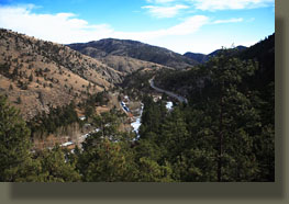
before. I started under a partly-cloudy sky from the trailhead, which sits
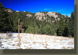
at around 5,700, at 10:45. There was an astonishing lack of snow
at the trailhead, and only marginal snow even up high. A strong Chinook
wind was drying things out. The well-marked trail lead through ponderosa
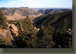
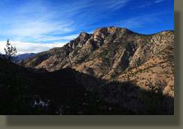
pine and Douglas fir on a north-face overlooking the Big Thompson for about
a mile, then turned south and the canyon was largely lost from view. In
this part of the Big Thompson, one can easily mistake himself as being
in the Poudre Canyon further north. There were some patches of ice on the
trail, and it made for some slips and slides, but overall it was pretty
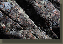
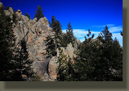
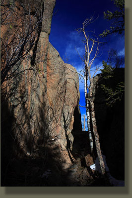
clear up to about 7,000 ft. Nice granite outcroppings lined many sections
of the trail, and theres a memorable section of trail that passes through
a slice in the granite, whether natural or manmade I cant tell. I made
it to the summit in about 2:15, and was a little disappointed at the almost
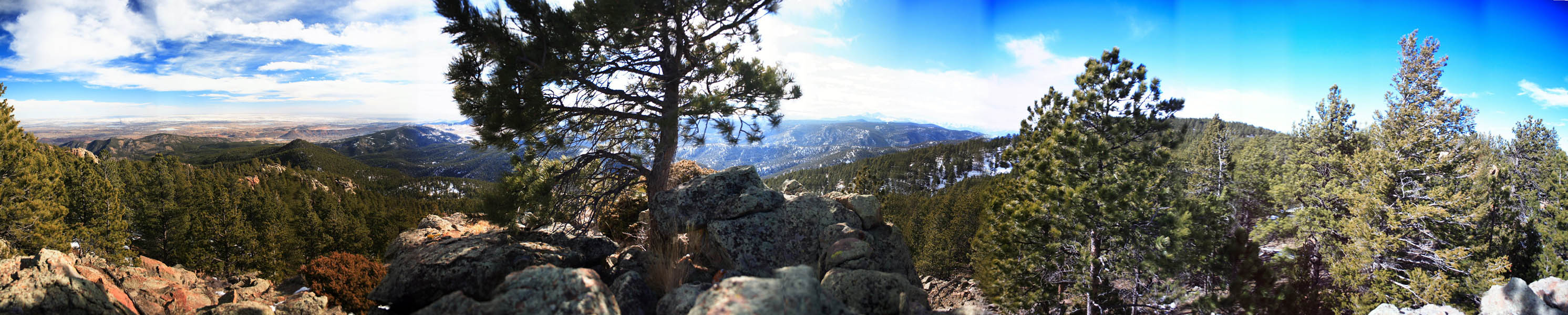
complete lack of view. Only a narrow strip of horizon to the west was visible
through the thick tree cover, allowing a glimpse of Longs, Meeker, Otis,
Hallet and maybe a couple of others. The wind was blowing like a banshee
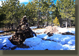
up there, even with the trees. A rock pyramid marked the true summit, complete
with summit log. I ate lunch a few dozen feet away with a few more trees
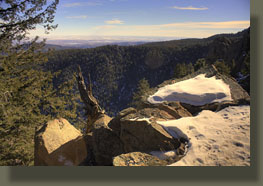
around me to block the wind, then trekked back down the trail. About 500
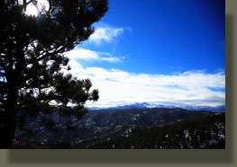
yards down, I turned northeast and hiked through the trail to a nice granite
knob that had a much better view than the summit. Sometimes you just have
to take matters into your own hands. Though the wind was ferocious, I enjoyed
the little side trip, from where I could see almost all of Loveland, everything
to the south and much of the Indian Peaks and Rocky Mt National Park. Though
I tried to drink plenty of water, the brisk hike, dry air and strong wind
conspired to dehydrate me, and I felt fairly crappy by the time I made
it back to the car at around 3:15, for a total hiking time of around 4.5
hours.
***
|
 |
;)
;)
;)
;)
;)
;)
;)
;)
;)
;)