
| Location: White
Mountains, 7.5 miles west of Lincoln, NH (19T 273099E, 4878485N)
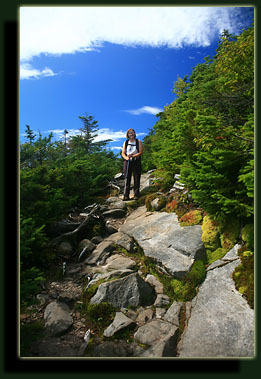
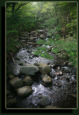
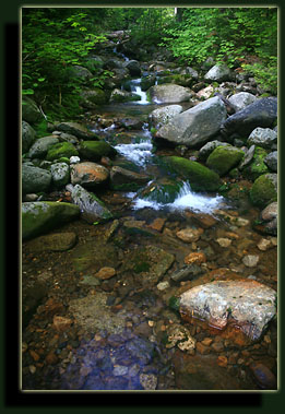
Access: From I-93, take exit 32 west on 112 , then west on 118 7.2 miles. Go north on Moosilauke Ravine Lodge Rd 1.6 miles and park along the road near the dead end. The trail is to the north of the road. Trail: From the Moosilauke Ravine Lodge: Gorge Brook Trail up (3.6 mi), Carriage Rd/Snapper Trail down (3.4 mi). Obviously steep, with a 2450' elevation gain, but never technical. AMC White Mountain Guide gives decent verbal directions. Map: 1:63K Trails Illustrated #740 Franconia Notch, Lincoln. Dogs: obedient dogs OK Fees: None Weather: Woodstock station Local Forecast August 14, 2006 Moosilauke reaches an elevation of 4,802ft, making it the 10th highest mountain in New Hampshire. It is #10 on the "four-thousand-footers" list, but still 1,486 ft lower than Mt Washington, which is the tallest peak in New England by over five hundred feet. I first heard about Mt Moosilauke in 1998, from Mom's neighbor, Bill. He described the trail as going straight up the mountain, absurdly steep, but with incredible views at the top. I was interested to go from then on, but it took almost 10 years to do so (I don't get to New Hampshire very often). While visiting New England in late summer 2006, Mom and I decided to attempt Moosilauke, and although she had already hiked it years before, I was very excited to finally get on top of a big New England mountain. So, early in the morning the day after I flew in from Colorado, the state with another high-mountain list that people like to talk about, we left Manchester under a warm bank of low-hanging clouds for the mountains. The drive took under 2 hours, and while it wasn't sunny out, it didn't feel like rain was threatening. Getting to the trailhead is a little tricky, since the final road to Moosilauke Ravine Lodge is not well marked, but we managed to make it there and found a parking spot on the side of the road near the lodge. We loaded packs and set off down the trail. At the very first branch in the trail, which occurs within 100 yards of the road, we had to doublecheck the map to make sure we didn't go the wrong way. The scale of my map was not helpful, so we read the trail directions on how to make it to Gorge Brook. For the record, you turn left. So, we hiked on down the trail and passed near the lodge before taking a north turn over the stream and began our long ascent up to the summit. Not long after the stream, we reached the junction with the Snapper Tr, and took a right turn to go up the Gorge Brook Tr. The green forest was still and quiet in the humid morning air, and faint flecks of filtered sunlight touched the worn path we strode on. The humming waters of Gorge Brook sluiced down the steep grade right next to the trail. The trail itself was steep, but well kept, with plenty of big rocks to stabilize the wet soil. I understand that the Dartmouth Outings Club takes care of all the trails, as the majority of the mountain rests on land owned by Dartmouth College. Mt Washington is the only other 4,000-foot peak that is not on US Forest Service land. We struck a lively conversation on the types of trees we were passing as we slogged up the slope, and I enjoyed being in such a lush forest. The value of keeping notes as a hike is progressing is in being able to report such things as all the trees growing along the trail. Months afterward, all I can recall is that there were plenty of maple, spruce and hemlock trees, all very large and healthy. After a mile or so, the trail leaves Gorge Brook, and a sign warns that you are about to leave the last reliable water source along this trail. We stopped here for a rest break, and had a snack. We still had plenty of water, so we didn't get any from the stream. Moving on up in elevation, the conifers became shorter and grew in higher density than down below. As luck would have it, the sun started poking out through clouds for ever-longer intervals, and it warmed up considerably.  When we neared the lodge again, we took a slighly different way back to the car and peaked inside the lodge, a rustic wooden building with large windows facing north to Moosilauke. Old photographs lined the walls, and I spent several minutes examining the building and people depicted in black and white under shiny frame glass. It seemed like a nice place to be. We left the lodge and walked 50 feet to the road, our car, and cruised towards home, stopping for a cone of fabulous ice cream in small town along the way. Links: Mt
Moosilauke History
|
  |
|
|
|
|
|
|
See more nature photography at Landscape Imagery Nature Photography. Page Created 11-9-06 Comments |