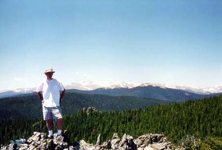
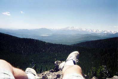
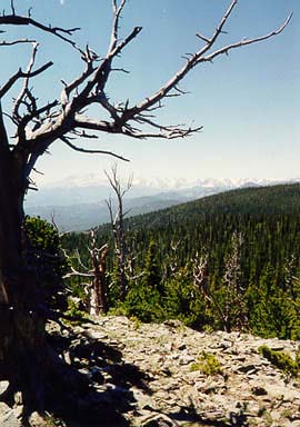
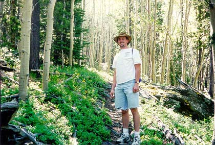
Lookout Mountain


Location: Roosevelt National Forest, north-central Colorado
Maps: USGS 7.5' Quad: Crystal Mt; Trails Illustrated 1:40K: Cache La Poudre/Big Thompson #101
Access: From Ted's Place on Hwy 287, take Hwy 14 west about 15 miles to a left on Stove Praire Rd. Go south for about 12 miles to Buckhorn Rd (marked as Pennock Pass). Follow Buckhorn west about 11 miles, then take Old Ballard Rd south for about 4 miles. The TH is on the left side of the road, parking on the right. This is a very tricky trailhead to find, so definitely bring a good map! Just remember, if you get to the Buckhorn Ranger Station, you've gone too far. When I last drove Buckhorn Rd in 2007, it almost looked like Ballard Rd was posted "No Trespassing", though I could have been looking at the wrong road. The turnoof for Ballard Rd is at NAD83 zone 13 461959e 4491285n. If you can't make it to the upper TH, you can also start from the Buckhorn Ranger Station (see West White Pine Mt), though the hike will, of course, be significantly longer.
Trailhead: NAD 83 zone 13 460102e 4489576n  Elev: 8990'
Fees: None
Trail: Trail begins across the road from the parking area and leads up to Lookout Mt in 3 miles and 1800 ft. 
Dog Regulations: Voice control
Webcam: Pingree Park 7 miles west (spring-fall only)
Weather: NOAA station data      Local Forecast


Lookout Mountain lies west of Fort Collins, high up along Buckthorn Road near Pingree Park.  From its summit, you can see Estes Park to the south, the Never Summer Range to the west, the Medicine Bow Mountains to the North, and Greyrock and Ft Collins to the west.  For all of these reasons it is aptly named. I have made five trips to the area, and made it to the summit three times.  The first trip was with Chuck in June of 1997.  We had very little trouble getting up there, and the weather was very nice.  The second trip was with Mark Ellsaesser in July of 1997.  We had planned on camping out near the trailhead in an aspen grove.  Before setting up camp, we rode our bikes up two miles of rocky logging road to the trailhead, then cruised back down at breakneck speeds.  Mark hit a bump, went airborn, and came down on his side, rolling.  Blood welled up on his body in profusion, and his bike was ruthlessly mangled.  His helmet cracked into two pieces and part of it was found several yards away.  The trip ended abruptly with me driving Mark back to Poudre Valley Hospital.  The third trip was made by Dave Burns and I in April of 1999.  The weather had been warm and snowless in Ft. Collins for weeks, so we were caught unprepared for the feet of snow which lay up near the mountain.  Without proper attire, we abandoned the trail after less than half an hour. The fourth trip was with Andra and Frank in July of 1999. We ran into very bad weather.  It got cold and wet and we spent almost no time at the summit because of it.  The fifth trip was with Dave Burns in October 1999, and was the last hike we took together before he moved to NY.  Frank went along. Once again, the weather wasn't too nice, but although it was cloudy, it did not precipitate.


The only good weather ever encountered at the summit, June 1997.
Continental Divide in the background. Sam in the foreground.


The view from my napping rock into Estes Park to the south.


Lots of dead pines on the mountain top. Lightning? Old age?


On the trail with Chuck Hostetler, June 1997. Look at those aspen!


Mark's bike accident on July 4th, 1997.


The trail to the summit is heavily wooded with aspen.


Dave and Frankie at the summit in October 1999.


Dave and I on Lookout Mountain, October 1999


Back to Hiking       NEXT

Page Created December 16, 1999
Last Updated January 2002
Comments