| Location:
Popo Agie Wildneress, Shoshone National Forest, Wind River Range, Wyoming
Trail: Not well marked, so you need a good map. Moderately strenuous, 8.7 miles, elevation gain 1700' Maps: USGS 7.5' quads: Cony Mt Fees: None Access: From Lander, take Sinks Canyon Rd west 13 miles to the end of pavement, where it becomes Louis Lake Road (FR 300). After 2 miles, turn right onto FR 302 towards the Fremont County Youth Camp. Go 4.5 miles to the end of FR302 and park. Trailhead: NAD83 z12 669401e 4729582n Elevation: 8850' Dogs: Leash control Webcam: 10 miles south at South Pass Weather: Current Conditions Local Forecast
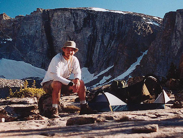
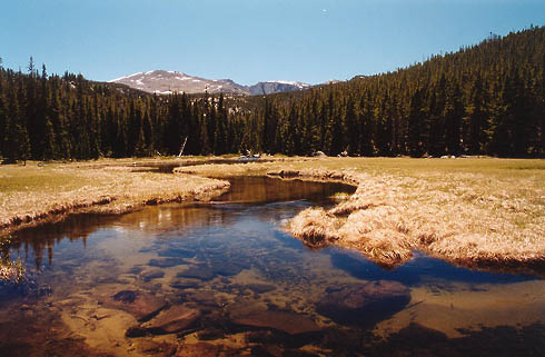
This was a great two night trip I took in June 2002. I started near the Little Popo Agie Canyon by Freak Mt and camped there late in the afternoon. I shared the area with an inquisitive moose who kept coming back, apparently thinking I would soon go away. The next day was very sunny and warm and I followed an old logging road until it petered out in the direction I needed to go, so I bushwhacked cross-country several miles to pick up another trail that did go where I needed to go. I didnít have my fly rod, but I sure saw a lot of nice trout in the streams I passed. The trail I had gotten on was faint at best, and it required constant attention to stay on track. Eventually, a couple miles short of my final destination, I did lose it, and simply went along in the most logical direction and tried to get my bearing whenever I came into a clearing or next to a lake. I hiked well into the afternoon and made it high up to the shore of Leg Lake by 6 or 7. I set up camp and explored the surrounding area, but didnít feel like eating a full dinner, so I settled for jerky instead.
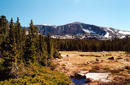
Leg Lake was truly impressive. Its massive granite cirque was imposing
on the far side of the water, stretching up in desert-varnished cliffs
at least 500 feet, maybe more. The water was perfectly still, quite unlike
the babble of all the streams or the wind-ripples on the lakes I had hiked
next to all day, and upon its surface I packed up camp without breakfast and began the long march to the truck. The way back went blazingly swift, and I picked up the trail almost exactly where I had lost it. The entire place was so nice and quiet, and I only passed one group along the way: three guys on horseback. I was so impressed that I endeavored to come back soon, but my return trip turned out to be a bust. You never know when youíll get one of those utterly fantastic trips, so you got to enjoy it while youíre there.
|
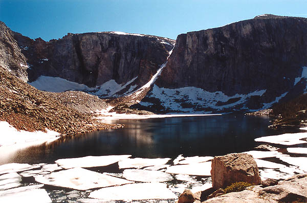
 floated
a myriad of angular ice sheets, gliding almost imperceptibly on unseen
currents. Honestly, the silence was eerie, and I did not take comfort in
being next to the cloudy, dark water at this lake, where the bottom was
hidden under groaning and bubbling sheets of ice. Instead, I stayed up
higher on the rocks above the shore and dodged the snowfields in my quest
to seek higher vantage points of the valley I had just traveled up with
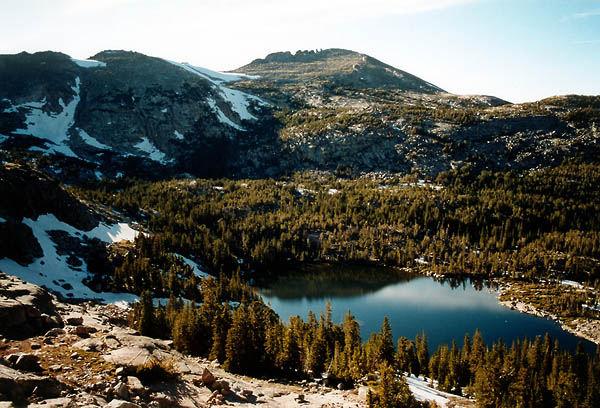
no trail. From the highest rocks, I could see seven lakes at once, and
vaguely pick out the way I had come based on the shapes of the lakes. I
waded in a shallow warm pool to ease the chafe on my feet and enjoyed the
perfect silence and solitude of the area. The lake is somewhere around
10K feet so the trees were matted and dense. Hanging food was out of the
question. I stashed it in a shrub a hundred yards from camp and hoped that
all bears and critters were down lower than I. I set up my tent on a flat
granite slab since every inch of soil was staked out by hopeful firs. I
slept without a rainfly to enjoy the stars, although I was so tired I never
woke up in the night to see them. I anticipated freezing temperatures that
night, but none came. At dawn, my thermometer read 40F. I was disappointed
to see the heavy clouds that had rolled in sometime in the night, blocking
my planned sunrise photo of the cirque walls. Owell, some other time.
