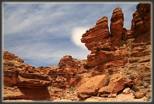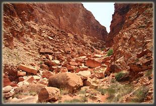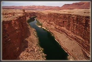
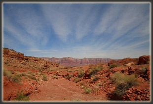
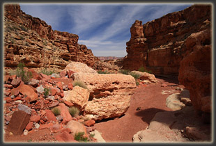
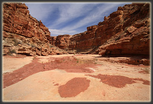
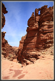
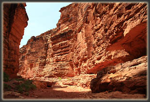
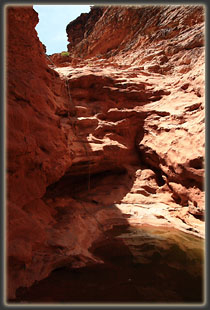
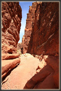
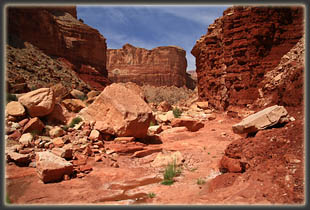
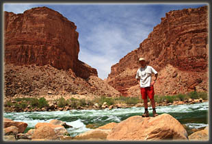
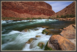
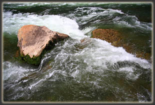
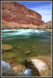
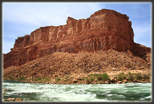
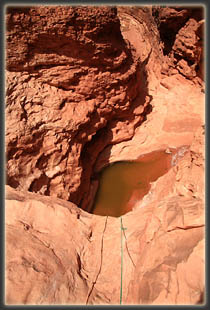
May 1, 2009 Friday Itís been 3 days since my upper back seized up while I was zipping up my sleeping bag at 2AM, and though itís gotten better each day, it still feels like Iíve got a fork stuck under my shoulder blade every time I take a deep breath. I am reminded that my twenties are over, and my body doesnít take days of hiking without signs of wear, anymore. I could change that, probably. I could work out at the gym every day, ride miles on my bike, jog every morning before dawn like some of my determined neighbors. I sometimes have bursts of enthusiasm and set a goal to do some such thing, but in the end, like most Americans, I fall into a routine of sitting at my desk job all week with short evening walks with the dogs and strenuous weekend outings that usually make me tired, but not sore. This time it caught up to me. I can hardly lift my arms to put on my backpack, but thereís no way Iím turning back on my first opportunity to hike in the great state of Arizona. Iíve parked my car along the side of Hwy 89A under a hot, almost smoggy-looking sky. Los Angles is only <400 miles> away or so, as the smog flies, so maybe it is indeed that peculiar man-made concoction of <what is smog?> afterall. Small, scrubby plants hug the ground that stretches out in shallow swells towards the cliffs to the east, as if they would get burned if they grew up any higher. A Navajo jewelry shack sits forlorn on the side of the road a mile up, I saw it when I turned the car around after going too far past the good access points for Jackass Canyon. Mostly there is just bare soil, stretching in all directions. I feel like my car is conspicuously out in the open, and fear leaving it alone along the side of a highway. There is no option, so I trudge off west towards Jackass Canyon, and glancing at my watch I see it is 15 after eleven oíclock. There are three main tributaries to Jackass Creek, and each one of those has half a dozen tributaries of their own. Thus, hiking west by way of any draw or gulley along a 2 mile stretch of Hwy 89A will lead one right into Jackass Canyon proper. My car is parked near a bridge, a good indication of a quick route to deep canyon, and after squeezing through a barbed wire fence, Iím on my way through a dusty wash, with rocks so dry they tinkle like glass under foot. There are no footprints from any animal in the wash. Isolation. Desolation. Just me, some cactus and a billion years of sand grains compressed into the rust-colored Hermit Shale that makes up the canyon walls, chipped, jagged and riddled with fissures and small holes that one can imagine are hiding tiny eyes watching you walk by. I like my sandstone canyons to be smooth, undulating, with respectable magnesium-oxide streaks gracing the walls, and perhaps some cottonwoods along the way. These canyon walls are nothing like that, and frankly, it makes me uneasy. The walls deepen as the creek bed drops towards the river, that desert oasis on the move, the Colorado. The canyon throws a few snakey twists before being joined by two tributaries, one on either side, both dry. If youíre looking at a USGS map, picture a lone hiker in red shorts, white tshirt and a wide brim hat trudging along that middle fork, into the maw of the sulfur-colored Cocconino sandstone canyon, down to the Colorado. The going has been easy and rapid so far. I let gravity pull me down with only minor resistance from my boots, descending layers of ancient rock like steps, hopping down sun-baked boulders and letting my mind wander. It is hot, and the sweat beads on my face only seconds before evaporating. I remind myself to drink lots of water. The easy-going stops at a 40-foot dropoff that makes my stomach lurch a little as I peer over the near-vertical fall into a stagnant pool of brown water sitting motionless below. Forewarned of this spot by multiple internet articles, I have had time to mentally prepare, and I waste little time in mental debate, and simply grab the fixed rope, face up-canyon, and walk backwards over the edge, leaning out. Thatís the hard thing, that leaning out bit. Iím no canyoneer, and steep dropoffs still make me queezy. I wonder vaguely how long this rope has been here, slowly degrading in the sunlight. Several steps down, and I find I can stand upright on a ledge, which forms the top of several stair-like strata that make useful stairs down to a wider ledge, which my feet slide sideways on until Iím onto a pitch I can handle without the rope. Three steps and Iím down at the waterís edge, looking up the cliff. Itís a nice rush of adrenaline. Only a fool would try it alone. I continue on down the canyon, in the shade for a few minutes, and sit for a drink. While resting, I start wondering if I remembered to lock the car door. Did I push that little button, or did I leave it unlocked so I could get in the back hatch without the key and forget to return to the driver door to lock up? I have my wallet, my camera and my keys, and the ďClubĒ is on the steering wheel, but the thing Iím most concerned about is my stack of memory cards holding all my vacation photographs from the last week, zipped into a little case in my red camera case. Perhaps itís the heat, but I suddenly become irrationally worried that someone will stop along that lonely stretch of highway, open my unlocked car door and simply grab the camera case and drive on. I am tempted to turn back immediately and make sure I locked the car door, but that seems overly obsessive-compulsive, so I resist the urge and decide to just hurry the hike along. Anyway Iím feeling pretty good right now, Karma-wise. From the dropoff down to the river, the canyon has collapsed. Dumptruck-sized boulders litter the canyon, and I pick my way down with great care, being sure not to fall or slip, and vaguely hoping that another dumptruck sized boulder high up on the canyon wall doesnít pick May 1, 2009 as the right time to join his compadres on the canyon floor. At one dropoff I find it is tall enough that I must lower my pack ahead of me by rope and then scramble down after it. Twice I have to leave the canyon floor and hike up the sides through rubble and loose boulders to get around drop-offs that canít be safely jumped. Itís very slow going, but also very enjoyable. The silence is broken only by the dull roar of the rapids in the river below, which I occasionally get a glimpse of as a gleaming strip of unlikely turquoise in the distance. Near the river, a brown park sign proclaims the boundary of Grand Canyon National Park, which I cross into for the first time in 24 years. I take a straight shot to the river, leaving the shallow dry creek bed. The smell of the river surprises me. Itís almost like standing at the ocean with the overpowering smell of brine. The water is very clear and cold, artifacts of the huge dam just a few miles upstream. Foam swirls on the surface and standing waves curl white water that slurgs and sliffles around the rocks of Badger Creek Rapids. Moss grows thick and velvety, neon-green, on the rocks. I leave my pack on the sandy beach, and hop some rocks out into the river to enjoy the cool spray of water and snap a few photos down Marble Canyon. I sit for several minutes and enjoy the view and the feeling of isolation. I belatedly examine my watch to estimate that I arrived around 12:40, making it a one-way trip of 85 minutes. Thoughts of the unlocked car and the desire to hike Soap Creek Canyon on yonder side of river break my reverie, and I slog through loose sand up-canyon, away from the cool, rushing waters of the river. Only yards from the shore, the desert takes over again, as barren and dry as if water were a hundred miles away. I slip into a nice rhythm of rock hopping, and make very good time upcanyon, following my own footsteps around dropoffs, and improvising new routes when the opportunity presents itself. I climb up the first drop-off packless and pull it up after me. Near the big drop-off with fixed ropes, a wave of minor nausea sweeps over me, and I recognize at once that Iíve been hiking too fast and without enough water. I find shade and force myself to rest for 5 minutes. That doesnít sound like long, but try sitting for a full 5 minutes while hiking sometime. It feels like a very long time when youíre anxious to be on the move. I make it up the big drop-off with the aid of the fixed ropes with no problem, and as the canyon becomes shallower, I run out of easy options to hike in the shade. I play a little game where I try to stay in the shade while continuing up-canyon, but it doesnít last long. Long streaks of hiking under the blazing sun are unavoidable. The heat is tangible; it radiates back at me from the rock underfoot. My feet are hot and sweaty in my boots, and my Achilles tendon on the right foot is aching. Onward and upward, I leave the rock walls of the canyon behind and near the highway via a shallow, sandy wash. The bridge I encounter seems different than the one I came down, and I have to get atop the road grade to see my car parked a quarter mile to the north. I hike on up to discover that, unsurprisingly, nobody has molested my car while I was away. Everything is fine. Karma is watching out for me. I open up the car at 2:20 to let a blast of heat escape while I sit on the bumper and remove my boots and socks and don my Tevas. I pull back onto the highway and note the temperature on the digital thermometer reads 99F. |
 |
