| Location:
Heqdquarters Trail, Medicine Bow National Forest, east of Laramie, Wyoming
Access: From Laramie, WY, take I-80 east to Exit 323 (Happy Jack Rd). Take Happy Jack Rd east for about 5 miles, then turn south onto the Blair-Wallis Rd (FR707). Follow Blair-Wallis (labeled as Headquarters Rd on some maps) for almost 2 miles to a right (west) turn that feeds into a dirt lot next to the TH. You can access the west side from a parking lot just south of the Lincoln Monument at the I-80 Happy Jack Rd Exit. The Tie City TH accesses the northwestern portion of the trail. Maps: USGS 1:24K: Sherman Mt West Trailhead: NAD83 z13 467658e 4563327n Elev: 8380' Trail: 3.6 miles one-way through lodgepole pine with a few meadows and aspen groves. Open forest beckons for off-trail exploration. The trail ends at the Lincoln Memorial on I-80. Begins at 8400 at the Blair-Wallis Rd and hits a maximum elevation of 8900. See my home-grown trail map here Fees: No fee if you park at Blair-Wallis (east access). Tie-City imposes a fee. I've never investigated fees at the Lincoln Monument TH. Dogs: Voice control Webcam: Vedauwoo Exit cam (5 miles south) Weather: Current conditions Local Forecast
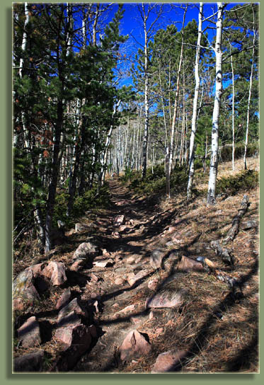
The first time I hiked the Headquarters Trail, I couldnt get together a mental map of how all the trails fit together. Even now, I have to keep track of which portion of the trail Im on. Experience has solidified the trail details in my head, but first-timers should definitely have a map on hand. Out of necessity for my own navigation, I put together a trail map. There is a network of ski trails near the Tie-City TH that I have never explored since it looks vast and extensive. Im convinced that once you go in, youll never come out. Since the Headquarters trail is the closest trail to home, we have hiked it quite a number of times. The entire area was once a military training ground, and signs at trailheads warn against touching any unexploded ordinance. Ive never seen any. From the eastern TH, the path starts out at a gentle uphill grade and goes past a spring that Makenzie always takes a dunk in. From there the trail leads uphill and takes a switchback through lodgepole pine towards an open ridge, crossing a rail fence via a metal gate, whereupon the trail splits and you can continue west via Browns Landing, or on the Headquarters Trail, which both meet up again a couple of miles west. Also from the ridge, you can bushwhack to the south and pick up the Crawford Point Trail which leads along the spine of the Sherman Mts to the south. The Headquarters Trail leads back into lodgepole pine and Douglas fir, heading downhill, until it hits the Summit Loop, an independent loop that intersects the HQ Trail and Browns Landing Trail, and thus serves as the chief confounding factor for navigation. Turn left and you can quickly reach the Browns Landing Trail, turn right and you can continue on the Headquarters Trail after a quick left turn, or continue on the Summit Loop, which eventually brings you back around to where you started. It was in this area that Mom and I came upon a lost jogger in October 2004. Her leg and lip were bleeding, she was wearing only shorts and a T-shirt, it was getting dark and she was lost. She was trying to find the Tie City TH, but was closer to the Blair-Wallis TH. Since we were heading back to the car, we offered her a ride, and ended up driving her to the other TH where she met up with her friend. The Summit Loop leads up to granite knobs that are always a nice place to take a lunch break, though the wind is often a nuisance. Mountain bikers really like this trail, and the Summit Loop seems to offer the most challenging terrain. Ive never ridden this one myself, but it looks like fun. The Headquarters Trail continues
for 0.4 miles to a junction of the Summit Loop with the Browns Landing
Trail. This is the intersection that had me confused for awhile. The main
Headquarters trail presses on for 1.5 miles through pleasant forest with
little elevation change, and passes by a spur trail that leads to a nice
open spot that overlooks Crow Creek valley and I-80 in the distance. The
trail ends (or begins?) at the Lincoln Monument, which marks the highest
point of the Old Lincoln Highway (now I-80). The Lincoln Monument sits
at the Happy Jack Exit off of I-80. On the way, the trail passes by an
offshoot to the Tie City TH. Since Im a well-known miser, I never park
at the Tie City TH because it costs money to do so.
|
;)
;)
;)
;)
;)
;)
;)
;)
;)
;) |
 Page created 1-31-08 / Updated 4-1-08
|
;)
;)
;)