

| Location:
Northeastern Oahu, near the town of Hau’ula
Maps: USGS 1:24K quad: Hau’ula Access: From Kailua, drive north on the Kamehameha Highway to the town of Hau’ula. Look for the Hau’ula Beach Park and park on the north end near a stone wall, across the street from the Hau’ula Congregational Church. Cross the street and walk up Hau’ula Homestead Rd, and veer right at the fork to continue up Ma’akua Rd. The houses peter out and the pavement ends. Cross a chain barrier, and continue on. The two loops trails are well marked, Hau’ula on the right (first) and Papali on the left (second). Trail: Easy 7-mile double loop through varied forest types, running along two ridgelines, and crossing two gulches Fees: None
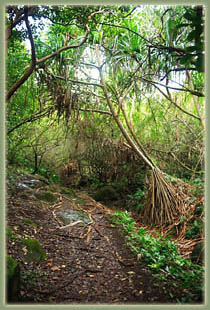
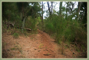
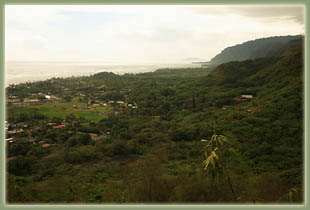
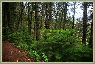
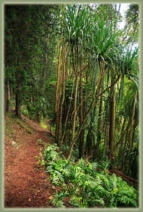
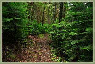
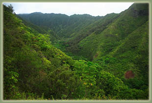
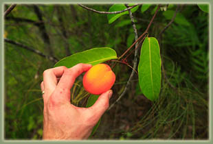
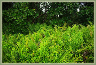
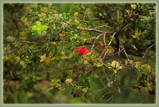
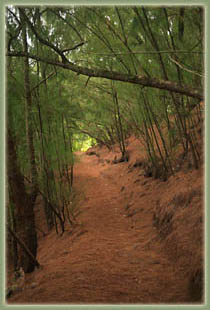
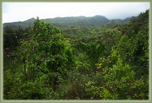
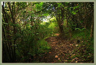
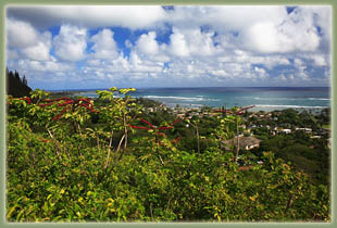
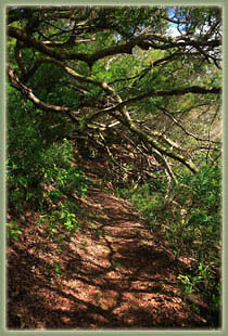
After a wet night in my hammock on Waimano Ridge, I caught a cup of coffee and a roll in Kane’ohe, then cruised up the Kamehameha Highway along the windward coast under mostly sunny skies. By a lucky accident, Alamo Rental Car was fresh out of economy cars when I arrived, so I got the midsize G6 upgrade for free. This meant sunroof, and nothing says vacation quite like a sunroof. Naturally, whenever it wasn’t raining, I positioned the sunroof wide open. The thing I noticed is that there was never a time along the windward coast when there wasn’t a rain shower visible somewhere to east. They just keep coming all the time, but none of them are very large. I passed in and out of several on my drive north, but always there was sunshine behind them. When I arrived at the town of Hau’ula and parked at the beach park, it was raining, so I read about Harry Potter’s role in the Order of the Phoenix and waited until it was past. Then I slapped on my boots and hauled my pack out of the trunk before setting off up the residential street to the trailhead. The neighborhood had thousands of power lines running overhead, all buzzing (from the rain? Just because?). It is a wonder that anyone can keep them all straight, and perhaps some of the locals take advantage of the apparent anarchy to score free cable. Stick it to the man. I passed by about 30 houses, and a couple of apparently inhabited shacks, before reaching the boundary with the state forest preserve. Crossing a chain barrier across the dirt road, I continued west through the forest until I came to the clearly-marked Hau’ula TH. I turned onto the trail and headed uphill through a mostly open and disturbed area, taking cuttings of interesting plants as I passed them, not knowing what most of them were, and feeling fairly confident that most would not allow themselves to be rooted in the cool climes of a Wyoming kitchen window sill. The trail crossed a stream with slick rocks, and I cut off a small rhizome portion of a large-leafed, red-stemmed ginger variety to grow at home. Shortly after, the steady incline lead through a deep carpet of ironwood needles, so deep that no other plants occupied the understory. The trail reached a junction made by the loop segment of the trail, and I turned right to take the trail counterclockwise. The next treat along the trail was a large grove of Cook Pines that took about 10 minutes to walk through. The stately trees were the largest I’ve seen on Oahu, and though introduced, were also among the prettiest. Widely spaced trees with thick trunks rose in ranks up the hillsides, reminding me very much of spruce trees back in Wyoming. I noted to myself that this was where I should have spent my night in the hammock since stringing a hammock between such trees would be much easier than attempting such a feat between small strawberry guava trees on Waimano Ridge! The trail continued on through varied plant communities the likes of which I’ve never learned, with varied forms and colors, until I came upon a wonderful stretch of trail that followed a ridgeline with a commanding view of Kaipapa’u Gulch to the west. Very beautiful and lush. At this point in the trail, I felt very removed from the bustle of the urban centers at Honolulu or even Kailua, and was very relaxed. I whipped out my cell phone and called Andra, but she didn’t answer. I left a detailed message describing my surroundings, and hung up. I noticed an orange fruit clinging to a vine nearby, and pulled it off. I cut a small hole in the fruit, and sucked a little of the juice out to taste it. Very sweet. I cut a little larger hole, enough to allow the slurry of seeds and gelatinous goo to come out. It was very sweet and pretty tasty. Nature is pretty straightforward with such things: poisonous plants always taste bitter and sweet plants are almost always edible (though, clearly, not all edible plants are sweet, see habenero pepper, see also brussel sprouts…"edible" in this respect is a very loosely-applied term.) A sweet fruit is saying, "Hey, I taste great, pick me! Spread my seeds far and wide with your feces!" Or, something to that general effect. You get the point. So, I picked another one to take home, and continued to nibble on the other. Later I found out these were passion fruit, and although I never felt any sort of passion, I did enjoy the flavor. The trail left the ridge and lead across a slick section in Waipilopilo Gulch, then through a dense section of lau’ae ferns, with their vinelike stems wrapping up and around small trees. I passed another grove of Ironwood, and even a lone coconut tree with coconuts high up in the crown. I daydreamed a little on my way down, and soon found myself back at the beginning of the loop. Someone had bent the aluminum directions sign in half while I had been hiking. I bent it back to freak them out when they returned from the loop. Back at the road, I turned west and continued uphill slightly to find the Papali-Ma’akua TH, which was no more than a 10 minute walk along the dirt road. The sun was out, and shadows from massive leaves gave more depth to the jungle. I turned left off the road and onto the trail. Not surprisingly, the trail was very similar to the one I had just left. I was still pretty jazzed about it all, however, and hiked briskly up the many switchbacks towards the ridgetop. The trail was covered with a thick layer of leaves, and everything was dripping wet from the recent shower. At the third or fourth switchback, a clearing with a bench offered a rest spot and a nice overlook of the town below and the turquoise water just beyond the white spit of sand. More switchbacks and I was up on top of Ma’akua Ridge, looking down across Ma’aku Gulch to the steep, jagged ridgelines beyond that typify the Ko’olau Range. When I reached the high point of the hike, a nice cool breeze greeted me, and I stopped to enjoy it for awhile. The trail left the ridge shortly after and followed an incredibly narrow bridge of rock that dropped off steeply on both sides for several dozen meters. The canopy was so lush I couldn’t really even tell where the slope ended. As I descended from the highpoint, the forest grew less dense, although at one point I had to bend down and do a sort of crabwalk to get under a very low-lying shrub that covered the trail. I dipped down into the bottom of Papali Gulch, then right back up the other side. In five minutes it went from sunny tropical paradise to monsoon, and I stopped under a particularly large tree for shelter. The upper leaves of the tree did a great job at soaking up and/or shedding water so that I stayed pretty dry. The rain stopped in less than 10 minutes, and I was back on my way to the beginning of the loop. Then it was down the switchbacks and back to the car. **** |
 |
 Page Created 1-20-08
|