North Fork
Big Thompson & Hagues Peak
September 2, 2011
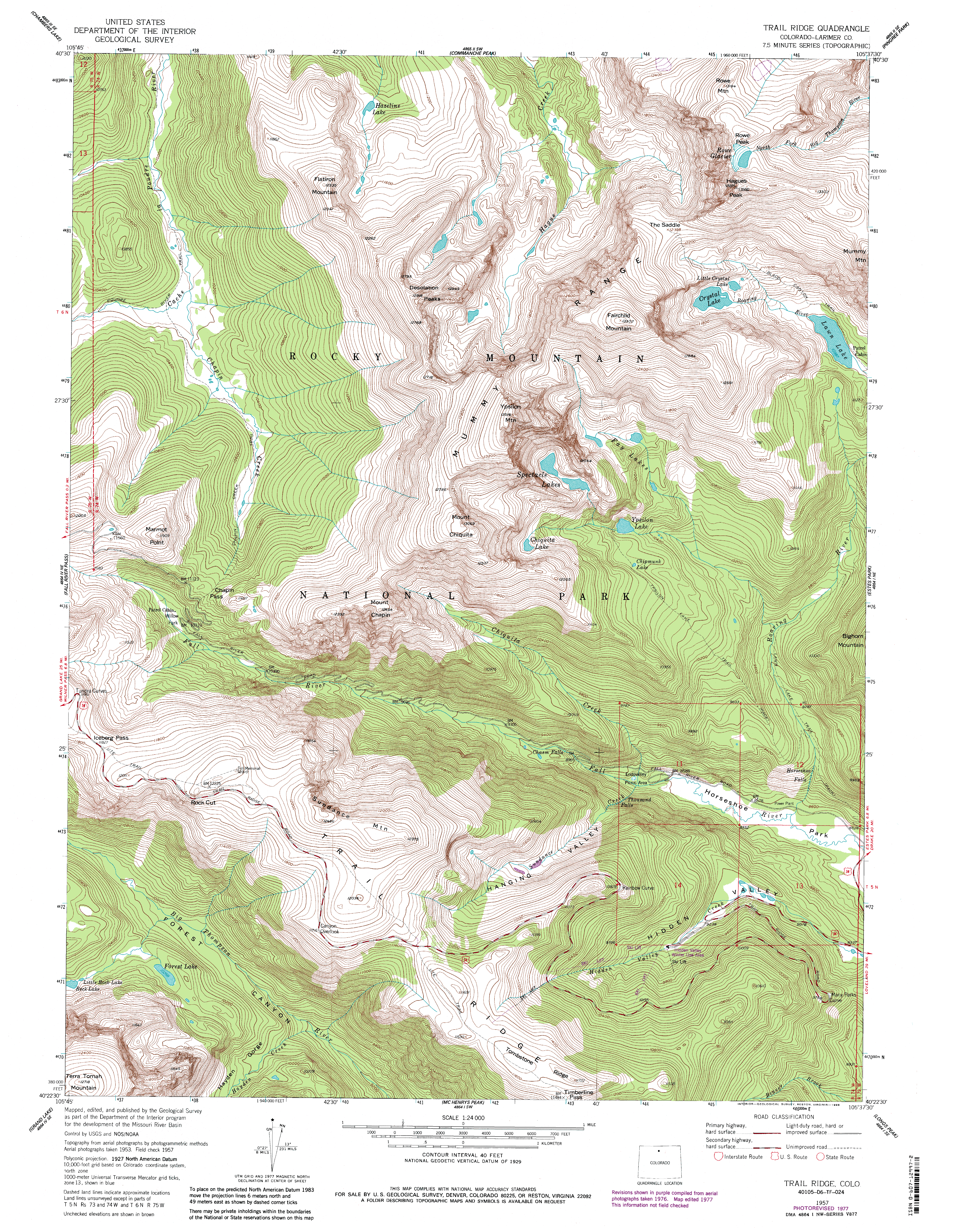
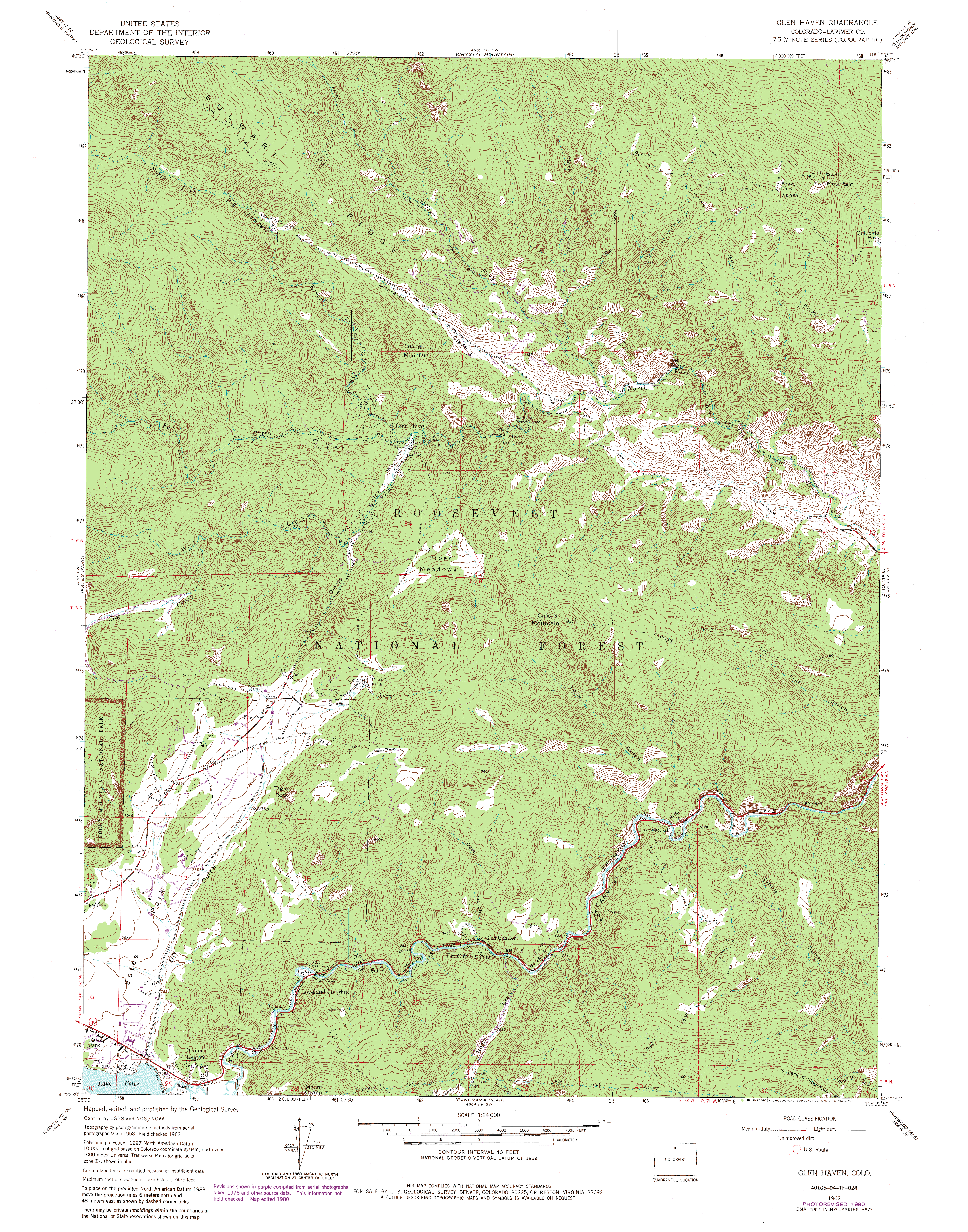
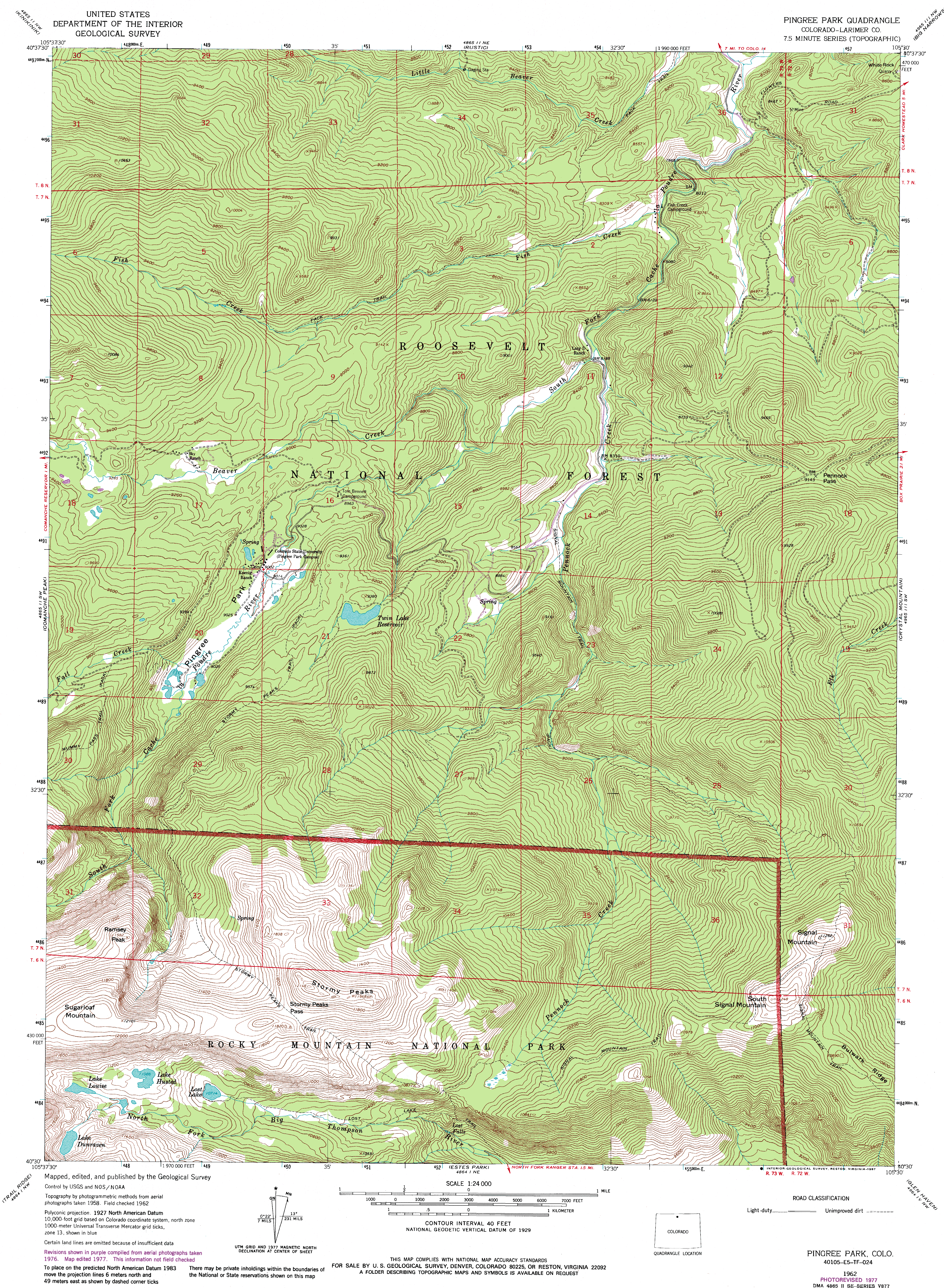
The trail heads immediately downhill through an open dry forest of Ponderosa, reaching the river after a 200 drop and heading upstream along the bank, crossing back and forth repeatedly as it alternates in and out of Douglas fir and ponderosa. The rustle of the river is lively and loud, and I pass a number of anglers doing their thing. Im saving my angling for higher up. After about a mile of walking, theres a dude ranch on the north bank of the river, but once that is behind me, its nothing but wilderness for the next 52 hours. In another mile the trail passes by an old cabin. In a little over an hour and a half I am at the park boundary, the trail heretofore passing through national forest. The boundary is a political boundary only, as the entire area is unbroken designated wilderness, Comanche Peak on the forest side, and Rocky Mountain NP Wilderness on the other. Its quiet and cool, but dark clouds have rolled in and its getting breezy. Its a bummer to get caught away from camp in the rain, so I quicken my pace to try to reach camp before the rain does. I pass by the North Boundary Trail at the 2-hour mark, and by 2:30 Im in Lost Falls camp, where both sites are empty and I have my pick. Both camps are in heavy timber, well-shaded, but with lots of dead trees that have been downed by the park service for safety reasons. I choose the camp further from the camp entrance, and set things up quickly in anticipation of the rain that comes soon after in a gentle, light shower with no lightening involved. It does cool things off a lot, though, and I pull out my sweater to keep warm. I filter water, eat a bit and nap for about an hour, my pleasant snooze interrupted by folks in camp 1 smashing wood for a campfire. No matter, its not good to nap too long anyway; makes it harder to sleep at night. I decide to take a walk and find Lost Falls. Armed with my topo map, I hike up the trail which gets pretty steep. I can hear the stream down in the gorge, but I cant see it through the trees. I hike up far enough that Im sure Im ahead of it, then plunge down through the forest, picking my way through downed trees and tangled shrubs to the water. The entire stream forms a continuous crash of water, and its not clear which cascade is Lost Falls. I mosey down the streambank a bit, but its very difficult terrain and I decide its not worth the effort or risk of slipping on the slick, mossy rocks along the bank of the creek. I retreat uphill. Its not clear if I found Lost Falls or not, but the side trip was enjoyable, nonetheless. By 6:00 Im back in camp, and I heated up some water for a nice bucket bath, followed by laundary. Feeling clean and warm, its time for dinner. I boil the Ramen, sprinkle on the delicious packet of MSG and wolf it down steaming hot. Then I enjoy a small Snickers bar (they call them fun size, but I find the bigger sizes more fun, myself), dried pineapple and a few crackers with cheese, all washed down with a cool bottle of Coke that I sunk in the creek upon arrival. The Coke could be colder, as the stream is not ice-cold, but itll do. In the woods, even a cool Coke is a tremendous luxury. By 7:00 the light fades.
Gone are the high-summer days of 9:00 sunsets. The air cools by the minute,
and I slip into my tent and get warm in my sleeping bag. I try for awhile
to sleep, but the long afternoon nap has confounded it, so I read my Stephen
King novel for a couple of hours before finally drifting off around 9:30.
September 3, 2011 4:30 AM, time to get up. I slip on my cold pants and shirt, pack some essentials by headlamp, and drift out of camp, silent as a ghost. By 5, Im on the trail, working up a nice rhythm, and warming up nicely. In the dark, I pass by the Stormy Peaks trail in about 20 minutes. The air is still and quiet, and the trees are dark and brooding in silver light of pre-dawn. Ice crusts the grass in the meadows near Lost Lake. By 6:15, Im at the lake, passing by the two campsites. One of them is empty, and Im disappointed because its the one I had originally wanted to occupy but had to settle for Lost Falls since these were full. Down to Lost Lake, and around the northern side. The lake is low, and I amble along exposed rocks on shore. The sky is glowing pale cyan. Rugged peaks at the head of the cirque begin to glow faint red and I consider setting up my tripod by this lake to capture the coming show, but the rim above Lost Lake is tall, and blocks off most of the cirque, so I decide to make a run for Husted Lake where the terrain is more open. I walk briskly through the marshy area on the north side of Lost Lake, then up the steep hill dotted with firs, startling a couplet of moose who go charging off to the north into the trees. I reach the crest of the rise above Lost Lake, panting for breath. Its 6:45, past sunrise, and the walls of the cirque are flaming orange in alpenglow as I rush to the highest point I can find on the east shore of Lake Husted: a pile of smooth granite that affords a perfect perch. I slip off my pack, pull out my tripod, slide out the legs and immediately begin clicking. Its a perfect morning and a perfect scene. The orange rock glows brilliant orange under a perfect, cleardrop sky. One of the shots will become my computer desktop background for the next 5 months. I snack on a Pop Tart, then head southwest towards Lake Dunraven, over a tawny plain that drops down into the very upper reaches of the North Fork Big Thompson. I pass by Lake Louise, and beyond that the valley tightens up and the stiff timberline krumholtz pulls at my legs and arms as I bull my way upstream along the thin rushing torrent of the river, one branch ripping a hole in my pants. After searching around, I finally find a passage through the thick tangle of subalpine fir and granite, and come out next to an enormous ice cave that straddles the cascading outflow from Lake Dunraven. I leap over the stream and walk into the snow cave, which is dripping water from its 7-foot roof and is so deep I can see no light from the other end. Lilies are popping up in the retreat of the snowfield, some glowing bright yellow, here only days before the first fall frosts. By 8:00 Im seated on a flattish rock looking down on Lake Dunraven, named for an eccentric Englishmen who once owned more than half of the current day Rocky Mountain Park as a private hunting reserve. His history is an interesting story unto itself, and there are many fascinating books about the history of land and people who lived in the park and how it came to be a national treasure. From Dunraven, I leave the water behind and head up the long slope towards the saddle between Mummy and Hagues Peaks, the tallest of the Mummy Range, a spine of mountains so large you can see it from my back porch in Cheyenne 70 miles away. A flock of ptarmigans scatters mildly as I pass through a boulderfield, but they are not accustomed to humans and have little fear. The saddle between Mummy and Hagues is all rock, and travel is slow as I pick my way across the spine of boulders. Luckily there is no wind, and the going isnt too tough, now that most of the elevation is below me. I attempted Hagues from the south side a few years back with Dave, but was unwilling to crawl up the steep, rocky slope to the summit, so its a sweet feeling to finally reach the top around 10:15. Hagues Peak is the highest point in the Mummy Range, the 4th highest peak in Rocky Mt National Park, and the highest peak in Larmier County, at 13,566. Its cool, but pleasant. The wind is calm, so Im able to loiter for a long while up top in comfort. A metal contraption with a solar panel sits near the summit, perhaps a weather station. I snap lots of photos, eat some snacks, then I retreat the way I came and hike on over to the Mummy summit (13, 425), which has a very dramatic southern drop to Lawn Lake below. Very scenic. From there I drop down to the plain to the north and sit on a gentle slope of grass for lunch. I pull my boots off and rest for a while. Being early in the day, I continue my exploration by topping Mt Dunraven, and then checking out the summit of unnamed Peak 12,305 beyond that around 2:30, both relatively easy peaks that nonetheless offer exciting perches above the North Fork Big Thompson watershed. Clouds are building, but they do not look threatening. I mosey on down the slope to the north, spying a bull elk who doesnt see me until Im absurdly close, whereupon he takes flight over the ridge and out of view. Further down, a bull moose with enormous antlers mingles with the willows. The park lives up to its name this afternoon. I head back towards Lake Dunraven, hoping to find a water bottle that I lost earlier in the day. I have a suspicion it bounced out of my pack when I leaped across the outflow stream (Ive lost bottles that way before), and sure enough, right on the shore, I find it, still cold in the shade. The walk back to Lake Husted is beautiful in the afternoon light, though my head is pounding from too little water at this elevation. I assemble my pole at Lake Husted and haul in a couple of brook trout before packing it up and heading down. The camp at Lost Lake is still empty. Back in camp around 5:15,
I take another hot bucket bath, though it is much cooler tonight. The chill
prompts me to gather firewood and after dinner of Ramen and crackers, I
build a nice cheery fire, reading my book by headlamp near the warm glow
of the firepit. By 9:30, I hit the sack.
September 4, 2011 Im up early in the morning with cold feet, but I lay in bed and read until the sun is peaking through the pines. Around 7:30 I get up, heat some water for coffee and enjoy a PopTart before packing camp. The sun is clear and yellow, casting that amber glow that hints at fall. On the trail by 8:45, I stop often to fish, keeping my rod handy. The river runs adjacent to the trail for long stretches, so its easy to pop out and take a few casts. I caught 5 brookies on a grasshopper imitation, and to my astonishment, I dont lose any flies in the thick tangle of willows along the river. A good day. I stop near the park boundary for lunch of crackers and cheese, and spend an hour reading by the edge of the river, enjoying the sparkling reflections jump up from the tossing water. Nearer to the trailhead, foot traffic picks up considerably, as you might expect on a beautiful summer day. By 3:15 Im back at the car, changing shoes and getting ready to head back to civilization. ;)
Peak 12, 305' ;)
Upper North Fork Big Thompson ;)
Morning coffee ;)
North Fork Big Thompson River ;)
Aspen daisy ;)
Warm sun on morning trail ;)
Mt Dickinson from the North Fork trail ;)
North Fork Big Thompson Trail ;)
One of the beautiful brook trout in the river |
;)
Sign to Lost Falls Camp ;)
North Fork Big Thompson River
|
;)
;)
;)
;)
;)
;)
;)
;)
;)
;)
;)
;)
;)
;)
;)
;)
;)
;)
;)
;)
;)
;)
