

| Location:
Black Canyon of the Gunnison National Park, Colorado
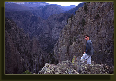
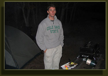
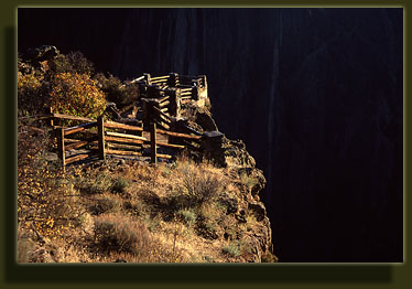
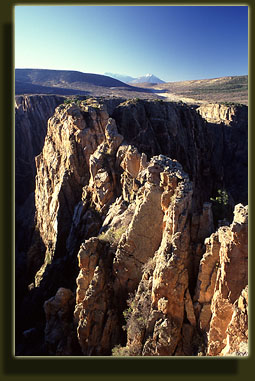
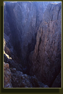
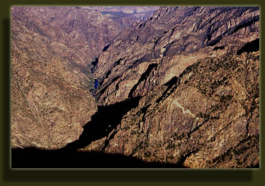
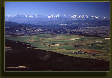
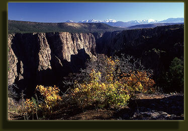
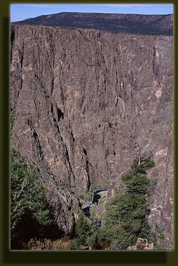
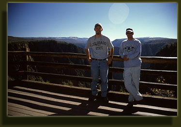
Maps: Park Service Map; USGS 7.5' quads: Cimarron, Cerro Summit, Cathedral Peak, Grizzly Ridge, Red Rock Canyon, Black Ridge Dogs: (From NPS Site:) "...pets on leash may be walked on roads, in campgrounds, to the overlooks, and are allowed on the Rim Rock Trail, Cedar Point Nature Trail, and North Rim Chasm View Nature Trail. Pets are not allowed on any other hiking trails, inner canyon routes or in the wilderness area." Fees: $15 7-day vehicle pass; $12-18/night campsite Weather: Current Conditions Local Forecast October 5, 2005 I picked Dave up at his parentsí house in Colorado Springs at around 11AM. We drove west into the foothills under sunny skies, and enjoyed an unusually warm October day en route. We stopped in Canon City and had a quick lunch at Subway, then cruised west on highway 50 through Salida. High clouds built as we traveled further west, but certainly nothing to get nervous about. It had snowed recently on Monarch Pass, so there were a few tense moments driving on the icy roads, but I had put the snow tires on the Saturn already, so we had that going for us. The drive to the entrance to Black Canyon of the Gunnison National Park (BCGNP) took longer than expected at about 5 hours, some of the delay due to the icy roads. Incidentally, I feel that tacking on "of the Gunnison" to the parkís name was a mistake. Black Canyon National Park sounds so much better to my way of thinking. We arrived late afternoon and I suppose because of the time of day we found no way to pay an entrance fee, though upon leaving we noted the guard shack was manned. We had no trouble whatsoever choosing a campsite at the South Rim Campground since every single campsite in both loops A and B were open. Loop B is apparently intended for RVs and campers, so we passed that one right by. We found ourselves a nice pull-in near the back of loop C, paid our $5, and set up the tent and unrolled the sleeping bags among the rusty-red Gambel oaks. It was chilly out at this higher altitude (8300 ft) and we were quickly donning jackets to keep out the cold. It was October, after all. The West Elk Mountains were dusted with snow on the horizon and glowed in the afternoon sunlight. We decided to go on a short hike before dinner, and started at the Rim Rock TH near the campground. This trail closely follows the canyon rim as it snakes its way north towards the Visitor Center about a mile away. It was very quiet on the trail and we encountered no other hikers out and about. Short oaks lined the trail, but did not obstruct the view in any direction. Looking down the deep crevices that plunge into the 2000 ft canyon can make you a little dizzy. Far below, the Gunnison River rushed between the rocky walls, sending up a faint whisper on the still air. I had always thought that the name "Black Canyon" referred to the dark-colored rocks that composed its walls. Dave suggested that perhaps the name referred to the fact the sun rarely had a chance to shine down into the canyon because of the steepness of its walls. I think that latter explanation is more appropriate. The air was calm and cool, but we soon warmed up from walking. Fall colors were very nice, but I sensed we had just missed the big show by a week or two, as many of the trees had already dropped their leaves. The trail snaked through open grassland, sagebrush and thickets of Gambel oak and followed a fairly flat grade. It intersected Tomichi Point, where we saw the first sign of other visitors, then carried on to the Visitor Center. The Visitor Center looked fairly new, and this may be due to increased funding owing to the recent status change of BCGNP from a National Monument to a National Park. We walked around the west side of the Visitor Center where a deck looked out over a short trail upon a pinnacle of rock on the canyon rim. We strolled down the path and out on this edge of rock out over the canyon. This point afforded a fantastic view down into the canyon, and allowed a considerable distance of its length to be seen to the northwest at once. We considered also tackling the Oak Flat Trail, a 2-mile loop that starts near the Visitor Center, but determined that it would be better to get back to camp and prepare dinner before it grew too dark. Thus, we hopped on the Uplands Trail, which is essentially a part of a loop leading back to the Campground, and within 30 minutes we were back at camp, getting ready for dinner. From camp, the main park road was only 30-40 meters away, which seems to be a strange design if you ask me (and if youíre reading this, you essentially are). Though not bustling at this time of year, the moderate amount of traffic was noticeable at such a close distance. I suppose, however, that if the campground is full, the bustling sounds of families camping would make the traffic noise seem less pronounced. Dave had brought along his brotherís propane hibachi and we quickly had the thing lit with burgers sizzling on top. While they cooked, we enjoyed the sight of the evening sunlight on the snow-capped mountains to the east, lighting up with a deep maroon. The air grew cool very quickly and I was soon wearing all my warm clothes in an effort to stave off the chill. We ate the burgers as it was getting quite dark, and I spent some time attempting to ignite the Coleman gas lantern that Iíve kept unused in the garage for about 6 years. It was a little rusty, and I finally acceded to Daveís offer to assist in the lighting of the thing. It seemed to have a plugged gas line, as the air hissed through, but it didnít seem to bring much gas with it. After 3 or 4 match-lighting attempts with Dave holding the match and me working the regulator, the pitch of the gas feed changed dramatically, as if I were filling a cup of water under a tap. Dave was lighting a new match when I heard this, and as he brought the match forward I said, "Watch this one." As soon as I said that, Dave brought the match close enough to ignite the gaseous pool of white gas in the lantern, and a fireball exploded outward and across the table for 10 inches or so. As soon as it had appeared, it was gone, with apparently no damage done. We both laughed at my belated warning. After downing the burgers, we played several hands of gin by the lanternlight as the stars came out overhead, accompanied by a very bright moon, nearly full. At what seemed like a late hour we went to bed, yet it was only 8:30. Camping in the late fall always throws one off, timewise. The next morning we awoke at around 7:30 as it grew light out. A heavy frost had covered everything in a thick white coat resembling snow. The morning was cold and clear. We hopped in the car and drove north on the South Rim road, stopping at almost every lookout point along the way: Pulpit Rock Overlook, Rock Point, Devilís Lookout, Cedar Point, Sunset View. Most of these lookout points required only a short walk of 100 yards to get right out on the canyon rim. Several had railings that cordoned off the 2000-ft drop beyond. At the terminus of the road, we parked the car and began hiking the 1.75-mile Warner Point Nature Trail. As near as I can tell, a Nature Trail designation implies that the route will be short, nearly level, and dotted with numbered pilons denoting something significant. Often there is a brochure involved. The morning warmed rapidly, and soon we were in shortsleeves under the bright sun. Warner Point commands a nice view of the canyon, especially to the west into the Gunnison Gorge Wilderness. We stopped here for several minutes to check out the lay of the land and take photos of ourselves. We followed the route back to the car, and started driving back towards camp at around 10 oíclock. Back near our food, we cooked up powdered eggs and cheese burritos, which donít sound like great fare, but actually tasted quite good. A quick pack-job followed and we left the park at 12:00, headed for Utah. |
 |

| Images from this and other
locations are available as prints for sale at Landscape
Imagery Nature Photography.
Page Created 11-10-06 Updated 12-15-08 Comments |