![]()
|
Location: Rocky
Maps: USGS Access: The most direct access is from the Lumpy Ridge Trailhead. From the intersection of Hwys 34, 36 and 7 in Estes Park, head north on East Wonderview Ave (Hwy 34) past the Stanley Hotel 0.4 miles, then head north on McGregor Ave (Devils Gulch Rd) 1.6 miles and watch for a brown sign for the Lumpy Ridge Trailhead. Turn north on the signed road and follow it several hundred yards to the parking lot.
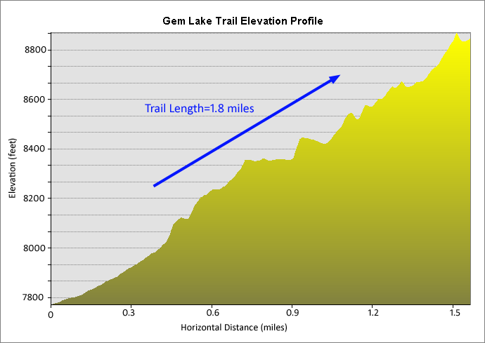
Trail: 1.8 miles
and 1,016’elevation gain (7809-8825’) to Dogs: No pets allowed on National Park trails Fees: There is no Park Service fee station at this trailhead
Webcam: 1.5 miles
south in Weather: Snow Conditions Local Forecast
I’m sure Makenzie sensed that we were going hiking without her, stuck in her kennel at the vet’s recuperating from knee surgery. I hated to be hiking without her, and I’m not looking forward to the 8 weeks of low-activity rehab on the calendar. But, the summer should be much nicer with her knee in working condition, and so Andra, Christine and I set out to enjoy the day without dogs, and this made it a good opportunity to take a hike in Rocky Mountain National Park, given that they don’t allow dogs on trails. My
map of the park is close to 10 years old, and this made it difficult to
find the trailhead we were after since the Park Service has changed
things around quite a bit around here, probably owing to the private
property access that all trails in this area require. After finding the
trailhead, we got out of the car and began dressing for the hike. I had
thought it would be a cool day, but it had already warmed up to 47
degrees by We
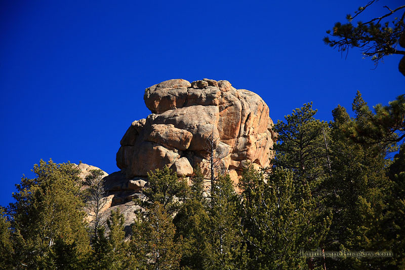
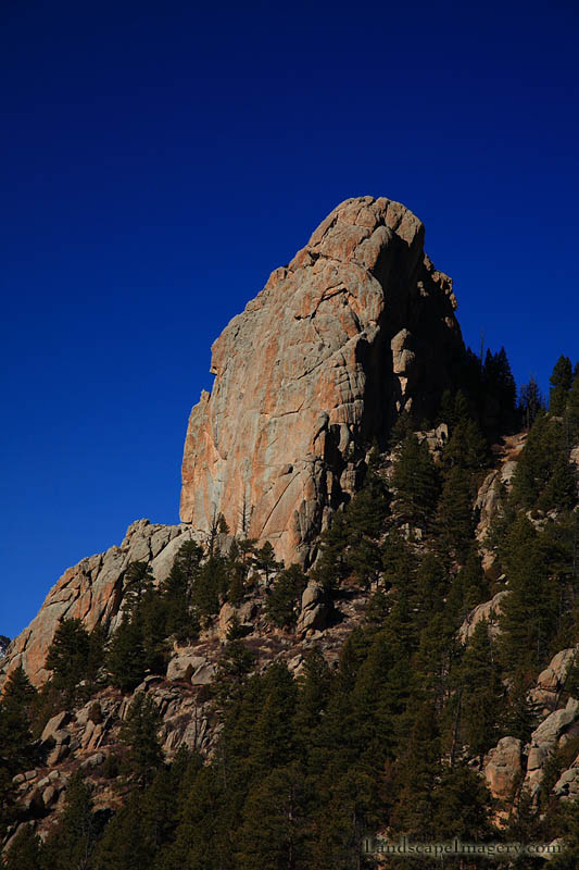
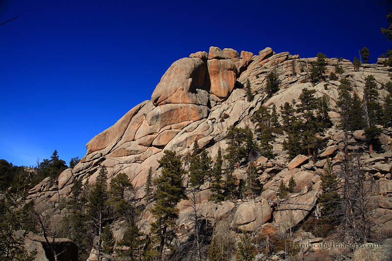
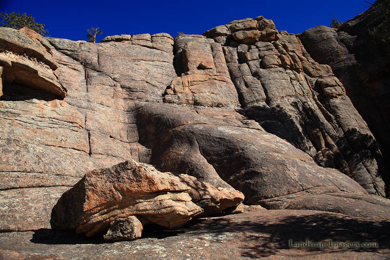
started up the wide gravelly trail through a wonderful assortment of
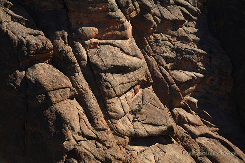
granite domes and spikes. The geology of this portion of the park,
situated on the extreme eastern edge, is much different than anywhere
else in the park, and we enjoyed it. Thick orange ponderosa pine trunks
dotted the rockscape, providing shade on the trail, but it was not
enough to soothe the heat, and I soon had to escape into the hidden
shadows well off the trail to escape my long johns which had conspired
to create oven-like conditions down there. I shed off my sweatshirt, and
when I returned to the trail to catch up with Andra and Christine, I
felt much better. We reached the Lumpy Ridge x We
took a short side trip to a group of rocks that provided excellent views
to We
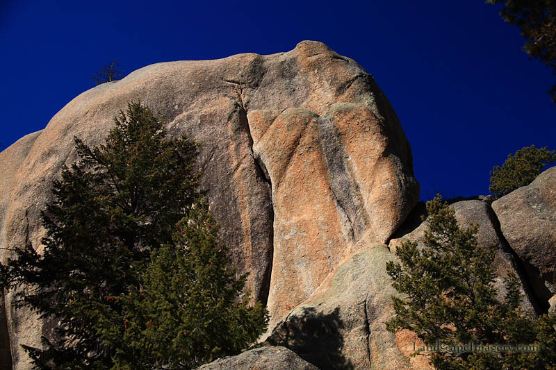
reached and passed what Stein called Paul Bunyan’s Boot, a granite
formation resembling a big boot with a hole through the toe. I guess I
can I see it, but I would never have independently come to the boot
resemblance. A short stretch of trail beyond that was shaded by the
rocks was particularly icy, but luckily it was short and we passed right
over it without trouble. We hit a nice rhythm up the gravelly trail
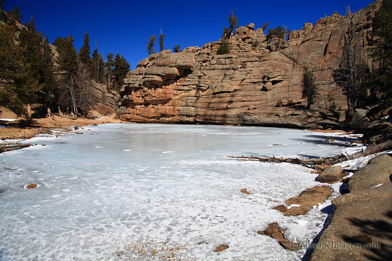
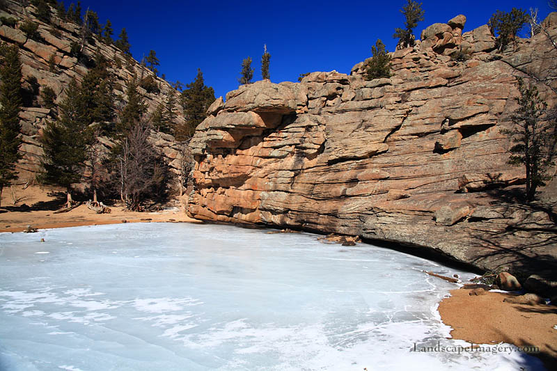
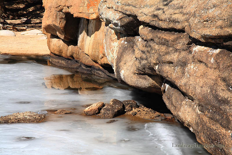
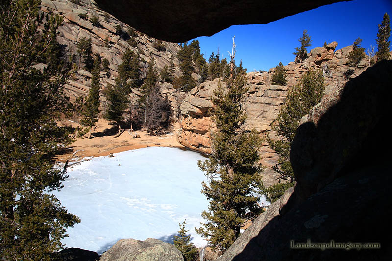
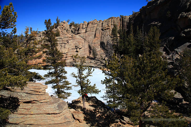
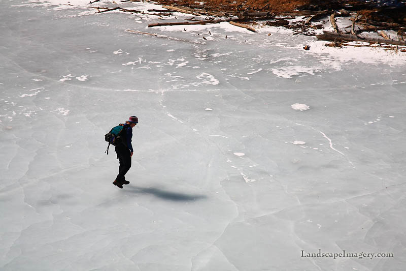
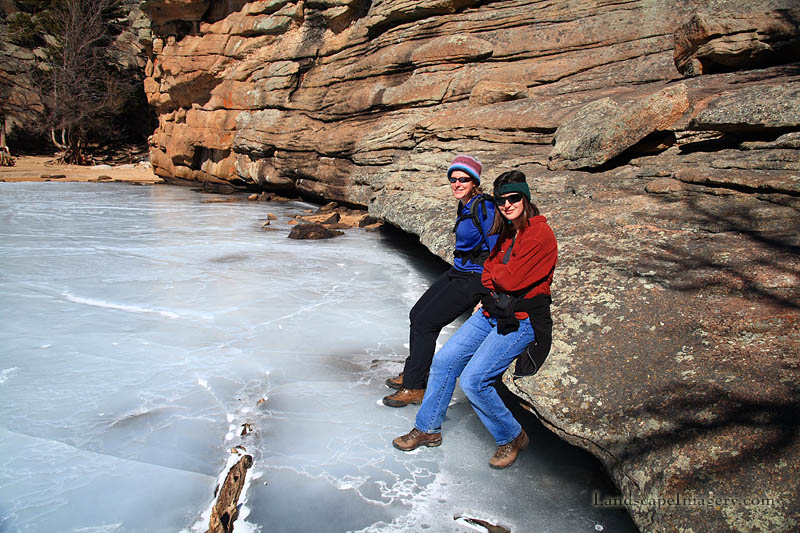
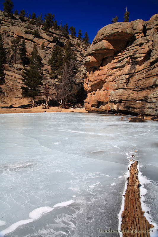
beyond, and before long at all we were at the final run up to Smaller than I had expected, Gem Lake sits in a depression between two swells of orange granite that can almost fool you into thinking you’re at Canyonlands (but not quite). A sparse population of ponderosa pines surrounds the lake, while the understory is largely absent owing to the dominant rock substrate. The water was frozen over to a thickness allowing safe passage across the surface to anywhere but the extreme north end of the lake where the ice was thin and small areas of open water glimmered next to the rocks. We walked out across the ice. Air bubbles deep within gave perspective on how thick it was, but we still heard occasional lurches and booms from the water below as the ice warmed up on top and cracked, sending ominous echoes down through the deeps. I
shimmied up some rocks to the north to photograph the lake, and then we
all scooted up rocks to the south to see it from that angle too. The day
was so nice that I would have liked to continue on past
|
              |

|

