Saturday, April 9, 2005
On the road. 8AM. Dogs left staring forlornly
out the front window of the Myrna and Jeffís east-Denver suburbia house
towards the last spot they saw the bumper of our green í99 Saturn cruising
up the street. No dogs on this trip. Barely 5 miles away, we stop for a
breakfast burrito of eggs, potato and green chilis (too few green chilis)
at a roadside cart beyond the incorporation of civic taxes. Capitalism
blooming on the side of the newly-widened county road. In 2 years, this
will all be housing.
The weather is generally good; clear skies,
a few puffy white clouds, 65F and calm. For the first 3 hour of driving
west on I-70 it remains so, albeit cooler. Our first pit stop is in Eagle,
at a small information bureau outpost on the banks of the Colorado, its
current already swollen with the muddy froth of the spring melt. Driving
on, Andra and I discuss politics Ė a safe subject since we rarely
disagree. Very little chance of offending. The skies darken near Dotsero,
and the music begins. Andra naps. A stiff south wind kicks up just before
we pull off in the Grand Junction for Petrol. Gasoline. $2.21/gallon now
and climbing. Back on the road we pass Fruita, Colorado National Monument,
Rabbit Valley, the Utah border, and several ďRanch ExitsĒ before rolling
into Green River. We determine that the Tamarisk Inn looks decent enough
for lunch, despite the odd pinkish sign out front, and settle in a corner
booth by a picture window with a grand view of the wide Green River, lumbering
along with barely a riffle around exposed mudflats and dormant willows.
On the bank below, the few specimen trees that are this restaurantís namesake
have been hacked down to stumps, the dead branches piled in disorderly
bunches. Spring cleaning in Green River. I order clam chowder (Green River
clams?). Andra opts for the surprisingly large Eagle Canyon chicken sandwich.
We are in good spirits, and laugh at everything. The full euphoria of the
road trip is upon us, despite the clouds. The food arrives, and is surprisingly
good. One doesnít wisely hold out hope for delicious food in a town with
only 4 restaurants. The key to never being disappointed is never having
high expectations, a wise man once said. The bread was especially satisfying.
Back outside, in the wind, I pilot our
car 300 ft to the John Wesley Powell Memorial Museum and Information Center
where we score a free Utah road map. Andra drives. Back on I-70, the post-lunch
lethargy grips us, and despite the music, eyelids droop. Rain comes and
goes in tidy, 4-minute showers, only once actually wetting the back window.
Colossal gusts of winds threaten to bump us right off the highway. The
rain showers become snow showers as we top out at higher elevations near
Salt Wash, and visibility drops. We opt to pull out at a scenic overlook
and nap. Thirty minutes later, the sun peeks out enough to wake me up,
and I trade places with the groggy Andra and drive on.
Very shortly, Hwy 27 looms ahead, we exit
and head south in a light, steady snow. Acres of aspen line the road, with
small spruce challengers mixed in every once in awhile. The blacktop is
wet, but white on hilltops where the snow hasnít melted. We pass a deer
herd so large it takes 20 seconds to pass at 50 mph. The road enters and
leaves Fremont, Loma, Bicknell: all forgotten-looking farming-ranching
towns, largely composed of muddy feed-lots, feed stores and a spattering
of ranch houses. Torrey sits at the crossroads of Hwy 24 and 12, and we
stop for a snack and gasoline at the Shell station. Andra pilots us on
over Boulder Mt, where all is blanketed in a glimmering shell of snow,
4-5í deep on the high passes and ridges. Only once does the car slip, luckily.
This drive is beautiful, although far from spring-like. We descend into
the small town of Boulder and pass through in minutes. Five minutes out
of town, we turn west on a dirt road that advertises the glamorous attraction
of Hellís Backbone. Ever noticed how pioneers loved to name things after
Hell? Iíll bet thereís some geographic feature with Hell in its name in
every county in America. In a light snow, we cruise down the shiny graded
road to a pullout and quickly conoiter a campsite 100í north of the road,
just out of site beyond thick juniper and pinyon. Taking only the essentials,
we hastily pitch the tent and climb inside while tiny, hard chips of snow
drop from above. It is cold, but the sleeping bag is warm. After reading
for only a few moments, I shut off my tiny flashlight. Andra reads on in
the dark long past my falling off to sleep. I guess her book must be better.
Sunday, April 10
My eyes perceive light, and I open them
to the blinding flow of sunlight on the tent fabric. Check the watch: 8AM.
Check Andra: Buried in sleeping bag up to the scalp, brown hair streaming
out. I let my eyes adjust, and watch the shapes of the frozen water droplets
on the bright tent fabric. So tiredÖ..I wake up again. The frozen water
droplets have vanished. Check Andra: Awake and reading. Check watch: 9:30.
After a few moments we speak, and I get dressed. Outside the sky is sunny,
and the air cool. We pack up camp and have breakfast of yogurt and granola
in the car. My hair has reached new heights of chaos during the night,
and we share a laugh over it before I cover it with a CSU ball cap. On
the road, I drive us towards Escalante, enjoying the immense rock canyons
we are passing by, and noting with approval the absence, for the most part,
of any type of guardrail between the pavement and precipitous drops into
certain-death. Freedom in all things is best.
The drive into the small town of Escalante,
Utah passes quickly, but beautifully (like a good lifetime), and we stop
in the BLM Visitor center, essentially a mobile home, at the far west end
of town. After brief instructions and advice, I am back in the car waking
Andra up from her short nap. The sky clouds up, and the wind gusts more
frequently. Most of Escalante appears lifeless, closed-down for the sabbath.
We stop at the only open gas station for flashlight-batteries, a notebook,
and chocolate; only the essentials. On the road again, heading east, we
hit the Hole In The Rock Road and continue southeast on this historic route
pioneered by hardy and arguably slightly-insane pioneers (Even if they
were level-headed when they set out, they most certainly were not when
they finished their trip 2 years later). Our goal is a specific side-road
that is rumored to harbor excellent camping sites. At mile marker 10, I
notice the mileposts donít match my odometer, which was reset at the junction
with Hwy 12. This makes finding our specific road challenging, and we never
do. Perhaps some diabolical college prank is at work here, like the time
I followed neighborhood Garage Sale signs that led me in a complete circle.
Since most roads are not marked on our map, we end up on a 2-track that
presents a decent campsite 50í off the route. Thus, at 4:00, we make camp.
Andra naps while I read, predictably, The Monkey Wrench Gang, and walk
around our kingdom-for-the-night. Cows bawl in the distance, and a brave
black-tailed jackrabbit lopes amongst the junipers, keeping an eye on me.
Well, Iím keeping my eye on him, too. Shifty jackrabbits. At 5:30 we organize
the contents of the car, which have become a jumble of clutter. The sun
comes out, but the wind is up still. It is chilly, perhaps 60F with an
additional wind-chill. I get a thumb-cramp penning this narrative while
seated in my folding chair outside the tent. Since the end of college and
those never-ending essay-exams, my thumb muscle has grown soft on the plush
PC-keyboard life that requires writing only when signing credit card slips
or Birthday cards. At 6:40 we eat more of those delicious nitrate-packed
hot dogs in a chilling-wind, despite the golden sunshine streaming down
on us. By 7:30 we are back in the tent, warming up and ready to go to sleep.
Only 4 hours in the desert, and already Zen is upon us.
Monday, April 11
I awake to welcome sunshine beating on
the corner of the tent. 8AM. What a great time of day. Without peaking
out of the tent flap, that little spot of sunshine on the tent fabric alerts
you to the wonderful, beautiful morning awaiting you, and the possibility
of a day that will live in your memory for years, suddenly popping back
into your consciousness on some weary, bleary, snowy day in January while
youíre pinned to your computer doing meaningless drivel for a paycheck.
That little spot of sunshine alerts you to the possibility of infinite
pleasure awaiting, just outside that tent flap. I dress quickly, anxious
to get out under the sky, and go outside into a clear, chilly and slightly-windy
morning. The sky is a cool, deep blue. I read The Monkey Wrench Gang and
silently will Hayduke towards even more clever and diabolical methods of
disabling a DC-9 while Andra snoozes quietly in the tent. At 9, she awakens
and we break camp. We polish off the quart of yogurt and granola, zip our
packs and drive east, away from a curious cow that made its way closer
to us during breakfast and by the time we left was only 20 feet away.
In 20 minutes we are at Big Hollow Wash,
which currently presents an insurmountable barrier to 2WD vehicular traffic
in the form of a deep and muddy crossing. We park near 3 other cars (all
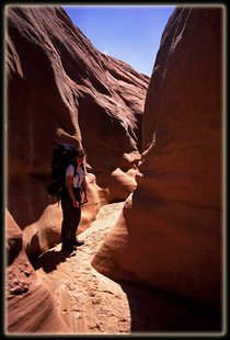
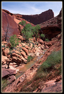
2WD) and shoulder our overnight packs. Big Hollow Wash is wide, sandy and
dry on this day. Probably that way on most days. The footprints of 2 humans
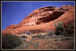
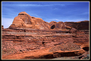
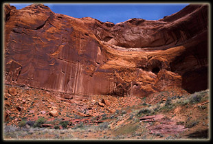
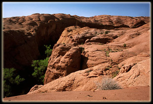
are clearly visible in the soft sand. Pink sandstone lines the wash in
sculpted walls 3 to 20 feet high. Shallow benches break the rock walls
occasionally with a bed of blackbrush and bunchgrass. Some passages are
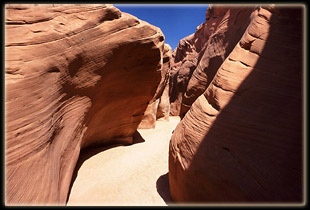
narrow and winding, with wonderful vertical walls only 6 feet apart. In
1.5 hours, we reach Red Well Junction. I leave Andra and packs in the shade
of a small side canyon to go obtain a permit at the trailhead, as instructed
by the burly ranger at the Escalante visitor center, which I accomplish
despite the register being almost a mile away. I pass opposite a group
of 6 elderly day-hikers along the way. Back with Andra in the wash, regretting
the delay, we continue downstream, snacking lightly on apple chips we dried
at home. After 45 more minutes of hiking through increasingly-thick vegetation,
we stop for a PBJ sandwich, and split a Clif bar. The dining venue is lush,
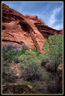
with an abundance of cottonwood. In fact, the cottonwoods are so thick,
neither side of the canyon is visible. On the north side of the canyon
water has pooled and sits still and murky. Coyote willows line the watercourse.
The creek, formerly dry, has become a good-sized run, 3 inches deep and
4 feet wide. We reapply sunscreen, enjoying that wonderful scent that is
synonymous with fun. The sun shines down unimpeded on our walk in the park.
Andra mentions her throat is sore, and hopes it is not a cold coming on.
Just after we start out again, we reach
the junction with Coyote Gulch, where we will spend the next 4 days. The
water increases in volume, fed by numerous side creeks and unseen springs.
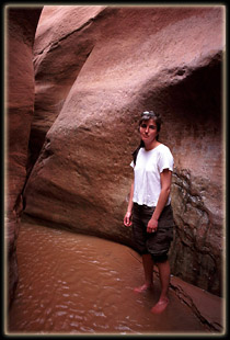
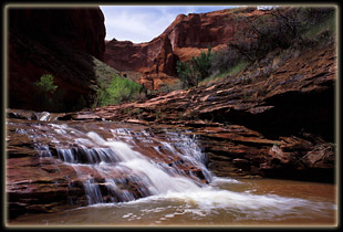
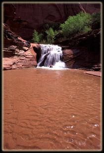
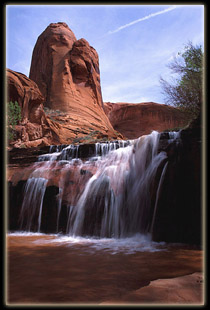
About 30 minutes after lunch, we reach a waterfall and take off our shoes
to wade in the cool water and soft sand. To reach the lower part of the
fall requires wading upstream in 3 inches of water through a short and
narrow slot. Because the slot is short, we do it twice, then sit in the
sun on the sand and listen to the rumble of turbulent water. Feet dry,
boots on and back on the trail.
About an hour and a half later, we stop
and pitch camp on an exposed and sunny ridge near the confluence of 2 major
drainages, the one coming in from the north being unnamed. We fill our
collapsable pail with water from Coyote to settle the silt, but immediately
after that I find that the unnamed creek has very clear water relative
to Coyote that requires no settling, so we filtered water directly from
that creek. I hike around the area. We share a Clif bar and make dinner
of burritos. Delicious! Somewhere along the hike today I have ripped a
tear in the seat of my pants. Andra assists me in sewing up the rip with
spare thread from the first aid kit. We wash up with almond castille soap,
very refreshing, and take a short walk in the twilight of the canyon over
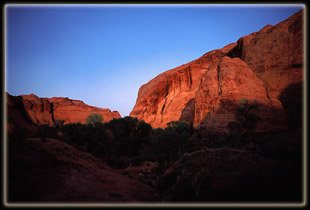
barren sandstone. Darkness follows the lengthy canyon sunset, which is
warm and still and quiet.
Tuesday, April 12
The sun is on the tent at 8, but since
I am sore, I ignore it and cover my head with the soft down sleeping bag.
What rouses both Andra and I are the nearby caws of a raven and the flapping
of wings so close it sounds like said raven is absconding with choice camp
gear. Since having dogfood stolen from the tent vestibule four years ago,
I am wary of any noise close to the tent. Of course this raven was not
really close. In reality he was snacking on the hindquarters of a rabbit
about twenty feet from the tent. The circle of life, in action. We eat
oatmeal for breakfast with the juicy red pulp of a rabbit body nearby,
and pack up camp after finishing. We filter water and mix Gatorade, and
are on the trail by 10. The day is perfect: clear, warm and sunny. Typical
southern Utah; by far better than the recirculated and filtered air of
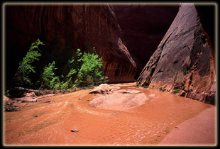
the office. The flow of water in Coyote Gulch is swollen, and no longer
simple to cross. Every traverse requires strategy and risk of wet socks.
We realize, somewhere in the back of our heads, that eventually we will
just have to get wet, but we wish to defer that moment as long as possible.
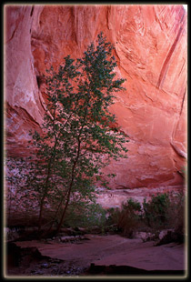
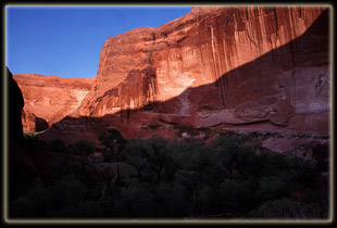
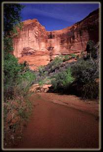
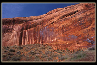
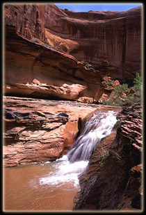
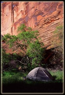
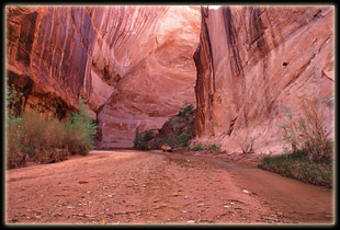
The canyon walls grow higher with each bend, and some of the overhangs
cover the creek so completely we feel like we are walking indoors. Birds,
mostly unseen, chatter in the abundant cottonwoods and boxelders. Our packs
scrape against the coyote willows that grow in short thickets at creekside.
The air is still. Andra has several run-ins with quicksand, one causing
her sock to get wet in the stream. We sip on Gatorade during the hike and
find it delicious in the heat.
At noon, we stop for PBJs, and a rest.
Several times it sounds like people are approaching through the dried scrub
oak leaves, but nobody appears. We can hear the occasional human voice,
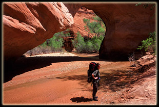
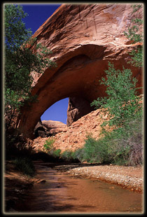
but see no one. Beyond our sunny lunch stop by only 200 yards is Jacob
Hamblin Arch. Very large. We get a view from the east, then hike around
the fin and back up the creek for a westerly view, before continuing in
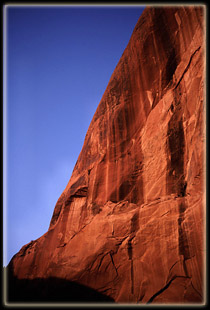
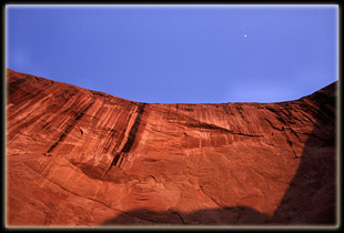
the deep orange canyon. In the quiet of the shade cast by the immense walls,
everything is cast in a reddish light, so that white shirts appear light
orange, and skin looks darkly tanned. We pass a tent, seemingly-empty,
then a solo female hiker, friendly. An hour or less passes with more steady
plodding. My right ankle tendon begins to throb, and I imagine the deep
sand and awkward foot angles of the day before. Andra reluctantly admits
her throat is no better today, and in fact getting worse. Seems like a
cold is imminent.
I consult the map, and am glad to see the
fin holding Coyote Bridge approaching. We wave to an old man and a couple
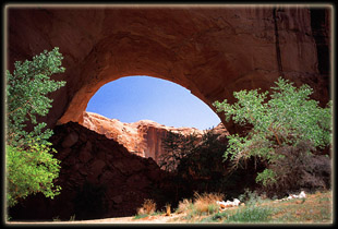
seated by a short waterfall. Then Coyote Bridge is in front of us. It is
a small irregular passage through a thin sandstone fin. The creek flows
happily through it. We follow. Why is it so entertaining to walk through
a natural bridge? Less than a mile later, we stop for camp, very tired
after 4 hours of hiking. We choose an elevated grassy bench, well away
from the trail and hidden by willows and oak, to pitch the tent. First,
Andra naps in the sun on the Thremarest while I explore the area and find
clear water in a side-channel. Back in camp, the flies are abundant, but
do not often bite. We pitch the tent, then mosey on down to water where
I wash my face, arms and clothes in the collapsible bucket while Andra
wades in the sunny, shallow stream. Our camp is in shadow early, yet it
is warm. We plan our day hike for the following day, filter water, cook
burritos for dinner and take a short walk to a high point where we can
look down on the canyon vegetation in both directions before the rock walls
bend out of view. As twilight sets in, the flies magically disappear, but
mosquitoes come to fill the void. I volunteer a few microliters of blood
before moving into the tent. Andra reads her Robert Jordan book, and I
enjoy Abbey.
Wednesday, April 13
Andra and I wake up around the same moment
at 7:45. We dress in the cool, damp morning air and eat breakfast of egg
and cheese burritos. It is my first experience with powdered eggs and the
event goes well. At 9 we are on the trail, heading downstream. Several
water crossings later, Andra feels the effects of her cold, and decides
to return to camp. At 10, we split, and I continue downstream.
The day quickly turns warm. The sky is
unbroken blue. Iíve worn my sneakers today and walk right through the ankle-deep
water at all crossings. This speeds the trip immensely, though the sneakers
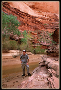
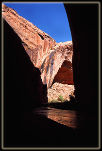
are not as comfortable as my boots. I come upon Cliff Arch, a very handsome
arch in a particularly deep part of the canyon with sheer rock walls. Shortly
beyond, I explore and photograph a very dark alcove with elaborate hanging
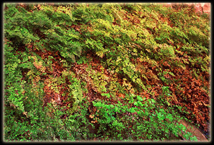
gardens. Maidenhair fern cascades from the tilted ceiling, and I envy the
lushness of the fern garden that Iíve never been able to recreate at home.
My potted maidenhair ferns seem to recognize that my sun room is not where
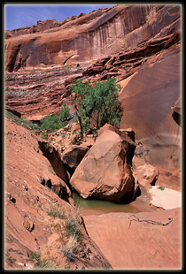
they should be. The canyon walls grow deeper as I press on to a waterfall,
and a stretch shortly after which proves tricky to negotiate. At first
I notice on the right bank there is a way to slide down a sandstone cliff
to the creekbed, and perhaps a way to climb back up the cliff using small
notches carved in the rock. I debate this for several moments before deciding
that I didnít want to risk not being able to get back up. I back upstream
around the head of the falls, and find a more reassuring route on the left
bank. It takes all four limbs to lower myself down a steeply-banked log.
The process would be very difficult if I were not in decent shape. This
is the fun part of this hike, though, having a bit of a challenge, a bit
of a scramble, and some route-finding requirements. I stop after descending
the log and finish off my 1st quart of Gatorade. Two more quarts of water
are in my CamelBack. I snap lots of photos, and keep my tripod handy as
I move on downstream. I imagine that I grinned without thinking at the
amazing tapestry of rock and flower all around me. Deep green pools appear
regularly, tempting me to bust a backstroke and relieve the heat that soaks
my skin. Near the river, I take to walking long stretches in the water
since it both feels good and is easier than the willow jungles on the banks.
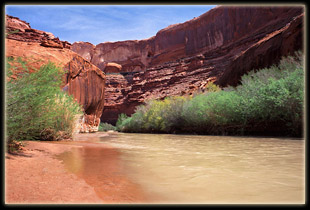
Before I know it, I am at the Escalante, a cold, milky current that looks
like it would be fun to raft, though I know it is often too shallow to
do so. I look upstream, but cannot see Stevenís Arch.
After a few moments of lingering in the
current of Escalante, enjoying the complete solitude, I start back. From
camp near Coyote Bridge it took 2h 10m to reach the river, stopping frequently
for photos. On the walls near the confluence, I can see the familiar high-water
mark of the Lake Powell. Now the lake is far down the Escalante, in fact
it is at its lowest point in almost 40 years, revealing much that has been
flooded since they filled Lake Powell. On the way back I take a sidetrail
and hike uphill for a view of Stevens Arch. This trail also seems to lead
to an alternative escape from the canyon. I stop and chat with two old
men who describe it to me. I feel mildy cheated that anyone can take such
an easy way in, but I donít see many people around, so apparently not many
people do.
I take more photos on my way back. I pass
a spring gushing from the rock of the canyon wall and fill my canteen.
Sacred Datura grows in the moist soil below. Walking back, I slog though
the water almost constantly, letting it splash my legs and hands. I arrive
in camp at 2:30, the trip back taking 2h 20 min, but including a side trip
up to see Stevens Arch. Back in camp Andra is snoozing in the shaded, but
hot, tent. Clearly, she is not well. The flies swarm around the tent, which
explains why she is in the tent rather than outside in the cooler air.
I make us PBJs for lunch, filter water and get in the tent. I read Ed Abbeyís
Monkey Wrench Gang while Andra naps off her cold. The tent is hot, but
the biting flies are worse. I entertain ideas of moving camp, but with
Andra sick, decided that is not a good idea. We laze around camp, in tent
and out Ďtil dinner at 6:45. The sky gets slightly cloudy. For dinner we
again have burritos, polishing off the beans and tortillas. At dark I set
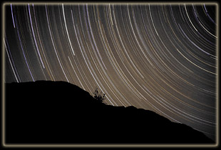
up for a starry sky exposure and initiate it around 9PM with the moon still
illuminating the far side of the canyon. Thus ends one of the most peaceful
and enjoyable days of my life.
Thursday, April 14
My watch alarm beeps in the darkness of
4AM. I lean outside the tent flap and release the shutter cable. The night
is warm and quiet. Andra and I step out of the tent into the warm night
Ė the warmest so far- and survey the view of the galaxy that is presented
above through the moonless night. So many stars to admire, so little time.
After sequential side trips to the bushes, we hop back in the tent and
sleep the wee hours of the morning away.
Later, the sun rises and wakes us up at
8:30. Breakfast is only a Clif bar each, to save time, and we are packed
and on the trail by 9:15. The hike back on this day is perfect. We go slowly,
pausing to enjoy these wonderful places neither of us may see again. We
stop on both sides of Coyote Bridge for photos, both sides of Hamblin Arch
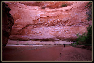
for food, and the magnificent 60 meter overhang between those two sides.
On the west side of the arch we sit in the warm sun and have PBJs. The
sunís shadow cruises across the ground at an almost noticeable pace, covering
about 20 feet in the 15 minutes we are stopped. The high canyon walls magnify
the sunís movements, acting as a sort of lever that propels the shadow
along. Iíve read that there is an established route of escape from the
canyon right around here, but I would hate to have to try to get up any
of these walls to the bench above. Very steep, and Iím not very brave.
Near the confluence with Hurricane Wash
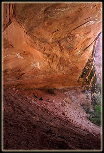
we stop at an alcove located on the north bank between Hurricane and an
unnamed side creek. This place is wonderful. The curve of the canyon has
created an air and water current that has carved out a giant hole in the
rock in the shape of a wedge: a classic alcove 60í deep, 100í wide and
50í tall. Inside, 3 levels of soft sand provide us with the perfect napping
spot. Andra unrolls her thermarest and I lean against my pack for a snooze,
blissfully free of flies. We loiter for an hour in the cool shade, watching
the gentle shimmer of cottonwood leaves in the wash outside. If I ever
return, Iíll camp near here.
Reluctantly, we shoulder packs and continue
upstream through the willows and shallow current. Near the site of Mondayís
camp, we stop just outside of the shadow of an overhang for camp. Andra
reads and dozes, still not feeling energetic. I move off to filter water,
and find a deep pool near the confluence with Coyote where I sit in the
warm sun on a grassy bank and employ all my arm strength in pumping the
filter that has become clogged with fine sediment. I pump slowly, out of
necessity, and watch tiny fish glide along just inches below the surface.
I swing by camp and drop off the water, then I find access to the slickrock
jungle above the rim and stroll around, sweating. It is 5 PM, and though
the sun is low, the air is very warm. The afternoon air is still and quiet,
with a sense of waiting for evening. Even the bugs are silent.
After a satisfying walk, I return to camp.
Andra is awake and reading, but still feeling pretty miserable. I leave
again, this time to explore the side canyon from which we got our clear
drinking water days before. Though choked with vegetation, I plow into
the canyon, and use a downed Fremont cottonwood as a bridge over the deep
stream to the east side, where there is more room to maneuver. I bushwhack
through a trackless jungle of brome grass, mountain mahogany and Gambel
oak for ¼ mile, cross back to the west side and climb up to an oak-covered
bench that provides difficult access to a sandstone ledge, 75í above the
water. I follow this wide and downward-sloping ledge (about 50í wide) for
another ¼ mile. Free of vegetation, I can finally see the architecture
of the canyon. A dry fork enters nearby but access is denied courtesy of
a 20í dryfall. The main canyon, continuously choked with vegetation, continues
out of sight around a bend. I follow the ledge around a gentle corner where
it abruptly falls off to the canyon floor. I see no footprints, and leave
none until I get back to the canyon floor where it canít be helped. As
in coming, my exit from this side-canyon of a side-canyon of a side-canyon
of Glen Canyon is marked by brutal scratches on legs and arms from unyielding
shrub limbs. Shouldíve worn pants, or perhaps Kevlar. Despite that, the
trip is a success. I can rest assured I wonít daydream about what the canyon
was like that I didnít explore, as Iíve done for others. This one lies
safely out of the way and canít haunt me with an opportunity lost.
Back in camp after an hour of strenuous
hiking, I find that Andra has pitched the tent on a hill 20í above us and
even unrolled air mattresses and bags. We quickly commence with dinner,
the time being about 7 and the sun getting low. We prepare an official
backpacking dinner pouch (rare for us) of vegetable pasta parmesan. It
is quite tasty. I supplement this with beef jerky and M&Ms. After dinner
we take a short walk, post-sunset, to admire the canyon curves from above
in the calm twilight. The moon is bright as we zip up the tent for bed.
I set up my camera just outside the tent flap, pointing north, to trigger
a long exposure, but hold off because of the bright moon. I set my alarm
for 10 oíclock and wake up long enough to trigger the exposure on the camera
outside. The night is warm, and I sleep the best night of the trip.
Friday, April 15
5AM. The sound of Andra moving in the tent
rouses me, and I roll over to find her with the tent flap open, staring
at the stars up in the sky. She steps out into the warm night and I follow,
barefoot in the soft sand. We stand for a moment admiring one of the least-obstructed
star-views in the continental US, then go our separate ways for a quick
potty break before piling back into the tent. I release the shutter hold
on my camera as I lay back down. Asleep instantly.
7AM. I awake to the dim glow of daylight.
Outside, the sun is only just touching the tips of the highest sandstone
domes to the east. The sight of sun on sandstone exhilarates me, and I
immediately lose all drowsiness and head out, buttoning my shirt as my
boots hit the sandstone. Andra rouses only long enough to squint at me
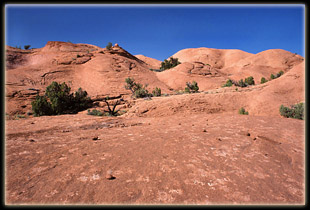
and hear me say, ďIíll be back in an hourĒ. I head upwards over the rock,
never once leaving a footprint in the islands of sand and cryptobiotic
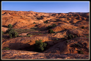
crust. This is always an entertaining goal to strive for. I roam across
the petrified dunes, composing photographs and admiring the desert flora:
Claret cup cactus with blood red blooms, yellow fleabane, evening primrose
in brilliant white, along with the non-blooming juniper, gallant ephedra
and prickly pear cactus. I soak in the magnificent feeling of total solitude.
I own this plateau for the morning, and am confident I will encounter no
other human. Really, that is grand. Not just knowing you are alone, but
knowing that you will continue to be alone for quite some timeÖthat there
is no risk of intrusion. Somehow that sets my mind at ease. Misanthropic?
Not really, for I am always courteous to others I meet in the wilds. I
think of it not as hating people, but absolutely loving solitude.
After an hour, as promised, I return to
camp. Andra is awake, reading, sniffling. Clearly she is not feeling well.
Damn virus. I cart my pack down the hill to the meal area and set up for
oatmeal, retrieve a pot of clear creek water to boil, then return to the
tent to help pack up more items. Breakfast commences in the cool of the
alcove shade. An electric blue sky shines above. Delicious oatmeal. We
load up and leave camp at 9:25. Not 300 yards later, we stop again near
Mondayís camp and I go force another 3 quarts through our decrepit water
filter. I note in my journal the necessity of purchasing a new filter element.
The day is clear, bright, beautiful. Back to the trail. We plod on, Andra
miserable from her cold, upstream into thinning vegetation. Every thirty
feet the sound of a lizard scurrying for cover through dry leaves draws
my attention. We stop at the waterfall only for minutes, then to make Andra
a sandwich 40 minutes later. In general we move pretty quickly through
vegetation ever-diminishing in density. The water level drops, as do the
canyon walls, and the sun rises higher and proportionally hotter. Soon
the water is gone from the creek bed, then later even the mud is dusty.
Irrevocably, the desert reclaims the lush Eden as we head upstream. Near
the fork with Red Wash we pass the last sentinel cottonwoods and enter
open sand under the open sun. Agonizing on the legs, for 3 more miles we
trudge through powdery silt, sinking with each step. The sand and sun conspire
against us. At noon we pass the Red Well junction, ruefully imagining that
for 10 ft of mud on the Hole in the Rock Rd, our hike would be over here.
We pass through 3 sets of entertaining and shady narrows, and this provides
respite from the heat since the air, funneled through the slot from the
wide wash, moves quickly and evaporates the sweat.
What follows is perhaps the most miserable
hike Iíve ever completed. In the sun, sans breeze of any kind, in the tractionless
sand, with no shade, and 30 lbs of gear, we march silently up the gulch
in the stifling heat. We stop once in a pathetic slice of shade 4í wide
by a wall, then move on. We drain our canteens of all water, and yearn
for the car and the gallons of warm water stashed in the trunk. Every curve
of the wash, barren rock and sand, becomes a hope for the road, the car
and the end. But time after time, the hope is dashed. Of course, ultimately
the road is reached, probably in much less time than it seems, whereupon
we find it has been graded and is perfectly passable now, even to babystrollers.
Not surprisingly, ourís is the only vehicle in sight. We pop the trunk
and rummage for water and food. A quart of water cascades down my throat.
I grab an orange and ravenously tear into it. Andra does the same. I down
a granola bar, lots of Doritos, jerky, more water, goldfish, more water.
Didnít realize I was so hungry. After the feeding frenzy subsides, we hop
in the car, windows down, and roll out towards blacktop 20 miles away.
Ten minutes later Andra begins to vomit
in the empty Doritos bag. Bad orange? Heat stroke? Who knows. We drive
into Escalante for cold medicine and drinks, then on to Boulder, 18 miles
away. Iíve never carried cold medicine in my first aid kit but I will from
now on. Just before we hit Boulder, Andra finishes ridding herself of whatever
caused the stomach discomfort, and is ready for pleasant travel again.
We stop for a quick leg stretch, then drive 55 miles north through thousands
of hectares of solid aspen trees to Torrey, where we gas up and have a
Subway sandwich at the GasíníGo. East through Capitol Reef in the glaring
afternoon sun, then north from Hanksville to Green River, and room 230
of the Holiday Inn, which offers a shower, a bed and a continental breakfast
from 6 to 10 oíclock.
|
 |


