
| Location:
Rocky Mountain National Park, Colorado
Access: Enter RMNP via the Fall River entrance and head west on Hwy 36 to Horseshoe Park. Take the old Fall River Rd to the right, and head uphill on the single-lane dirt road to the Chapin Pass TH. Trailhead:UTM NAD83 z13 438066e 4476260n, 11,046' Trail: The trail is well-developed to Chapin Pass, faint to Mt Chapin, and even more faint to Mt Chiquita and Ypsilon. It is 2.5 miles to Mt Chapin. From Chapin Pass to Mt Chiquita, it's 0.9 miles, and to Ypsilon beyond another 1.4 miles. A straight shot back to the TH from Mt Ypsilon without crossing Chiquita or Chapin is 3.6 miles. A round trip hike to all three, as described here, racks up 8.4 miles with 3,050' elevation gain. Fees (2010): $20 7-day park pass; $40 annual park pass; $80 annual Federal Lands Pass Dogs: not allowed Weather: National Weather Service Forecast Snow Depth Map Webcam: View of Mt Chiquita and Mt Ypsilon from YMCA of the Rockies
September 17, 2009 Its the waning days of summer and the forecast bodes well enough for Griff and I to try to pick up a nice hike to the three summits of Chapin, Chiquita and Ypsilon, the southernmost peaks in the Mummy Range. These form the extremely scenic backdrop to Horseshoe Park, which is the first large meadow one comes to when entering Rocky Mountain National Park from the Fall River entrance, especially in the winter when they are coated from base to summit in gleaming white snow. I pick Griff up from his house before dawn, vaguely wishing I was back in bed, and we drive south under a brilliant, clear sky to Estes Park, and into Rocky Mountain National Park by way of his annual pass. The gate attendant livens the mood by showing us a giant orb weaver spider she caught in her booth and is keeping in a large yogurt tub. The sun is shining clearly through a crystalline blue fall sky as we drive on up Fall River Road towards the Chapin Pass trailhead. Its late September and the aspen leaves are beginning to change. Most are still green, but there are definitely some very yellow ones hiding in there. Rounding a corner, a large bull elk appears in the middle of the road, and scoots over only enough to get around the car on his way down the road. Its fall, and the bull elk are congregating in the meadows below for the fall rut, bugling and sparring. We reach the trailhead and park along the dirt road. Its chilly, about 40 degrees, and a slight east breeze blows in through the trees. In the shade, it feels pretty cold. I throw on my boots and pack, and we hit the trail around 8:30. The first short portion of the trail heads uphill at a steep pitch through thick evergreen forest of spruce and fir. We take a right turn at the first trail junction, and in a few shakes were out in the open above treeline. Its warmer in the sun, so we stop to remove layers before continuing on the trail heading north. The trail skirts along the western base of Mt Chapin, all above tree line, though its rounded top prevents us from seeing the summit. We know its up there somewhere, and soon were looking for signs of a trail up to the top. The map I have doesnt even show the trail were on, much less the one were looking for. No trail appears, but the map clearly shows that if we head all the way north to Chapin Pass, well be well past Chapins summit. So, about ½-mile south from Chapin Pass, we start heading uphill to the east towards Chapins summit. The going is slow over steep, rocky terrain, but its not too far up and by 9:45, were up top. The gentle slope on the western side of the mountain is altogether different from the glacially-carved cliffs that drop away on the eastern face. Jagged pinnacles of granite dot the fractured mountainside as we look down to the forest below, a tiny ribbon of dirt road winding through it. The wind is stiffer on the summit now that we have no mountain to block the east wind, and we don jackets as we sit near the summit shelter ring. Nobody else is around, but we can see tiny figures down below near the pass, heading this way. We time our departure to take place prior to anyone else arriving. There is a worn trail that runs down the northwest face of Mt Chapin to Chapin Pass through the short tundra grasses and cushion forbs. Long strips of the tundra are broken to reveal rough rocks and boulders, as if the mountain were gashed and the rocks bled out from the wounds. A large lenticular cloud has formed overhead, blotting out the sun. The alpine tundra seems such a friendly place when the sun is shining, and such a gloomy, foreboding place when its not. We pass by a family of 4 on their way up to the summit, and reach Chapin Pass ourselves at ten after 10:00. We hold a brief conference at this trail junction, where the option to return to the car exists, alongside the option of continuing on to Mt Chiquita. Griff is for heading up Chiquita, and I am too. We head on north, up the southwest face of Mt Chiquita, a block of granite that sits xyz feet higher than Mt Chapin. The trail is clearly marked to begin with, as it runs straight up the hillside through grassy tundra. Closer to the top, however, all is rock, and the path is indicated by small cairns, though any route one cares to pioneer will lead up to the summit just as easily. We take it slowly on this steep section, and before we summit, the sun returns. Near 12:00, we make it to the broad summit, and examine the view from several vantage points before settling into the rock storm shelter ring on the southeastern edge of the summit for lunch. The sun is warm, and with the lack of wind, it is very comfortable to just sit and relax in the shelter ring. In fact, we pass over half an hour here with leisurely lunches and scenic horizon inspections. Its 1:00 and were on our way to Mt Ypsilon. Ive gotten a headache, which is pretty common at high altitudes, like 12,000 ft. Ive tried to tank up on water, but it seems like once a headache sets in, its there until I get down to 6,000 and take a nap. The col between Ypsilon and Chiquita is not nearly so demanding as between Chapin and Chiquita, so its not long before we pass over the col and begin heading uphill on the rocky slopes of Ypsilon, which is taller than both Chapin and Chiquita. Griff complains of a headache, too, and stops to down some Advil. My head is pounding, but my legs feel great, so I am in favor of continuing on up. Along the ridgeline, the spectacular scenery down below at Spectacle Lakes is amazing, and we slow our pace to soak it in. Large snowfields, left over from last year, still cling to the east-facing slopes. After hiking up and over several false-summits, we reach the high point around 2:20, and sit on the rock monument near the summit to enjoy the view and eat snacks. The sun is still out, as well as the wind just part of hiking this time of year. From the summit, Mt Fairchild is clearly visible since it is the next mountain on the ridgeline. Beyond that, Hagues Peak sticks its jagged summit up, and to the east of that, Mummy Mountain rises up from Lawn Lake and glows in the autumn sunlight. I examine the route from Ypsilon to Fairchild and it looks at least a Class II in places, and seems to be the more difficult than anything we have hiked to this point. Our energy is waning, despite almost constant snacking, so we decided to end it at Ypsilon, which was where we had originally planned on ending it anyway. We dally at the summit, snacking and enjoying the mountains all around. Im always struck by how close together everything actually is. Cameron Pass would be at least a 4 hour drive from here, yet from Ypsilon Peak, its clearly visible only 11 miles away. The wind is strong, but the temperature is up near 55 degrees so it feels pretty nice. It is after 2:30, and the sun is taking on its characteristic fall-afternoon orange hue. We take a more direct route back, bypassing the Chiquita Summit to Chapin Pass, then heading steadily downhill from there, also bypassing the Chapin summit. There are very few people out and about, so it feels pretty wild and open. In all, the hike back only takes us about 2 hours, whereas the hike up took around 6. We reach the parking area around 4:45. My little Subaru is the last car there. We take it on up Fall River Road to the Alpine Visitor Center, which is closed. Darn, could have used a caffeinated drink to soothe this headache! Owell, it can wait. We drive on down Trail Ridge Road to Beaver Meadows, and exit the park back in to Estes.
|
;)
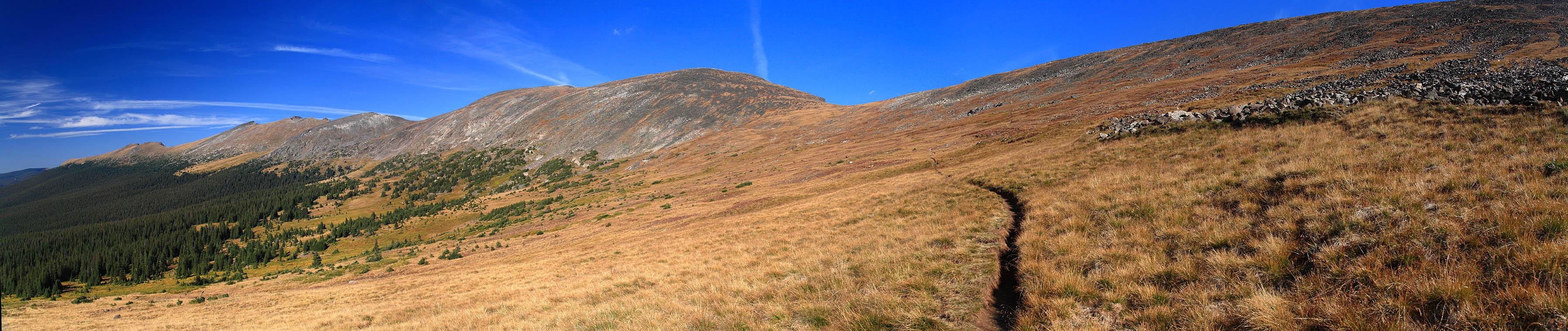
Starting out towards Mt Chapin
|
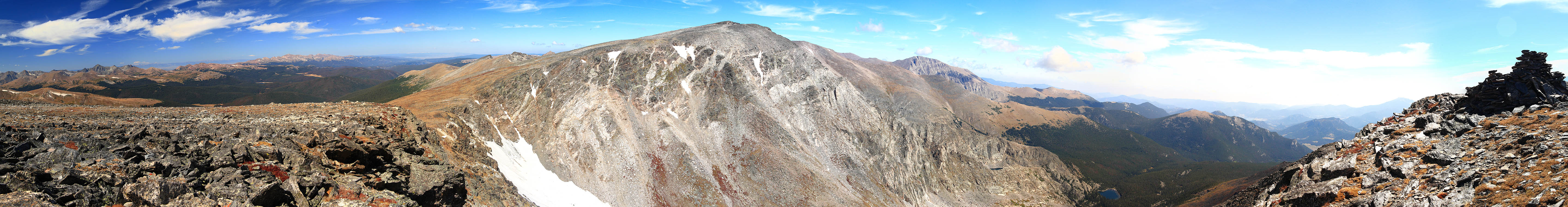
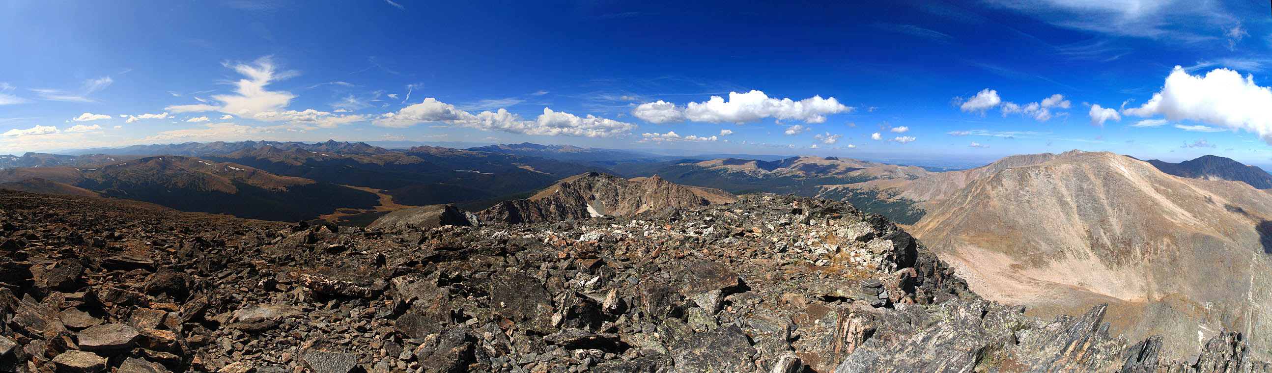
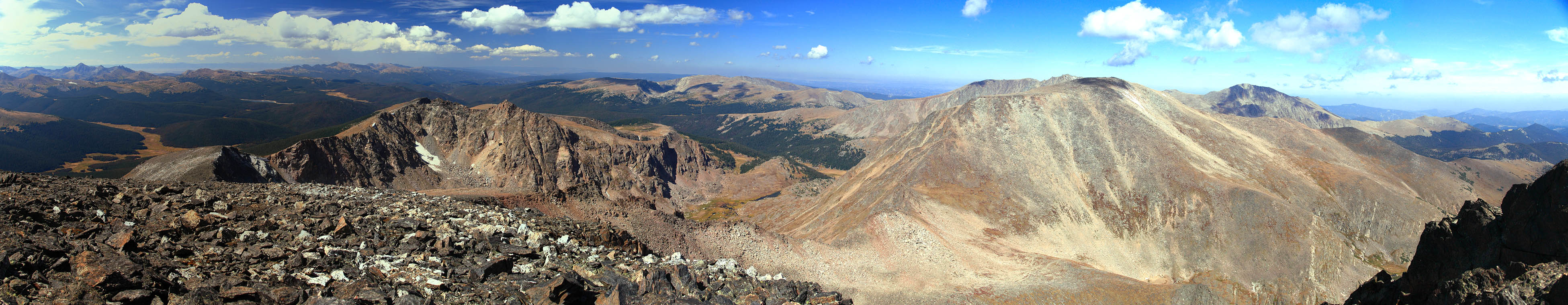
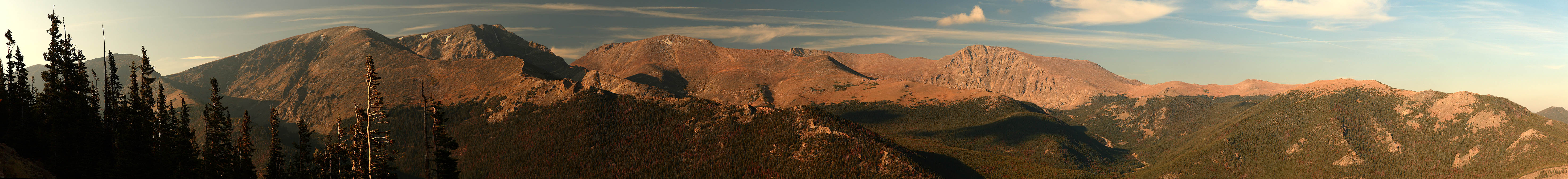
Various panoramas from points
along the hike (click for larger image)

Page created 1-24-10
|
;)
;)
;)
;)
;)
;)
;)
;)
;)
;)
;)
;)
;)
;)
;)
;)
;)
;)
;)
;)
;)
;)